BEST 20 Rockstar Images of 2014
Pretty weak roster this year as I shot one music festival and one local act. Still, it was fun and I am grateful for the chance to photograph musicians doing what they do best and it is what I do best. Mount Baker Blues Festival, you rock. And, thanks to the Jasmine Greene Band for allowing me to be a part of the experience.
Hi-res jpg images can be seen at my photography website.

Steve Willis, keyboards, harp, accordionist, Elvin Bishop Band. Mt. Baker Blues Festival 08/2014

Elvin Bishop. Elvin Bishop Band. Mt. Baker Blues Festival 08/2014

Elvin Bishop with a fan. Elvin Bishop Band. Mt. Baker Blues Festival 08/2014

Bobby Patterson. The Fat Tones. Mt. Baker Blues Festival 08/2014

Scott Greene. Jasmine Greene Band. Tulalip Casino, Marysville, WA 01/2014

Jasmine Greene. Jasmine Greene Band. Tulalip Casino, Marysville, WA 01/2014

Jasmine Greene. Jasmine Greene Band. Tulalip Casino, Marysville, WA 01/2014

Eleanor Tsaig. Ori Naftaly Band. Mt. Baker Blues Festival 08/2014

Eleanor Tsaig. Ori Naftaly Band. Mt. Baker Blues Festival 08/2014

Prentiss Alajuwan Yancy. Ori Naftaly Band. Mt. Baker Blues Festival 08/2014

Ori Naftaly & Eleanor Tsaig. Ori Naftaly Band Mt. Baker Blues Band

Scott Holt. Mt. Baker Blues Festival 08/2014

Derek Wiseman. Scott Holt Band Mt. Baker Blues Festival 08/2014

Eric Saylors. Steepwater Band Mt. Baker Blues Festival 08/2014

Eric Saylors. Steepwater Band Mt. Baker Blues Festival 08/2014

Eric Saylors. Steepwater Band Mt. Baker Blues Festival 08/2014

Eric Saylors. Steepwater Band Mt. Baker Blues Festival 08/2014

Eric Saylors. Steepwater Band Mt. Baker Blues Festival 08/2014

Eric Saylors. Steepwater Band Mt. Baker Blues Festival 08/2014

Eric Saylors. Steepwater Band Mt. Baker Blues Festival 08/2014
2014-10/11 WA/OR/CA/NV/AZ/NM/UT 2/5
Day 8/Monday/October 13:
We awoke to another sunny day and drove north on Highway 89 toward Lassen Volcanic National Park. Lake Almanor was again on our route so we stopped on the south side of the lake near a boat launch, day use area and campgrounds. The lake was low but evidently high enough for the California Department of Fish and Game to plant 6,000 trout. They were chauffeured from the Crystal Lake Fish Hatchery near the town of Burney. We watched the fish wiggling and flashing their way to freedom from the two pipes.
Continuing east on 89 to its meet with 36 where it became 36/89 would bring us toward Lassen. Just past Morgan Summit (5750) we turned north onto Lassen Park Road through a heavily forested area. Along the way we were delayed by some road construction but it seems it is an ongoing activity in the rush to complete projects before inclement weather.
Our plans were to spend the night at either campground in Lassen. But, we were not that impressed with the park, at least not impressed to remain longer than a drive through. Because we have a dog, we are not able to hike the many trails that are available to park visitors. We are fine with that and, at times, either of us hikes the shorter trails while the other wanders the parking lot with Toller. also, it was sunny so I believe it would be more photogenic on a stormy day or if there was fresh snow. We stopped at several viewpoints, including one to have lunch where the wind blew strongly.
Once through the park, we turned north on 44/89 toward the Pit River campground off Highway 299, where we had stayed several years before. On the way there, we stopped at the Subway Cave off 44. But, the path to the cave or tube looked too much like rattlesnake country so we just admired the large pine trees in the parking lot.
Returning to Highway 89 we drove north toward Highway 299. Just for a change of pace, we turned onto the Cassel Fall River Road, a meandering narrow two lane county road eventually ending up in Fall River Mills and 299. Turning west onto 299, we soon arrived at the road leading to the Pit River campground. A USFS campground, the price for a night’s stay was $4 with our Senior Pass.
We were the only ones there besides some day use picnickers and the camp host. We picked a spot, set up and I wandered with my camera gear to the boat launch on the Pit River to see if the light was adequate to photograph the two mini waterfalls that, split by a wooded islet, emptied into the stiller waters in front of me. Our previous visit was later in the year so the fall color hadn’t peaked. The light was dull and the color even duller, so I packed up, walked and fed Toller, fixed supper and went to bed.
Day 9/Tuesday/October 14:
The light improved in the morning so I was there at the boat launch to shoot some frames with slow shutter speeds for the cotton candy effect and some to catch the sputter of the water as it poured over the rocks. But, there was neither the color nor the fog like the previous time. You take what you get and enjoy being in a special place.
Pit River Powerhouse #1, an impressive Art Deco structure, was just a short drive away through a private guest ranch (yes, you can drive through despite private property postings). We spoke with several workers who said it was really cold in this area in the winter. The facility was fenced and gated so we couldn’t tour it so I just snapped a few iPhone shots through the chain link fence. It was spare, austere and had those long multi-paned windows.
About five miles west on 299 and five miles north on 89, is beautiful Burney Falls. A fisher at Pit River told us we could come in the back way and walk along the trail to the lower view of the falls which can also be accessed by going to McArthur-Burney State Park and walking down below the upper overview. We drove down a road and parked in a small parking lot. I noticed a sign that gave directions and distance for the local trails plus the Pacific Trail. As I walked down to the bridge that crossed Burney Creek, I wasn’t really sure which direction to head (directionally dysfunctional) and didn’t want to encounter a bear alone (no dogs allowed on trail so Tony remained behind the sign), so we drove to the entrance of the park.
We walked the short distance to the upper viewpoint and I shot a few frames as the falls dropped 129 feet, but the best images are photographed along the paved walk down to the bottom. All along the way, there are compositions using a wide angle for the entire falls and a telephoto to capture the details. We had visited here last April when the Spring greens were vibrant and lush. This time, I wanted to shoot the Fall color. After about an hour or so, probably the “or so”, we ate lunch in the parking lot. There are trees in this park that I am unfamiliar with. We also saw them in the surrounding forest. I have included a photo of one titled “Mystery Tree”.
The wind was beginning to pick up and the rain was sputtering as we drove on 89, 44 and 36 on our way to Susanville to fuel up and buy a few groceries. We stopped along Highway 44 at the Bogard-Lassen Rest Area, a palatial rest stop for such a sparsely populated area; check out the photo below. It was really howling as we arrived in the Safeway parking lot. We weren’t really sure where we would camp for the night. We ultimately wanted to explore the Smoke Creek Desert area then drive along the western shore of Pyramid Lake but knew that driving into arid areas in the rain in the coming dark would be foolish.
Using an iPhone app, I found Ramhorn Spring, a BLM campground north on 395 that we could tuck into for the night then decide which way we would drive in the morning. The campground was populated by hunters who were off looking for mule deer. One who stayed behind said he had a night vision camera that caught a few mountain lions sneaking around behind the boulders we camped next to. Mountain lions which we have behind our home wasn’t bothersome; I was thinking rattlesnakes tucked into the rock pile. We set up as dusk approached, ate supper then went to bed sheltered from the elements.
Day 10/Wednesday/October 15:
The rain intensified during the night and the wind hadn’t slowed down. We decided to skip the Smoke Creek Desert to head for the west side of Pyramid Lake. There were some places that one of the WtW folks suggested we visit but we can return here as it is closer than our New Mexico destination this trip. We drove south down 395, turning east on Wendel Road just past the BLM Wild Horse Adoption Corrals.
As the paved road turned to gravel, it became Sand Pass Road. The rain began breaking off abut the dark storm clouds were ominous. We could see that the sky was become lighter toward the southwest which was our general direction. Just as we were approaching the turnoff to Highway 2 which would bring us along Pyramid Lake, I saw a large rainbow. “Let’s follow that rainbow”, I yelled, thinking that a photograph was in the making with the desert, brooding clouds and a rainbow.
Driving north along the Sand Pass Road, we could see that multi-colored arc over the hills. We drove on until we could see just a short wide band over the alkaline dry lake bed. We were a little late but did bang off a few as I was running down the road. After it disappeared, I looked around to see two square white wood-framed buildings along the RR tracks. They were falling into disrepair, no longer needed. I am not sure what their purpose was, maybe for supplies or living quarters for the crew or maintenance employees. The trains still run. It is named on our Benchmark maps as Sand Pass.
We backtracked to Highway 2 into the Pyramid Lake Paiute Reservation. Along this road is the access to the Fly Geyser, a multi-hued wonder, on private land. No trespassing means that and you need special permission from the landowner. You are also required to obtain permits to even drive off the main road if you are non-Native. We could see the Needle Rocks off in the distance, their jagged points guarding the lake’s shore. The light shining through the clouds played off the beautiful blue of this large lake. The Truckee River feeds the lake, although there is no outlet. It is one of the few remaining lakes that were once a part of ancient Lake Lahontan.
When 2 became 445, gravel turned to pavement. At Sutcliffe, there is a fish hatchery that raises the cui ui, an endangered fish endemic to these waters. In the same area along the shore is an RV park (parking lot type), marina, visitor canter and ranger station. South of Sutcliffe, 445 turns toward Reno and 446 goes to Nixon and 447. There are several tribal parks, lake access points and picnic areas along the western shore but you need to buy a permit at the Paiute Tribal Headquarters in Nixon. On the other side of the lake is Highway 447 from which there is no lake access except for a closed gated gravel road. If you followed that road you would drive by the Great Stone Mother and Basket and The Pyramid which can be seen from 2/445.
At the junction of 446 and 447, we turned south to Wadsworth and Fernley. We bought fuel by the I-80 interchange and headed south on Highways Alt 50 and Alt 95 toward Silver Springs. Past Silver Springs, 50 turns toward Carson City and Alt 95 continues south to Yerington where Alt 95 joins 95 just past Shurz. On 95, traffic is fast as it is the main connector between Reno and Las Vegas. Semi trucks are especially fast and will pass you. The highway is flat, very straight in long stretches but there are very few places to pull off to allow them to pass.
Soon, we arrive at 20 Mile Beach, a free BLM campground on Walker Lake. There were a few campers near the vault toilets but we chose to drive down a sandy road to be closer to the beach. At last, Toller could run and run. I think he knew as we unfastened his harness and detached the leash that he was free to go. We watched him run in circles then flat out sprint. All too soon, it was time for his supper and ours as the light was fading quickly. At the south end of the lake is the Hawthorne Army Depot where there are miles of bunkers storing munitions, I believe. We only hoped that we would not be awakened in the darkness of night by a huge KA-BOOM!
Day 11/Thursday/October 16:
Quiet reigned (no missiles raining down) during the night so we were in one piece in the morning. We were greeted by a superb sunrise over the mountains across the lake. It lasted for some time and spread clear across the eastern sky. Toller was allowed to run again and took full advantage of the opportunity. We broke down our camp quickly and returned to 95 to fuel up in Hawthorne, just a few miles south.
From Hawthorne, one can take Highway 359 through some sparsely populated areas into California arriving at Mono Lake and the eastern entrance to Yosemite. One could also take the Bodie Road, a rough ride to Bodie State park, a genuine ghost town, preserved in a “state of arrested decay” by the California State Parks Department.
But, our destination was exploring some 4×4 roads off of Highway 6 on the way to Tonopah. There isn’t much to see from Hawthorne to where 95 joins Highway 6 at Coaldale and there isn’t much to see there, either. I wanted to see about a gravel road that went from 95 to Mina but some trucker was on our tail so we had to speed on by. These roads aren’t often marked and you are going by so fast that you have passed the entrance by the time you figure out that’s where you want to turn.
95 goes through two towns that are barely hanging on: Luning (population 40) and Mina (population 75). I noticed in a Google search that their populations are in decline. Luning has a rest stop and Mina has the Hard Rock Market (for sale, I think).
At Tonopah Junction, we left busy 95 for Highway 360. This road isn’t as flat and straight but there is some traffic, mainly semis. close to the highway, we saw a pair of burros grazing. I looked at the map and there was a POI for the Marietta Wild Burro Range. We drove down the road until we came to an overlook. We saw a group of four burros about 500 feet off the road, nibbling at the sage brush while over behind the mountains to the north, we could see and hear some major dynamiting happening at a mine among the cluster on the map. They must have become accustomed to the booms because they only looked up occasionally to check us out.
It is probably a good thing we did not find that road off 95 as there are many mines in the area and the road may be off limits. At times, that is the case; we find a road that has ghost towns or interesting geology and it is either closed or the trucks are running to deliver goods or remove the extracted material. Marietta was no longer a ghost town, but had a small settlement there with modern trucks.
Back on 360, we stopped at Belleville, really not much more than a site, as the few buildings were reduced to a pile of stone rubble. It was a community set up to provide water to the Candelaria Mines down the road. It had a population of about 500 people at one time and included a restaurant (we found oyster shells), doctor’s office, telegraph and assay station, livery stable, school, two hotels, restaurants, blacksmith shops and seven saloons. Belleville existed for about twenty years, from 1872 until 1892 when the mines got their own water source nearby. People, since its demise, have been poking through the rubble. We found many items including ceramic beer bottles, bone china, very small shoes, some hardware, rusty pieces of machinery, lots of thick aqua blue, purple, and olive green bottles, etc. All of the china and bottles were broken but we did find a used up but intact bottle of E. G. Lyons Jamaican Ginger.
We journeyed on to Highway 6 picking up 264 which continues south until it splits into 266 (to 95) and 168 (to 395). 264 merges with 773 which is the road we wanted. Off 773, we drove across a wash and continued up to where we camped last April. We wandered around looking for interesting rocks and photography locations. Boundary Peak, Nevada’s highest mountain at 13,140′ was visible from our camp site. The lighting too direct and the sky wasn’t filled with the dramatic storm clouds I like so I shot detail shots of the petrified wood hoodoos.
The quiet filled our ears and the millions, no billions, of stars filled our eyes. There is a large ranch or two nearby but we couldn’t see their lights. I love these silent, barren places where there are no distractions except the stark beauty. Listening to the nothing as we watched the sunset is magic. We were the only ones within miles. It is so different from our home where large trees obscure our sky views and the city lights shine too brightly for the next hill over to block completely.
Day 12/Friday/October 17:
This morning I shot more telephoto images of the same subjects as yesterday. The foothills below Boundary Peak had some interesting light so I worked that for awhile. We had breakfast then decided to drive the truck down to the lower area to follow the wash. We stopped to look for rocks and found a pocketful of Apache Tears, some clear, others more opaque. We could hear a group of ORVs close by and soon they revealed themselves coming up the wash. With a wave, they drove up to where we had been.
We drove further on the wash, stopping at a wide area. The wash made a right turn then left. Where the right became a left, the road was blocked by a foot tall rocky upcropping that would challenge our rig. We could see that it had been breached before. We contented ourselves to wander around checking out the petrified wood hoodoos. I wanted to stay longer to explore beyond to see the end of the wash, to see if the end, if there was one, was a box canyon. But Tony had an itch to rockhound for agates near Tonopah.
Once on Highway 6 we drove to Tonopah, stopping only at the now familiar Millers Rest Stop. After fueling up at the Shell, we went directly to our secret location and, darned if we didn’t get skunked. Maybe the light was bad in the late afternoon or maybe we took them all last April. We wandered around a bit, hope fading in tandem with the sun’s rays.
This is as good a place to stay as any, we thought, so we popped the top, made sandwiches and looked at the maps for our next destination. Often, we have a general idea of what we want to see by circling POIs on our well-worn Benchmarks. I also jot down a “general” itinerary on my iPhone. Sometimes, we go by the script, but mostly just allow serendipity and the signs along the way be our guides. Tomorrow was to be one of those days. I wanted to drive to Delamar, a remote ghost town, but that would mean miles of driving. Anticipating the unanticipated, we went to bed.
Day 13/Saturday/October 18:
The light made all the difference: we pocketed (knapsacked?) more than two dozen big’uns (1″ -2.5″D) in about two hours. They differ from the Summer Lake area because they are not as lumpy and are a milky blue color. Our agate lust sated, we headed east on Highway 6, stopping at the Saulsbury Wash Rest Area.
Last April, we had driven south from Highway 50 on the gravel road through Monitor Valley, crossing the Monitor Range over to Antelope Valley then recrossing the Monitors to the Ralston Valley. In Antelope Valley, we saw a large herd of wild horses. Since we didn’t complete our Antelope Valley drive (which segues south into the East/West Stone Cabin Valley), we turned north onto the road through West Stone Cabin Valley to see what we could see. As we drove along the gravel road, we saw a small group on a bluff, two white ones brightly shining in the sun. They watched us as we drove by slowly, looking up then browsing. We passed by a couple of springs, a few more horses then turned around to find a place to camp overnight. We almost drove to the junction where we drove into the lovely McCann and Hunts Canyons last April.
The green oasis of Stone Cabin Ranch was visible during much of our drive, so we turned east toward it knowing that the road would be okay. It is a typical Nevada ranch, complete with corral, stock yard, old rusty trucks, tractors and implements, a few weathered outbuildings and a main house. We then drove south on the road that passes through East Stone Cabin Valley. Suddenly, a band of 3 horses galloped across road ahead of us. They left their hoof prints in the alkaline area that we thought might make a good spot to camp. To the west was a small canyon that they disappeared into. We ate dinner as we watched the sunset. It was another quiet night.
Below are iPhone 5 photographs but the DSLR images can be found HERE

Delivering fish to Lake Almanor in California

Lassen Peak in Lassen Volcanic National Park

Picnic site in the day use area at Pit River campground along 395 in California

Camp site among the pin oaks at the USFS campground Pit River

Pit River Powerhouse #1

Mystery tree in McArthur-Burney State Park. Cedar?

Pacific Coast Trail sign near Burney Creek

Fall foliage ablaze along Burney Creek

Burney Falls plunging 129′ viewed from the overlook at McArthur-Burney State Park.

Burney Falls from along the walk down to the lower overlook at McArthur-Burney State Park.

Bogard-Lassen Rest Area along California’s Highway 44

Evening glow at Ramhorn Campground off Highway 395 between Susanville and Alturas, California

Road sign along High Rock Road on the way to west side of Pyramid Lake

Looking over Smoke Creek Desert from Sand Pass. The rainbow was over to the left.

Welcome to the Pyramid Lake Paiute Reservation

Tufa forms in the foreground; The Needles Rocks in the distance. Pyramid Lake is barely visible as a thin line in between

Walker Lake north of Hawthorne, Nevada. This lake has receded greatly; 168 vertical feet since 1868 and is ⅓ its former size due to the Derby Dam on the Truckee River and irrigation

Sunset along Walker Lake looking north from the west side.

Walker Lake sunrise looking east on west side of the lake

Pretty in pink wildflower at Walker Lake

Early morning looking south at Walker Lake which is another remnant like Pyramid Lake from ancient Lake Lahontan

Welcome to the Murietta Wild Burro Range. We saw a total of 6.

Overlooking the valley where the mining town of Marietta lies. Over the mountains in the distance you could see and hear the dynamite blasts. The burros we saw browsed without comment.

Broken refuse from the ghost town of Belleville (1872-1892) along Highway 360 in Nevada

Broken china and beer bottles left at Belleville, Nevada

Remains of a dwelling (?) at Belleville, Nevada

Remains of a stone structure at belleville, Nevada-note the broken glass and rusted cans

Petrified tree stumps left from a swamp after ancient Lake Lahontan dried up

Walking along the wash in a former swamp in the former Lake Lahontan

Where the natural rock barrier ends most vehicle’s attempts to follow the wash

Another view from the other side of the rock outcropping

Petrified tree stumps that were once a swamp in Lake Lahontan

Walking along the wash passing petrified tree stumps

Lunch along the dry wash at the turnaround for most vehicles

Parking spot with a view

Beautiful yellow wildflower along West Stone Cabin Road

Rusting work trucks at the Stone Cabin Ranch

Hoof prints in the alkaline soil crust near where we camped along the road in East Stone Cabin Valley

Sunset where we camped along East Stone Cabin Road just north of Nevada’s Highway 6
2014-10/11 WA/OR/CA/NV/AZ/NM/UT 1/5
Day 1/Monday/October 6:
It is highly recommended that you make reservations for the Coupeville to Port Townsend ferry. If you arrive at the ferry terminal in peak season, you may wait for a long time. Also, don’t let it be a surprise if the the ferry is grounded due to tidal action (high or low). When you make your reservations on line or by phone, you can check to see if your sailing is a go. There is also an app or two for the Washington State Ferry System but I don’t have them. Fort Casey State Park is conveniently located nearby so we purchased our annual Washington State Parks Pass ($30) which was due and a Senior Off Season Camping Pass ($75 for free camping October through March and Sunday – Thursday in April). Our 12:30pm sailing departed on time.
Once on the other side (Olympic Peninsula), we drove south on Highway 20 until it connected with Highway 101. We drove southbound on 101 until turning west on the Satsop Coquallum Road for a change of scenery. Besides, we wanted to check out Schafer State Park, a 119 acre park on the Satsop River. The campground had been closed since October but we wandered around the park along the river.
From Schafer State Park, we headed toward Lake Sylvia State Park on the East Satsop Road. The park is just north of Montesano. The campground is located on lovely Lake Sylvia. Some campsites are set close by the lake shoreline, others are near a slow stream or on the interior loop. Few people were there so we were lucky enough to get a lakeside site. We guessed this would be a Popular class non-hook up site which, in the shoulder season, would cost $25 on a Monday. With our off-season pass, it would be amortized over the next 7 months.
We walked around the campground then crossed a bridge over the lake then returned for supper. We sat by the lake watching the ripples on the glassy surface until the sky turned pink. It was quiet and we slept peacefully.
Day 2/Tuesday/October 7:
We awoke to a foggy morn. We drove slowly along Highway 107 to its junction with the coastal portion of Highway 101 through Arctic, Raymond, South Bend, and along Willapa Bay to Long Beach. Traffic was light except for a few logging trucks. It was still foggy once we stopped in Long Beach to allow Toller to run on the beach. Long Beach is a dog friendly town that allows dogs to freely run and play on the very long packed sand beach of this ocean shore town. You can also drive your vehicle but you need to be mindful of soft sand.
We picked up Highway 101 again and crossed the Astoria Megler Bridge into Oregon. In Warrenton, we stopped at Fred Meyer for fuel and groceries. Back on 101, we drove through the coastal towns of Seaside, Cannon Beach, Manzanita and Garibaldi until we went inland to Tillamook famed for its dairy products. 101 remains inland until just before Lincoln City. The drive is through pastoral dairy farms.
Just north of Depoe Bay, of the Smallest Harbor in the World fame, and just south of Lincoln City, is our favorite beach to look for agates. The beach has changed over the years yielding fewer and smaller agates. Still, it is fun to walk along the crescent beach as the ocean waves break. We missed low tide when the agates are easier to find, but did pick up a few. Polished by the ocean’s relentless pounding, they have that dull glow that sets them apart from other rocks. You can also find fossils there, mostly shells. The weather was overcast with some drizzle.
Our route south took us through Depoe Bay to our campground for the night. It had been tiring driving through the fog so we elected to stop at Beverly Beach State Park. Oregon state parks are some of the nicest anywhere, with clean campgrounds and free showers. We do not need hook ups so a tent site is $17 in the off season. The beach is long and sandy and just a short walk under the Highway 101 bridge. No agates to seek on this beach as it is mostly sand. Still, it is enjoyable to walk along the crashing surf. After a nice long walk, we ate supper and went to bed early to get an early start tomorrow.
Day 3/Wednesday/October 8:
This morning we continued down 101, stopping for another beach walk at Muriel Ponsen Wayside just north of Carl G. Washburne Memorial State Park. It is easily accessible from the parking lot although the vegetation along the drive in needs pruning for the larger RVs. Last Spring when we were here, I found a few agates but wasn’t so lucky this time. Still, it is refreshing to walk along Oregon’s seaside. Oregon’s beaches are public, unlike my home state of Washington where access is limited.
In Florence, we fueled up at the Fred Meyer and bought a few last minute supplies. From Florence, it was an inland drive to Reedsport to head east on Highway 38. This is an easy drive along the Umpqua River with little traffic. At Elkton, we went southeast on Highway 138 to Sutherlin on I-5. Just a short jaunt down I-5 brought us the the eastern portion of 138. This is a very scenic drive along the North Umpqua River. One POI on our list was Susan Falls. But since it was becoming late in the day and the hike was 2.1 miles one way, we put it off for another trip. We noted that there was the Susan Falls campground nearby up the road.
We were stopped along the highway when a biker stopped to ask if we needed help. He lived nearby and advised us to check out Steamboat Campground on Steamboat Creek, a USFS facility. It was closer than Tokatee Falls, another falls on our itinerary, so we drove up the gravel road to the campground. The falls were underwhelming and were marred by a cement fish ladder. We paid our $5 fee and settled in for the night. This was a small campground and we had one neighbor who wasn’t visible through the large trees.
Day 4/Thursday/October 9:
The logging trucks began their day at 4:00 am so we were up and about earlier than we wanted. We tried to time our departure to after we heard the trucks head either up or down the road which narrowed at times to a single lane. Being Pacific Northwest natives (and a grand daughter of a logger), we are familiar with these lumbering beasts (ok, bad pun). We didn’t have a CB to check for oncoming trucks so just hurriedly drove the several miles back to 138.
The fall colors were ablaze along the North Umpqua Riverso we pulled over for a photo op. There are many trails, waterfalls and campgrounds along Highway 138 so we will definitely return. At the Tokatee Falls trailhead, there is a very large (8′ D?) wooden aquaduct that evidently was still in use as it spouted leaks. The vegetation growing out of the seams made it look like a Chia Pet. The trail is about .5 one way via 97 steps up and 125 steps down. It is a beautiful trail through the woods (big leaf maple, yew, old growth cedar and fir) along the North Umpqua River to the viewing platform. Along the trail is an overlook above a round gorge that the swirling water and sediments gouge out. The falls are spectacular: the river etches its way through a gorge that drops 40′ into a pool then plunges another 80′ into another large pool. What is a scenic bonus is the columnar basalt that the falls drops out of. A short and easy hike in, Tokatee Falls is one of the most beautiful falls I have seen.Tokatee Falls has a campground, also.
We passed by Diamond Lake where we had camped at Thielson View about a year ago. This is a beautiful campground that has many sites along this lovely lake with a view of pointy topped Mt. Thielsen. We could have dropped down to visit Crater Lake but had a schedule so turned east on Highway 138 which teed into Highway 97 at Diamond Lake Junction, an unofficial truck route that we try to avoid. A short 15 mile segment brought us to Silver Lake Road which bisects the Klamath Marsh National Wildlife Refuge. The lake was dry and we saw few birds.
Just before Silver Lake, the road ended at Highway 31. Our destination was the rest area at Summer Lake, a free place to camp. It is right off the road but 31 sees little traffic. We also enjoy looking for agates nearby and always find a few pocketfuls of some nice ones. They are different from the ones we find along the Oregon Coast as they are not polished but they are larger and have a knobby opaque quality. After a fruitful rockhounding session, we returned to the rest area for supper and sleep. We were joined by three other vehicles for the night seeking a place to camp. There is a store/gas station across the road if you need to resupply or get fuel. If I remember correctly, diesel was cheaper there than in Paisley, a town further south. The Summer Lake area is one of eastern Oregon’s great places to explore from the Summer Lake Wildlife Area to the USFS roads above.
Day 5/Friday/October 10:
After a further mining of agates in the Summer Lake area, we drove toward Lakeview to fuel up and head south on 395 into California. If you wanted a shortcut over to 395 north of Abert Rim, there is a road through the XL Ranch that runs from paved Red House Road through a small canyon which becomes more rough and rocky. Eventually, as you near 395, the road becomes easier and is graded gravel. Sometime ago, we ran this route in reverse (direction, not gear) so were fooled at the beginning. Not recommended unless you like to crawl and bounce through pasture land. On the way to Lakeview, we drove through Paisley and met up with 395 at Valley Falls.
We fueled up at the Shell station on 395 just north of Lakeview but didn’t stop for groceries at the Safeway which has been in town since 1939. If you need supplies, this is one of the better stocked grocery stores for miles until you are well into California (even Alturas has less of a selection).
It is always a nice drive into California along 395, a nice highway that sees little traffic. We had to stop at the California Agriculture Department checkpoint to declare our produce on board. Sometimes it is open, sometimes not. After Alturas, we drove down 299 through Canby when it merges into 139, and Adin (nice small town with an interesting warehouse of treasures peeking through the windows) where we headed south on 139.
It was getting dark and we were a little anxious for a place to spend the night. One of my iPhone apps indicated a BLM campground near Eagle Lake. There were no signs indicating a campground but we did find a clearing off the road overlooking the lake so we pulled in and set up camp. There was little traffic to bother us and soon, after dinner, we went to sleep.
Day 6/Saturday/October 11:
We awoke early, anxious to meet up with a group of pop-up truck camper enthusiasts from the Wander the West forum at the Meadow Lake campground in the Tahoe National Forest. We stopped at the Susanville IGA for groceries and fuel then headed west on 36. From Highway 36, we took 147, the scenic route along Lake Almanor (which had water unlike poor dry Eagle Lake). We stopped at a scenic overlook for a potty break and to stretch our legs. Toller always wants out so we wander around with him so he can do his business and get some exercise.
After the overlook, we took Highway 89 south, stopping at Indian Falls. I am glad we did as it was a beautiful area and a very important spiritual and cultural area for the Maidu Tribe. There are large blue gray rock outcroppings that you scramble over to get to a better view of the falls. Even in mid-October, there was still a flow.
89 continues south and east as 89/70 through Quincy and East Quincy. Then, near Blairsden, 89 becomes its own road which we followed south to USFS Road 07. We would follow this road and USFS Road 86 near Weber Lake for 20 miles, becoming rougher until we saw a group of pop up campers at Meadow Lake campground.
We were warmly welcomed by this enthusiastic group with which we felt right at home immediately. I have been a participant on their forum for several years, getting and giving advice about campers, destinations, modifications and other areas of interest to those who explore backroads and backcountry. We soon found a place to set up camp and did a walk about to meet everyone. There was a pig roasting on a pit donated by Marc of XP Campers. Marty, of All Terrain Campers cooked up a hearty and aromatic onion soup. I think it was MarcBC who brought a homemade walnut pie. Others brought ice cream, salads, casseroles, etc. We brought home grown Honeycrisp apples from our neighbor’s orchard. We did not go hungry.
Thanks to Ted who organized it all and Bill for the decals. We weren’t the ones who came from the furthest away (Grant from British Columbia, our northern neighbor did) but we probably drove the most miles as we tend to travel back roads, all in the spirit of Wandering the West. I hope we can all meet up again to share our adventures and camping rigs. We got some great ideas and hope to incorporate some this winter. One of the campers hung a mini hummingbird feeder from a bough. Noted.
The sunny weather held all weekend. Toller enjoyed playing with the other pups who were well-behaved. They ran and frolicked among the campers. We enjoyed meeting the dogs who folks mention in their posts. After a wonderful pot luck dinner amongst folks who felt like long-time friends, we headed for bed to sleep among the pines with full tummies.
Day 7/Sunday/October 12:
Most folks headed back this morning but we stayed to walk around Meadow Lake, a reservoir that was quite low. We spoke with Smokecreek, a retired BLM archeologist, who told us to visit the Smoke Creek area east of Susanville as we would be traveling that way.
We wanted to return to Indian Falls and Burney Falls and drive through Lassen Volcanic National Park in between. We said our goodbyes to those still in camp and back tracked to Indian Falls. We stopped in Quincy for fuel then drove to Indian Falls via 89/70 for late afternoon photography. Golden reflections highlighted the water above the rock outcropping 20 feet above the pool below where the gold shimmered.
Tony disappeared with Toller and after the gold shimmers disappeared, I began to look for them. I went upriver a ways and found them in an even more beautiful location. In the distance, twin falls dropped a short distance about 20-feet apart. The entire scene was magic. Boulders and submerged rock outcroppings were scattered in Indian Creek. Placed among the rocks near the water was a beautiful large lobed leafed plant that was changing from green to red. I couldn’t have asked for a more photogenic location. I shot wide and long and everything in between.
It is difficult to describe the emotion that I feel when I am in a beautiful location and the cameras’ batteries are charged and the media cards have been formatted and are ready to fill. I really try to be restrained initially, composing with the thumb and forefingers of both hands to see the potential, trying to get a feel for the possibilities. But, the light was fading and so I just continued composing through the viewfinder, pressing the shutter, hoping that this wondrous place wasn’t a dream. I had to place my tripod at odd angles and lengths in the eroded pitted rock outcroppings, hoping that it was well enough anchored to prevent any shake.
Back at the camper, we decided to spend the night. There were no signs prohibiting overnight stays and we were the only ones remaining in the parking lot. After dinner, I reviewed my photos. I wasn’t disappointed. No one disturbed us during the night and we slept well.

Our campsite at Lake Sylvia State Park near Montesano, WA

Toller and Tony enjoying their freedom at Long Beach, WA

Our campiste at Beverly Beach State Park along the Oregon Coast

Bridge over Yaquina Bay in Newport, OR

The beach at the Muriel Ponsen State Wayside along the Oregon Coast

Sand sculptures on the beach at the Muriel Ponsen State Wayside along the Oregon Coast

Art Deco bridge that crosses the Sluisaw River in Florence, OR

Late afternoon along the Middle Umpqua River

Along the Middle Umpqua River and highway 138 as it crosses the Cascade Range

Campsite #1 at Steamboat Falls campground

Steamboat Falls on the Middle Umpqua River inOregon

Informational sign near the trailhead for Tokatee Falls

Wooden aquaduct near the Tokatee Falls trailhead in Oregon
The trail to Tokatee Falls

Deep rounded gorge created by the fast swirling waters and sediment of Middle Umpqua River

Exploring along Summer Lake in Eastern Oregon.

Our BLM campsite near dry Eagle Lake north of Susanville, CA
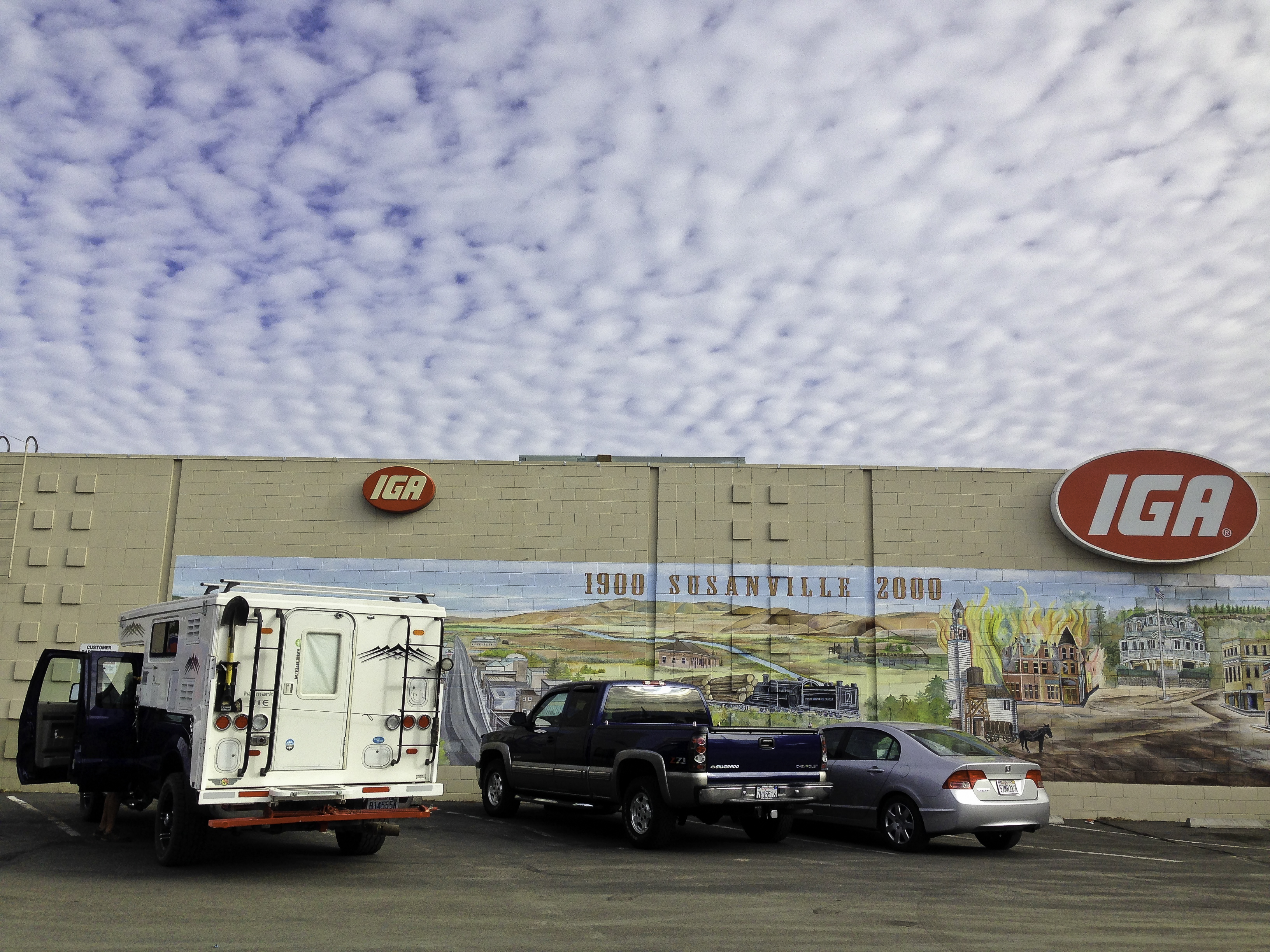
Colrful mural depicting 100 years of Susanville, CA history

Indian Falls near Quincy, CA.

WtW folks enjoying the campfire at the meetup at Meadow Lake campground

Camping at Meadow Lake campground in the Tahoe National Forest

Tony and Toller enjoying the shores of Meadow Lake, a reservoir in Tahoe National Forest

Meadow Lake campground in the Tahoe National Forest, site of a WtW meet up.

Indian Falls, sacred to the Maidu tribe near Quincy, CA

Twin waterfalls up stream from Indian Falls near Quincy, CA
2014-09 WA/OR/ID/WY/MT 4/4
Day 16/Wednesday/September 24:
I really wished for some beautiful clouds this morning but the fog gods left their trail of dewy droplets. Still, fog can make for some moody images. It soon lifted but the sky was cloudless and there was a ripple on the lake where yesterday was like glass. We said goodbye to Karry from Colorado and headed out to the roads that would take us back home. We had reached the furthest point east and south of our trip so the remainder of our adventure would be homeward bound.
There are several spots off the road where you can disperse camp. We had met some campers who had camped along the Green River who showed me a photo they had taken yesterday, a wide angle shot with the river running toward Squaretop Mountain, a terrific example of leading lines/S-curve composition. We looked for it and found a few possibilities. Our plans for further adventures would be to more throughly explore Western Wyoming, places on the map like Plumes Rock, Chimney Rock, Killpecker Sand Dunes, Adobe Town, Crazy Woman Canyon, The Haystacks, etc. And, spend a few days, exploring this area and relaxing in our chairs along the banks of the Green River, fishing and relaxing.
We missed 40 Rod Road, a shortcut over to 189/191, by gawking at the scenery. It would have saved us probably 10-15 miles. We drove back through Hoback Canyon to 26/89 heading west into Idaho. This is beautiful country, I thought, as we drove along the Grand Canyon of the Snake River toward Alpine, Idaho. In Alpine Junction, where we fueled up, tourism hit a dead end. A large complex of Swiss Alpine themed buildings including a restaurant and motel was for sale and appeared to have been for some time. We see a lot of businesses that cater to travelers that are for sale and abandoned. I want to know the backstory. Why are these places for sale? Where do people stay? Is it the RV industry or do people have to ration their vacation time to see only the top-tier of their bucket list?
We dropped down along 26 to parallel the Palisades Reservoir, a dammed up portion of the Snake River. Our camping destination was Falls Campground along Fall Creek near Swan Valley. We turned off of 26 to USFS Road 058 toward the campground keeping an eye out for a sign for Fall Creek Falls, a scenic falls that I wanted to photograph. The campground was closed (for the season?) so we drove down Fall Creek Road (USFS Road 077) along the creek of the same name and found some areas with informal camping spots (rock fire pits). The waterfall was visible as we returned from the closed campground so we at least knew where it was. It was getting dark and we were tired. It was quiet except for the occasional bellow from the free range cattle.
Day 17/Thursday/September 25:
I misjudged the time that the sun would rise so parts of the waterfall were already basking in the sunshine. I made the best of an poor situation and fired off a few wide angle shots. We returned to Highway 26 enroute to Idaho Falls. Because we wanted to arrive home to tend to the garden and attend a friend’s going away party, we, gasp, got on I15 and drove to its junction with I86 just north of Pocatello. I86 merges into I84 just east of Burley. I am not a fan of freeways but Idaho’s aren’t as congested and the traffic flows freely, if fast.
Soon, we said good-bye to freeways at Mountain Home and fueled up. From Mountain Home, we drove on Highway 67 (Grand View Road), crossing the Snake River at Grand View to 78. We followed 78 (the Murphy Grand View Road) past dairy farms and the Snake River Birds of Prey National Conservation Site. We saw no eagles or other larger birds of prey but did spot many hawks. We drove through Murphy and Guffey at times following the Snake closely.
At Marsing, we turned west on 55 then north on 95 through Homedale. At Homedale, we turned onto 19/201 and proceeded through Adrian. We crossed the Idaho/Oregon border just west of Homedale. It was harvest time in this part of the world. Overladen dump trucks spilled their loads of red and yellow onions at every turn. There were trucks also carrying carrots and potatoes, stew veggies. We picked up a few large red onions laying by the road side.
Somewhere in the midst of this farmland, the winds began to blow forcefully and we were now trying to see our way through the soil billowing across the road from one fallow or harvested field to the other. 201 brought us to Nyssa where we stopped to fuel up. One of the local farmers was fueling up next to us and said if we continued to drive west, we would be driving away from the winds. He also mentioned he was having a great harvest this year.
From Nyssa, we headed north until the junction with 20/26 which would take us to Vale, Oregon. We camped at Bully Creek Reservoir northwest of Vale, at a county park that had showers and power, our first hook up site on this trip. Since we were out of daylight, campgrounds were few and boon docking on farmland is not encouraged, we took advantage of the power and showers for $15. The reservoir was down substantially, like most of those we have seen. It was quiet as there were only two campers here including us.
Day 18/Friday/September 26:
After using the campground’s water and our hose to wash off almost 3 weeks of dirt, we returned to Vale and turned north on highway 26. Our map showed a shortcut via Reservoir Road but it hadn’t been used in a long time. 26 took us through small towns like Willow Creek, Jamieson, Brogan, Ironside, towns that are fading away or gone. We were looking for a cut bank along the road just before Unity that someone during one of our travels was said to have carnelian rocks. It wasn’t really evident as there were a few rocky banks along the highway and we weren’t sure how far from Unity, but we did find some pretty rocks along a promising area. The few people driving by were probably wondering what we were looking for.
In Burns, several weeks ago, a local man told us about Strawberry Mountain where he worked falling juniper. He said it may be worth our while to check it out. We drove toward Unity to ask for information at the Ranger District station but it hadn’t been open for some time. You could buy some maps from a kiosk but we wanted utd info on camping, road conditions, POIs. We could have backtracked to USFS Road 16 but chose to just sample the area by driving to Prairie City.
We immediately liked Prairie City, a friendly Mayberry RFD kind of town. The storefronts were original with stone, brick and wood. The friendly locals directed us to the correct road to the Strawberries and Tony shopped at the Mom and Pop grocery store. We had this same feeling at Condon, Oregon, last spring, another authentic real small town America place on the map..
Following the Prairie City South Road (62), we made a semi-circuitous route through the Strawberries. 62 turns left becoming 16. Since we were in the Malheur National Forest, there were a few campgrounds along or off the road. They were circled on the map for a “next time”. At Parish Cabin campground, we turned onto 15 toward Seneca and Highway 395.
It seemed just a few days ago we were traveling south on 395. Northward bound, we passed through Canyon City (fuel at Shell) and John Day. From John Day, 395/26 took us west toward Mt. Vernon where we followed 395 north toward the Oregon/Washington border. Since it was getting dark quickly, we drove onto USFS Road 432/3940 to find a place to camp for the night. It was hunting season so we did see a few hunters parked here and there. We set up camp on a single track dirt road among the pines, far enough off in case someone wanted to pass by.
Day 19/Saturday/September 27:
It appeared that the road we were camped off of would take us north a ways then drop down to 395. But, since it was a weekend and hunting season, we back tracked to 395 to resume our homeward direction. As we drive along 395 in this section from south of Fox to Long Creek and north of Ukiah, there are some really photogenic old barns, churches and homes. Somehow, we are there too late in the morning or too early in the evening or it is a cloudless day. One of these days….
We make good time driving 395. It is a good road with some traffic, altitude changes, and curves, but very drivable. We pass through small towns that time forgot, thriving at one time in this open range ranch country when ranches were smaller.
At 74, we turn west to travel this time on the Little Butter Creek Road through ranches along Little Butter Creek. Turning onto 207, we stopped at the Echo Meadows Oregon Trail Interpretive Site. We stretched our legs, read the information in the kiosk and wandered down the trail to look at the wagon wheel ruts. Overhead, we heard strange sounds. Hundreds of large black birds were flying south in numerous Vees. Later, we found out that they were brants.
We stopped in Umatilla for fuel then crossed the Columbia River into Washington. We exited onto 14 then headed north on 221.retracing our steps from when we began. From Benton City, on 221, we drove along the Yakima River to connect with highway 240. We turned left, again passing through the Hanford area. Too soon, it was getting dark and we needed a spot to camp. We thought of the rest area just before the Vernita Bridge. But, semis were there, maybe for the night, so not wanting to hear and smell diesel all night, we drove across the bridge to the boat launch and found a spot away from the weekend crowds. And, I don’t think Washington has an ordinance that allows you to spend the night at a rest area like Oregon and Nevada.
Day 19/Sunday/September 28:
We slept well and hit the road early. It was beautiful sunny morning as we drove along the Columbia River and the vineyards that thrive here. I forgot to mention when we passed by here several weeks ago, we also drove by Priest Rapids Lake and Dam. There is a large RV park and community there called Desert Aire, definitely not our style. They even have their own airport.
Since we are adhering to our route that we began this trip with, in reverse heading home, I will be brief. From 205 , we joined I90 until the exit 151 past George to 283 to Ephrata. In Ephrata, we drove the Sagebrush Flat Road/Rimrock Road/Coulee Meadows Road northbound. I took a few iPhone photos of some barns and the volcanic rimrocks. When “the road that frequently changes its name” ended on Highway 2, we made a sharp left on 2 westbound for about 5 miles then turned north yet again on 172 which meandered past wheat fields and more abandoned buildings. Someday, I would like to get permission to photograph these old structures before they become one with the ground. Most of the access roads are gated and posted so no trespassing.
We found Ridgeport Hill Road which, in a meandering way, took us to 17 and through the town of Bridgeport. Next time I will play tourist and photograph the really well-done chain-sawn sculptures hewn from standing 70 year old sycamore trees along the main road through town. There is a salmon, horse, eagle, and other animals.
From Bridgeport, we drove onto Highway 97 to fuel up in Brewster. Highway 153 was just ahead at Pateros and our favorite fruit stand called the Rest Awhile Country Market. We bought some organic apples and a pastry for Tony. This is fruit tree country: cherries, nectarines, peaches, apricots, pears, and apples. With productive volcanic soil watered by the Columbia and Methow rivers, this region grows some of the best produce in the country. You know, famous Washington apples.
153 past before Carlton was open so we drove it to just before Twisp. For a change of scenery, we took the Eastside Winthrop Twisp Road. It is a little slower paced and you drive by the North Cascades Smokejumper Base. We noticed all the homemade signs of gratitude to the firefighters in this area who fought the Carlton Complex fire. Brave men and women.
We picked up 20 again in Winthrop. Because it was still early, we drove off 20 to Mazama to check out several USFS campgrounds. Around Mazama, there are many vacation homes, some grandiose but most just small weekend cabins in the woods. The closer we got to the campgrounds, the rougher the road became. We stopped at a trailhead to walk around and let Toller stretch his long legs. We returned to highway 20, deciding the spend our last night at Klipchuck. We could have pushed to head home but we don’t like to travel at night, especially along very winding and dark roads.
Day 20/Monday/September 29:
We were a little anxious this morning as we were going to head up the looooong switchback on 20 toward Washington Pass. Last June, the radiator in our truck developed a leak almost to the top. (I have yet to document that episode as it is not fun to relate). At this point, I can recall it and almost laugh, well, almost, as it cost us over $2000 to replace it with a Mishimoto aluminum model. We limped to where we could get cell phone service in Newhalem to call AAA. We were certainly glad that we had a camper full of water and that there was a campground that we could replenish the tank with. Pretty trying at the time.
We took the long climb with ease, both of us breathing a sigh of relief. We made our usual stops along the way home, at the Diablo Lake overlook where we met several men in a homemade wooden camper sitting an older fire truck and at Gorge Creek Falls Viewpoint.
Since we had lots of time, I wanted to reshoot the falls behind the Gorge Powerhouse. I usually just shoot the one you can see from the bridge but there are several others to see by climbing a steep set of stairs. I promised that I would return in a half hour and you know how it goes when you are having fun. My time was up so maybe next time I will ask for an hour.
The rest of the trip was uneventful. We returned home to put the garden to bed, clean the truck and camper, plan our next adventure, work on photos and attend a going away party. I usually don’t keep track of mileage, food or fuel expenses. I do know that we spent $57 for camping. I think it might help others if I tally up our costs, either daily and/or at the trip’s end. I only know that it is worth whatever it costs. We are not extravagant people, choosing not to camp at RV resorts or dine out. Happy trails.

Beautiful morning looking out over Green River Lakes to Squaretop Mountain.

Toller posing by Green River Lakes

Fall Creek falls near Swan Valley, Idaho

Old weathered building in Ironside, Oregon on Highway 26

Red Barn on Highway 26 west of Ironside and east of Unity, Oregon

Camus Creek along Highway 395 south of Ukiah Dale Forest State Park

Old historic church in Fox, Oregon along highway 395

Along Coulee Meadows Road south of Highway 2 near McCartenay, WA

Abandoned farm along Road C NW north of Highway 2 south of Withrow, WA

Ravages of the Carlton Complex fire along highway 153 along the Methow River

Wooden silo along the Twisp Winthrop Eastside Road in Washington state

Diablo Lake from the overlook along highway 20 or the North Cascades Highway

Homemade camper parked at the Diablo lake overlook

Gorge Creek falls along Highway 20 or the North Cascades Highway

Ladder Creek falls area behind Gorge Powerhouse in Newhalem, WA off Highway 20
2014-09 WA/OR/ID/WY/MT 3/4
Day 12/Saturday/September 20:
I am glad we gave our tent camping neighbors firewood as it was cold last night. We broke camp (easy to do with a truck camper) and drove south to the Tetons. One of my bucket list photography locations is Oxbow Bend along the Snake River. There is guaranteed to be a crowd of photographers waiting for the early light to hit the Tetons above the glowing gold of the aspens groves. Anyone can photograph here; access is anywhere you park along the roadside. I knew we wouldn’t arrive in time for the early morning light so we drove along Jackson Lake taking our time, stopping at Moose Falls.
The Flagg Ranch Visitor Center was closed for the season (I wanted info on dispersed camping) so we drove on to scout out a camping spot for the night. While we were taking a bathroom break at a picnic area near Fonda Point/Lizard Creek Campground, we met a Four Wheel Camper owner from Idaho. He advised us to travel down the Pacific Creek Road to boon dock on USFS land. I had circled it on our benchmark Wyoming map as a place to check out. He confirmed that it was a decent place.
Since it was along the way, we joined the hordes along Oxbow Bend. We managed to snag a place to park along the road among the large RVs and tour busses. It was a clear, cloudless day showcasing the brilliant blues and golds. I scouted the area for a spot to shoot from in the early dawn as it would be dark when we came to shoot tomorrow or the next day.
Just a short drive south from Oxbow Bend was the turn east onto Pacific Creek Road. We drove on a paved road for a time then past the turn for private residences. After the turn to the left, it became an easy graded gravel road where we encountered another Four Wheel Camper on a truck with FWC graphics. He was in a hurry but waved to us. We didn’t drive all the way in but decided that this would be fine for a night or two.
We backtracked out to visit Two Ocean Lake reached by taking the first fork before the road continues back to the highway. Parking was at a premium here and we just squeezed in. It is a lovely lake but too many people spoiled what could be solitude. There were trails that you could explore here and at Emma Matilda Lake but there were bears in the area and Toller was not allowed on the trails. We headed back to the main road, stopping along a pullover to eat lunch.
It was still early so we decided to visit Mormon Row and the famous Moulton Barn where, in 2010 I was fortunate to photograph a double rainbow behind the iconic structure. I found a good place to plant my tripod for a morning shot (Tetons are primarily for early risers as the range is lit up with the first rays at dawn). A quick look at our map showed that Flats Road was a good candidate for boon docking. We drove past a huge mega-mansion that displayed larger than life bronze figures of a Native American on a horse that was pawing the air and several men in a canoe hitting rapids at an angle. Very stunning and very expensive.
I wasn’t sure if we were within park boundaries but we saw some folks camping off the road so decided this would be a good spot amongst groves of aspens with a million dollar view of the Teton Range. After supper, I searched for the perfect backlit aspen images and found one near our campsite. We watched the sun set behind the Tetons and fell asleep under the clear night skies.
Day 13/Sunday/September 21:
If you want to photograph that special predawn light, you have to arise early. We broke camp quickly then headed the short distance toward the Moulton Barn. There were already several photographers there and I set up my gear at the spot I had chosen yesterday. Funny that we all chose to be at an angle to the building rather than directly in front. Just our artists’ eyes that line up the perfect framing.
The clouds were lovely but the more dramatic ones were outside of my ideal composition. I had to go really wide to include them. The light didn’t hit the front of the barn as I wanted but just to be there was exciting. My company was a great group of other photographers who were glad to be there, too. I met a guy whose brother’s blog I follow. He was a fine photographer in his own right. I have his card somewhere. Usually, I am the lone female but there was one other this morning. I don’t think she really knew what she was doing as she was asking many questions. This is poor etiquette as you never interrupt someone shooting during peak light.
Since we were near the Gros Ventre area, we drove south on Mormon Row to its intersection with Gros Ventre Road. This scenic road will bring you through the Gros Ventre Slide area. In 1925 a huge rock slide tumbled down the north face of Sheep Mountain, across the Gros Ventre River and uphill for 300 feet. This created a large dam across the river which, in 1927, partially failed causing a flood which destroyed the town of Kelly downstream. There is an overlook above Lower Slide Lake where you can see the slide area. This lake also has the Atherton Creek campground.
Driving on, we came to the red hills. I remember that the area was prettier in the spring when the green fields contrast more deeply with the red of the hills. Still, it is lovely and the complementary color scheme is stunning. We passed by several campgrounds (Red Hills and Crystal Creek). There was a beautiful ranch property along the banks across the river.
The road continued but we decided to quit early to check out River Road, a 4×4 road that parallels the Snake River. We started driving it but it hadn’t been graded for some time and washboards really bother my husband’s back. We returned to Teton Park Road. Since we were close to Jackson and getting low on fuel, we went on into town to get fuel and a few groceries at the Albertsons.
Returning from Jackson, we headed up the highway to the Pacific Creek Road to camp for the night. There were a few vehicles parked off the road but they weren’t very private and we weren’t desperate yet. We found a rutted road that led to a clearing. There were several horses tethered and one who was in a portable corral. We saw the FWC guy from Idaho and talked about places to explore. There was a very nice spot down by Pacific Creek which was occupied. We settled for a place off the muddy road near some cottonwoods but not too close. We call them widow makers back home. Early to bed for early we shall rise in the morning to grab a spot at Oxbow Bend.
Day 14/Monday/September 22:
It was a dark and stormy morning, but photographers are ever hopeful for a break in the clouds or a stray shaft of light. What I previewed from this morning didn’t excite me. I only had time to process the 5 stars during the week we returned home before our next epic trip to the Southwest. I mainly shot reflections of the aspens in the water as the Tetons didn’t want to come out to play. While waiting for some drama, I met a gal who took her photography seriously. Three camera bodies, all Nikon, one set up on remote firing every few seconds. She had just quit her job as one of mayor deBlasio’s staff photographers because, as she said, she was tired of podium shots. We had quite a bit in common (Nikons, suspicious of Adobe CC, etc.) but I didn’t get her card.
We drove north to explore a gravel road to the river where there used to be a cattleman’s bridge before the area became a national park (interesting history of the conflict between ranchers, conservationists and the Rockefellers). I shot a few reflections then we moved on.
I wanted to photograph Schwalbacher’s Pond so we drove down to the parking area. I shot a few reflections near the trailhead but soon the rain dampened any further attempts. It was a nice place for a lunch as not many people ventured down here except for serious photographers who were probably here much earlier for the classic shot.
Antelope Flats was just down the highway so we headed east. The clouds and sun were playing peekaboo with the aspens and cottonwoods in the Antelope Flats Road area. The lighting was dramatic for afternoon photography so we parked off the road so I could mingle with buffalo. Not really, they are powerful animals and you do not want to get in their way. They are faster than you think so I kept a watchful eye on them and the light.
Soon, it was time to return to Pacific Creek Road for the night. The light was fading and storm clouds were brewing. Returning, I saw some really dramatic lighting at the parking lot just before Oxbow so we pulled to shoot some of the more dramatic shots of our trip. The aspens obligingly lit up, the Tetons were dark brooding hulks and the clouds were ominously black, grey and navy. This is what I love about photography: the suspense, the drama, the beautiful locations, and the surprising compositions you can find just off the highway. I was joined by an Asian couple who stood right next to me when there was plenty of room many yards on either side of me. Maybe it is the culture or maybe they thought I looked like I knew what I was doing. They were shooting wide, I was shooting long.
We drove to Pacific Creek Road just a short jaunt away and parked next to the sign that marked the USFS/NP boundary. As good as any, we thought. This is bear country so we kept our bear spray handy. Toller was quiet all night so we didn’t need to worry but it still pays to be “bear aware”.
Day 15/Tuesday/September 23:
We were up early to return to Oxbow Bend, in the dark. As we approached the target area, we could see photographers’ head lamps which made it easier to find. When it is dark in the Tetons, it is dark. They sky looked promising so I set up at “my” spot. The clouds over the Tetons began to color up and I believe there may be some keepers in amongst some duds. I broke my split neutral density filter and don’t own enough flash card capacity to set my camera up for HDR (3-9 shots of the same scene in ½ to 1 stop increments). At least I have Nik’s HDR Effex Pro which will do tone mapping with a single exposure and balance out the highlights/shadows.
Sadly, we left the Tetons and headed into Jackson for fuel, this time stopping at Smith’s for groceries then we were on our way to the Green River Lakes area north of Pinedale. We followed 26/89/189/191 south to Hoback Junction where we turned southeast on 189/191. This highway passes through Hoback Canyon which has a nice campground between the Hoback River and the highway. We may return for photographic possibilities.
When we plan for trips, I, the planner/navigator, look carefully for POI and geologic features that may be interesting to explore and photograph. One such feature I wanted to check out in Wyoming on this route was the Open Door on Granite Creek Road (USFS Road 30500). Also, Granite Hot Springs and Granite Falls might prove worth the drive and a place to camp. We started up the road but signs at the beginning indicated the hot springs were closed. We drove on anyway but the road deteriorated so we stopped to have a snack and return to the highway. In the winter it is a Snopark.
We passed through ranch country and trophy homes and the town of Bondurant. Just before the Green River at Daniel Junction, 191/189 divides and we drove east on 191 toward 352, the road that would take us to the Green River Lakes area. We drove by by small towns like Cora and ranches like the Flying U and Circle S and The Place and Green River Guest Ranch, closed and for sale. The aspens were in their prime glowing red and gold against the blue sky.
352 eventually changes from paved to gravel as it enters the Bridger Teton National Forest becoming USFS Road 650. It follows the Green River until its headwaters at Green River Lakes. The road is rough in places and graded in others. I will tell you now, the long drive drive is worth it. There is an official campground along the way, Whiskey Grove but there are also many places to disperse camp.
Waiting for us at the end of the road was the Green River Lakes campground. It had just officially closed for the season so was free. We were one of two campers there plus the camp host who was leaving the next day. The light was fading fast so I grabbed my equipment and headed down to the shore. I discovered this place from the cover of a book on camping in Wyoming. Squaretop Mountain is reflected in the lake along with White Rock (I think that’a the name). If the lake is clear of any ripples, the reflection is stunning. It is an evening shot as the fading light highlights the peaks.
While I was shooting, a fisher in his canoe came toward shore. He asked if he was bothering my shots and I replied, no way, you add to the images. He obliged by casting his line as he paddled back and forth across the lake. I shot some photos of his catch with his P&S (it was too damaged to release, the fish, not the camera) and we chatted awhile. Nice guy who lives in Colorado and loves to fish. I did send the images I shot of him after we returned home.
Tired, but happy, I walked up to the camper, ate dinner and fell promptly asleep.

The famous Oxbow Bend in the Tetons

Driving on Flats Road in the Tetons

Aspen grove along Flats Road where we camped in the Tetons

Gros Ventre Road-Tetons

Gros Ventre Valley-Tetons

Gros Ventre Road in the Tetons

Gros Ventre Valley Red Hills-Tetons

leaving the Gros Ventre Valley in the Tetons

Aspen reflection in the Tetons

On a back road in the Tetons near Oxbow Bend

On the trail to Schwalbachers Landing-Tetons

Cottonwoods between in the Antelope Flats area. This looks like HDR but isn’t. It is just the natural lighting.

Dramatic scene in the Tetons near Oxbow Bend

Dramatic scene in the Tetons near Oxbow Bend II

Aspens along Pacific Creek Road where we camped in the Tetons area

Moulton Barn on Mormon Row in the Tetons

Tony scoping out the scenery along the way to Granite Hot Springs on USFS Road 30500

Golden and red-tinged aspens along the drive to Green River Lakes

The Green River along USFS Road 650

Aspens along Highway 352 and the Green River

One of the nicer vault toilets at a government campground: Green River Lakes
2014-09 WA/OR/ID/WY/MT 2/4
Day 7/Monday/September 15:
We tried to capture the early morning glow on the gorge walls we witnessed yesterday evening but the sun’s rays didn’t light the walls like the evening did. After trying to capture this lovely gorge cut by the North Fork Owyhee River, we drove up a winding gravel road to the flats where there were more ranches. From the campsite to the end of this scenic backcountry byway is fairly flat open range country. We did see lots of cows and cross over many cattle guards.
We met one rancher who spoke with us about a half hour on ranching out here in one of the least populated areas in the U. S. He is a 5th generation rancher, proud of the hard work it has taken him and his family to continue to ranch in this remote area. He said he never thought he would see the day when his market cattle would fetch $1500 each. I am not sure if he was referring to this year’s calves or yearlings. Based on weight, it would have to be last year’s newborns. Here, they talk about their land in thousands of acres like most of the arid west.
The Owyhee Uplands Backcountry Byway officially ends in Grandview, ID but decided to take a shortcut: just a few miles after Mud Flat Road became paved, we turned onto the graveled Shoofly Cutoff Road which after less than 10 miles ended at highway 51. The roads of the Owyhee Uplands Backcountry Byway change twice. From Pleasant Valley Road (paved) the roads we followed were Juniper Mountain Road (wanders in and out of Idaho/Oregon, graveled, southerly direction) and Mud Flat Road (easterly direction, graveled until the very last part).
After crossing the Bruneau River, 51 becomes 51/78. This highway passes the Bruneau Sand Dunes State Park which has the highest single-structured sand dune (470 feet) in North America. It has several campgrounds and judging from photos I have seen can be a great place to photograph. However, we only had so much time and, having left a week later than previously planned, we were anxious to explore Wyoming. Idaho will be for another time as this state has a wealth of photogenic gems.
Just before the Snake River, we followed 78 to Glenns Ferry for fuel then drove about 20 miles on I84 to exit 141 and highway 26. 26 runs due east until it tees into highway 75 at Shoshone. We followed 26/93 through Richfield and ranch country. It was harvest season because we saw many long trailer trucks loaded with giant rectangular bales of beautiful green alfalfa.
Since, it was getting darker, we began scouting for our overnight stay. Along this highway runs the Little Woods River with several sportsmen’s access points. We turned down a rutted single track road, crossed a one lane wooden bridge to a nice clearing by the river. No one else was there. It was free, quiet, private and we could hear the river through the pop up’s screened flaps as it came around a corner. We enjoyed a night of great sleep listening to nature at Patari Bridge sportman’s access..
Day 8/Tuesday/September 16:
What a beautiful sunrise over the river bend. We left early to arrive at Craters Of The Moon National Monument before the heat and crowds. We stopped at the Goodall’s Cutoff Historical Marker to read about the narrow trail that the early settlers traveled to avoid crossing the great swaths of volcanic rock. This area is also where one of the last herds of antelope migrate and wildlife officials are trying to prevent its disappearance. We usually stop at historical markers and other points of interest to stretch our legs and allow those with a speedier agenda to pass. History is so much more alive if you can actually visualize it happening where you are standing.
The trails in Craters of the moon are short, easy and interesting with interpretive signs for the curious explaining the swirls in the volcanic rock and information about how this area was created. I walked most of them while Tony stayed in the parking lots with Toller who, as a dog, is not allowed on trails. The Visitor Center has an informative display, is staffed by knowledgeable rangers and has clean rest rooms. The campground was right by the road and the sites didn’t appear to be that private. If you wanted to spend more than a day there, it is one of the few campgrounds around.
We passed through Arco which featured an entire rock wall of “Class ofs” years high above the town. We have seen a few rock walls or hillsides where the locals have written on or arranged rocks displaying its initials but not entire wall of graduation years.
From Arco, we continued on 20/26/93 to the junction with 22/33 which was the most direct way over to Rexburg. We passed by more fields of harvested alfalfa and trailer trucks ready to haul the bales to market, probably south to the Snake River area. Past Howe, we drove by Little Lost River Sinks and Big Lost River Sinks. These are where the river sinks into the ground to appear later. It also feeds the giant Snake River Plain Aquifer upon which the Snake River area dairy farmers depend to feed their many cattle and grow the rich alfalfa. If you eat Chobani yogurt, the Snake River area is where it comes from. I won’t get into politics here, but this is yet another battle over water rights in the West.
In Rexburg, we fueled up then bought a few groceries at the local Albertsons. From Rexburg, our destination was the Mesa Falls area where we hoped to photograph two beautiful waterfalls on the Henry’s Fork River. At Ashton, we left 20, a very nice divided highway to drive on 47 where the falls are located. We meant to camp at Grandview, but I misread my map and we ended up at Warm River. It was a nice campground but it filled up quickly mostly with large RVs and we got one of the few remaining sites. The falls were just up the road a few miles so we settled in and spent the night among the large willows.
Day 9/Wednesday/September 17:
We left camp early to get to the falls before the sunlight (waterfalls photograph beautifully in shade or indirect light-direct sunlight won’t allow detail in the highlights). The Lower Falls is viewed, at least officially, from an overview a short walk away from the parking lot right off highway 47. There are trails below where you can get much closer to the thundering falls. Another trip? I am usually wary around falls due to wet rocks and vegetation can lead to a natural slip and slide. The Upper Falls charged a $5 admission which also entitles you to admission to Harriman State Park which is on the way to Yellowstone’s West Entrance.
Upper Falls is accessed by a path and stairs which leads to a viewing platform. Fall color was abundant on the walls across from the viewing area. The falls were thundering by you at eye level. Out came the tripod and 24-70 mm lens as a wide angle was definitely needed here. The telephoto was perfect to capture the clumps of colorful vegetation attached to the far walls. Breathtaking and worth a visit. The visitors center, housed in the Big Falls Inn, an historic log cabin lodge built in 1915 by the Snake River Electric Light and Power Company, wasn’t open while we visited.
Harriman State Park, a former ranch and private retreat, once belonged to the Harriman and Guggenheim families. W. Averill Harriman, a career politician, was a former governor of New York, diplomat and presidential candidate. The park includes 11,000 acres of wetlands, lakes and the Henrys Fork River running through the middle in addition to the many log cabins of the rustic compound of the Harriman family. We drove by Silver Lake, hoping to see trumpeter swans or sandhill cranes. No luck. We also drove a ways on a graveled backroad hoping to see better views of the park and lake but since we wanted to get to Yellowstone before dark, we backtracked to Highway 20.
Once we arrived at the West Entrance, we discovered several campgrounds were closed as was part of the road to Old Faithful. I knew that arriving in the park without reservations was a crap shoot but the ones we wanted to camp at the first night were either closed or full. Mammoth was full and Indian Creek was closed. We aren’t fans of the larger campgrounds so skipped Norris and Madison and they may have been full as well. We did drive the Firehole Canyon Road then backtracked north to try our luck past the North Entrance in Gardiner, MT at a USFS campground. On the way, we stopped at the Artist Paintpot where I walked the trail to see nature at work (or play).
Mammoth Hot Springs was crowded with both tourists and a large herd of resident elk gathered for an elks convention. We drove north to Gardiner only to find that Eagle Creek campground was crowded with a large group of middle schoolers. Okay, I like kids but not several classfuls all at once. We made our way back down the winding gravel road toward town and set up camp at a pullover. We had a lovely view of the town and no one made us leave. Not ideal, but it was free.
Day 10/Thursday/September 18:
It was a drizzly morning so we left our spot by the side of the road to explore the Mammoth Hot Springs area. I have been to Yellowstone twice before but never this part. I was excited for the photographic possibilities, especially converting to B&W. Grey skies are perfect for moody photos and the Mammoth area’s steam vents look eery.
Just outside of Gardiner is that famous saying etched into the arch’s cornerstone that was laid by President Theodore Roosevelt in 1903: “For the Benefit and Enjoyment of the People.” This is the spirit of our national parks, at the time, unique in the world. We encountered some road work so one way traffic was the norm for a few miles. With such volatile seismic activity underground, parts of Yellowstone’s roads are buckling underneath.
Even though it was early morning, the parking lot at the main terraces was beginning to fill. I grabbed both Nikons with their assigned lenses (D800-70-200mm and D700-24-70mm). Lots of detail shots with the sky excluded yielded some interesting images that appeared to be from an alien world. The dead trees added some drama like some photos I have seen of the desert in Namibia. Not for everyone, but I like them.
I began my ascent up the wooden stairs to view the other geysers and assorted geologic features but big black thunder boomers developed. With my tripod, I was a walking lightning rod. Down I came in a big hurry, the loud booms getting closer. We then drove the one way loop to view the Lower Terraces. Yellowstone has amazing features one after another, wherever you turn. It is an active cauldron area, still evolving, still building. What was there yesterday is either bigger or gone today. Fascinating.
There is a one way dirt road, the Blacktail Plateau Road, that runs one way west to east. We thought we could avoid the bucket-listers that check off their must see items then move along at a fast clip, not really seeing anything. No such luck. They decided to drive this one, too, even in their rental sedans. We poked along, looking for wildlife and enjoying the fall color. At a pullout, we stopped for a leisurely lunch in front of an aspen grove. Just before the exit, we encountered a stubborn bison who stood his ground, not allowing us to pass. Finally, he moved on, slowly, when he was ready and not before.
Our next destination was the Lamar Valley, Yellowstone’s Serengeti, where we hoped to see the famous megafauna. At Tower Junction, we took the Northeast Entrance Road that passes through the Lamar Valley. We spotted several fishers along the Lamar River, a catch and release cutthroat fishery. We mostly saw bison and mule deer herds.
It was raining now and we had yet to decide where we would camp for the night. We passed by Slough Creek and Pebble Creek campgrounds, both full. At the Northeast entrance, we asked the ranger who told us to drive past Cooke City just a few miles where we could disperse camp on the Lulu Pass Road. There were other campgrounds but they were closed due to grizzly activity. We drove a short way up a gravel road, ate dinner inside and slept with the bear spray close by.
Day 11/Friday/September 19:
Relieved that we had no ursine visitors during the night, we left camp early to see if any wild life was about. At a trailhead, we talked with a group of fishers who were not able to fish due to the muddy condition of the river. No fishing nor photos of the river and the golden aspens and cottonwoods today. And, someone had hit a bison, either that morning or last night during the downpour. Later that day, a ranger informed us that bisons were one of a few animals that did not have eye shine at night. If you hit one on the road, and were not using due diligence, you could be liable for a $5,000 fine.
We drove south toward West Thumb Geyser area as I remembered some beautiful colors in the pools along the boardwalk from a previous visit. As I said before, Yellowstone changes. Or, it could be that the Technicolor pools I saw in June, 2010 were a Spring thing. We did talk to the owner of a Man expedition vehicle parked next to us. They were Europeans who had been on the road for 14 years. The interesting part of their vehicle was the display of license plates on the cab from many of the countries they had visited.
We were in luck for camping tonight. Lewis Lake, which does NOT allow generators, was open and not full. We picked out a nice spot then walked to the lake and around the campground. Our neighbors were a young couple from Germany who were traveling our country for 6 months before they returned home to begin looking for work as they had just graduated from graduate school in the science field. They were also investigating the possibility of a work visa. Since they were tent camping, we gave them some firewood, kindling and paper as it is cold at these altitudes.

Morning photo of the gorge by North Fork Campground in the North Fork Owyhee Wilderness. The evening sun shown on the opposite canyon wall.

Directional/distance sign on the Owyhee Uplands Backcountry Byway in Idaho

Wild sunflower off the Owyhee Uplands backcountry Byway

Morning at our campsite at Pagari Bridge sportsman access on the Little Wood River

Goodale’s Cutoff, an emigrants bypass of the extensive lava fields in idaho

Pronghorn migration passage near Goodale’s Cutoff in Idaho

Several volcanic formations in Craters of the Moon National Monument
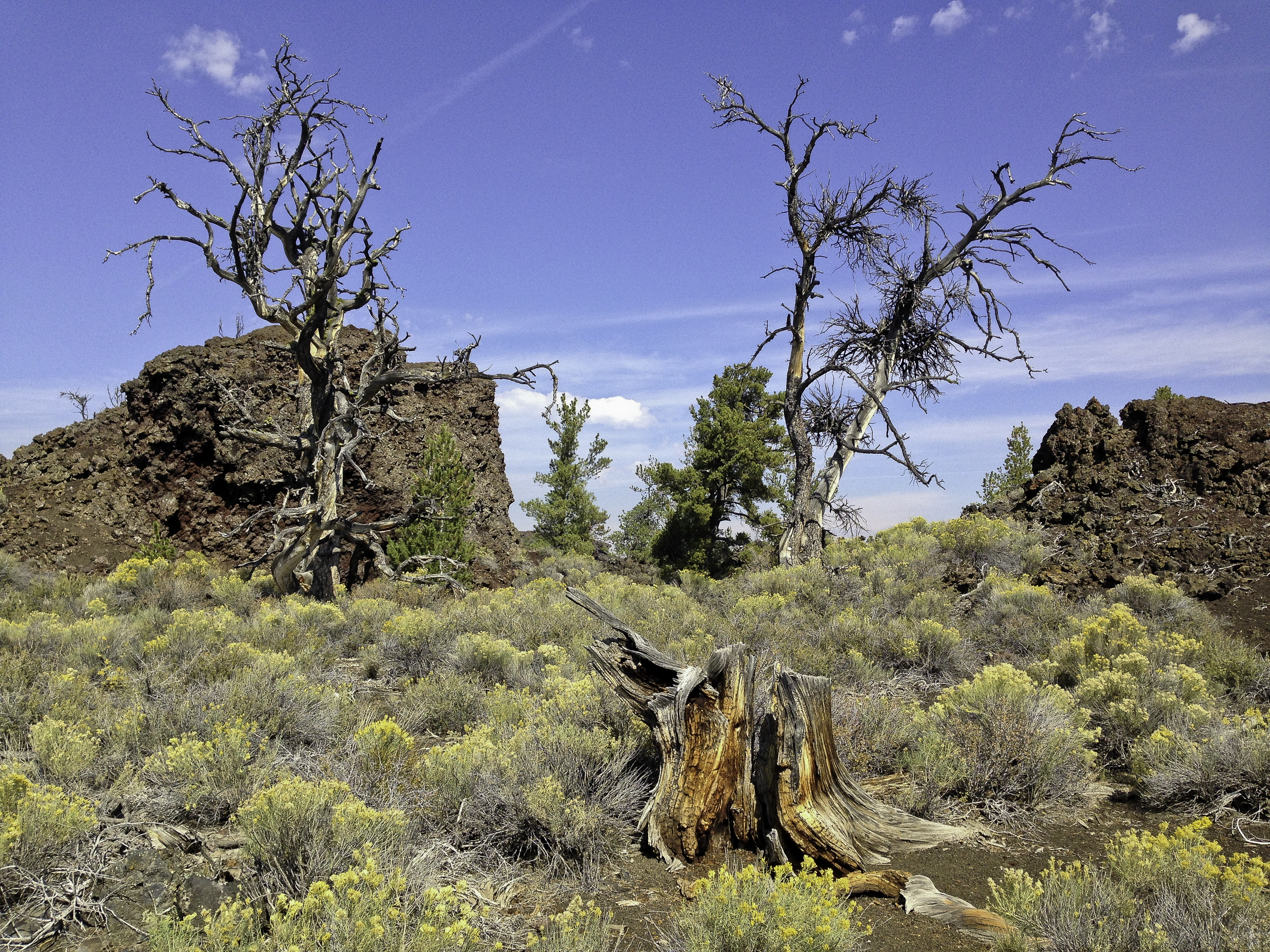
Dead trees on the Devils Garden trail in Craters of the Moon National Monument

A native plant existing in the volcanic rocks of Craters Of The Moon National Monument

Campsite at Warm River campground

Upper Mesa Falls in Idaho on the Henrys Fork River

Barns at Harriman State Park in Idaho

Firehole River from the Firehole Canyon Loop (one way)

Artist Paintpot in Yellowstone

Stupidity comes in many languages

Camping off the the road to Eagle Creek campground overlooking Gardiner, MT

“For the benefit and enjoyment of the People” North Yellowstone Entrance Arch

Devil’s Thumb from along the boardwalk in mammoth Hot Springs

Another view of Devil’s Thumb from the boardwalk

Overlooking the Town of Mammoth Hot Springs from a Lower Terrace Loop overlook

One of the geologic features on the Lower Terrace Loop in Yellowstone

The barren landscape on the Lower Terrace Drive in Yellowstone

Aspen grove where we ate lunch on the Blacktail Plateau Road in Yellowstone

The winding Blacktail Plateau Road in Yellowstone

Buffalo who wouldn’t yield to oncoming traffic on the Blacktail Plateau Road

Our camping site on the road to Lulu pass near Cooke City, MT

Cooke City, Montana

Campground status sign at the Northeast Entrance to Yellowstone

Man expedition vehicle from Europe in West Thumb Geyser parking lot in Yellowstone. We look very small
2014-09 WA/OR/ID/WY/MT 1/4
*Day 1/Tuesday/September 9:
Because I5 from Marysville to Olympia is such a traffic-choked exercise in frustration, we usually take Highway 20 east over the North Cascades Highway to the dry side of the state or head west on the same highway gaining access to the Olympic Peninsula via the Washington State Marine Highway ferries. This time, the North Cascades Highway was our choice as we were headed east toward Wyoming. It can be a leisurely drive with overlooks and trailheads along the way to Winthrop, an over 150 mile drive from Bellingham.
We usually stop at the Diablo Lake overlook to use the vault toilets and enjoy the vistas of the mountains and the blue green lake. We also stop at the Gorge Creek falls overlook to enjoy 2 waterfalls. Often, when you live in a beautiful area, you almost take your environment for granted. I never tire of the mountains, waterfalls, lakes, and rivers. Well, maybe the grey skies and drizzle but then we wouldn’t be the Evergreen State.
Since we left later than usual and weren’t sure about road closures due to the extensive summer forest fires near Twisp, we opted to camp at Klipchuck, a USFS campground (elevation 2940′) in the pine trees off Highway 20 which muffle the road noise. Early Winters Creek is nice to listen to also if you get a creekside site. Mid-week, after Labor Day, is a great time to camp in a popular area in peak season. Our Senior Pass discounted the camping fee to $4.
We wandered around the pine forested campground. Our neighbor had a truck camper trailering a motorcycle. His small dog fit into a pack behind the windshield on his bike which he would take on short jaunts. After our dinner of homemade soup and sandwiches, we fell asleep.
*This journey and subsequent ones will be in honor of my sister’s son who lost his 9 month battle with melanoma yesterday. A former Marine and father of three, he fought a valiant battle with this insidious disease. He loved to travel so we will wander the west in his memory.
Day 2/Wednesday/September 10:
After returning to Highway 20, we passed through Winthrop (tourist trap) where we fueled up. At Twisp, we were directed to the Twisp-Carlton Road, a detour around the destructive Carlton Complex fire near highway 153 where that same area subsequently suffered mudslides. 153 connects with Pateros and 97. We were glad to see that our favorite fruit stand/bakery/orchard just before the junction with 97 escaped the fire damage. We bought organic peaches and pears for me and an apple fritter for Tony.
Turning east from 97 onto 17, we passed through Bridgeport and the Chief Joseph Dam (potty break) until we turned south on Bridgeport Hill Road NE. We spotted an interesting fluted rock formation so drove up a dirt road almost getting stuck in some deep sand. Formerly a ranch, all that remains are piles of fencing and collapsed structures, poplar trees (to shield the winds), and a wooden water tower. Now, it is the West Foster Creek Wildlife Area set aside for the sharp tailed grouse, among others.
Zig-zagging down 172, we arrived at Highway 2 (if we wanted to return west to Everett, we would travel this road). Just a short while later, we turned south on Coulee Meadows Road/Rimrock Road/Sagebrush Flat Road which brought us just north of Ephrata. It was a paved road that wandered through wheat fields and abandoned farm houses and outbuildings.
From Ephrata, we went south on 28/283 to its junction with I90 just before George (the Gorge Amphitheater is close by). We crossed the bridge over the Columbia River/Wanapum Lake to Vantage. Our plan was to camp at Wanapum State Park but it was closed because of breaches in the Wanapum Dam down river. Because we had planned this small detour to visit Gingko State Park, we were stuck with staying at the Vantage Riverstone Resort nearby. $11 paid for a grassy strip near residents who lived in permanent trailers.
Gingko Petrified Forest State Park has a trail that winds up a hillside featuring caged specimens of petrified maple, walnut, fir and, of course, gingko. A sign warned of the presence of rattlesnakes but the trail had little vegetation for them to hide in and a local hiker said he rarely saw any. The coolest part was the rustic home for the resident ranger built by the CCC. It is a multilevel Craftsman bungalow.
When we returned to the RV park, we met a couple who knew the parents of the groom whose wedding we shot last August. In a twist of fate, we had met the bride’s parents while we were exploring the Olympic Peninsula near Port Angeles last Spring who asked us to be the wedding photographers. We played with the small dog that belonged to one of the kids who lived nearby, had dinner, then went to bed.
Day 3/Thursday/September 11:
Back on I90, we made a quick exit after recrossing the Vantage Bridge onto Highway 243. This highway follows the Columbia River passing through vineyards and now we were on the opposite side of the Wanapum Dam where we saw work in progress to repair the damage.We cross the Columbia River once again at the Vernita Bridge. Nearing the end of this trip, we will be camping here in several weeks amongst the many people who launch their boats.
On 240 we pass through the Hanford Reservation (DOE) and the Hanford Reach National Monument. Just move along folks, nothing to see here, just gated roads leading towards compounds. Just after turning onto 225, we stop at Horn County Park to bathe Toller at one of the campsites. Most sites are in the open in a grassy area but several are amongst some shade trees along the periphery.
Highway 225 leads us to Benton City and an on ramp to I82. We follow this quiet freeway east and south to again cross over the Columbia River into Oregon. Just for a change of pace, we exit onto a road that will bring us to Oregon Highway 207 or the Hermiston/Lexington-Echo Highway. We could have taken the exit for Highway 395, our eventual main road through the northern part of Oregon. But, we decided to take a more scenic route that would lead us to 395 further south. We would bypass Hermiston and the outskirts of Pendleton.
Somehow, we became lost on a road that ended in a cantaloupe field. Since, it appeared the harvest had finished, we took several that remained and eventually found our way to 207. We were in Oregon Trail territory according to a highway sign. From 207, we turn left onto Butter Creek Road, winding our way through ranch lands along Butter Creek. At Vinson, we turn onto 74 then begin our southbound journey down 395.
In the distance, we could see smoke to the west and south. We stopped at the Ukiah-Dale Forest State Scenic Corridor along Camus Creek for a picnic lunch. There was camping there also, but it was too close to the highway. 395 goes all the way into southern California passing through some beautiful country such as along the Eastern Sierras. Here, in Oregon, there is little traffic except for the occasional logging truck.
We began to scout for a place to camp for the night but wanted to avoid any fires. Toll Bridge campground was an option but it looked like a scene out of a spooky movie (our truck barely made it through the brushy entrance). We explored several roads on either side of 395 along the Middle Fork John Day River but only found several folks fishing and no roads for dispersed camping. Just after we explored those two roads, we drove further down 395 and found an ODOT clearing for disposal of rock slide debris. We had a view of some livestock on the next hillside over, a scenic rocky ridge and the valley below. The highway quieted down and we slept well.
Day 4/Friday/September 12:
395 continues south until a junction with highway 26 at Mt. Vernon where we fueled up. No self-serve in Oregon; there is an attendant who fills your tank. 395 and 26 are the same road east until you again turn south onto 395 at John Day heading towards Burns. Last April, we took a county/USFS road south from Dayville which would have led us to just outside of Hines near Burns. Somehow, we missed a turn and exited onto 395 way north of Burns.
This time, we found 63 aka the Izee Road, and retraced our route to follow the Burns-Izee Road to Hines. 63 is across 395 by the Zwick Old Growth Interpretive Trail. 63 ends at 68/47 which is the Burns-Izee Road. In a funny way, USFS roads, well, other roads too, take on another number and name: 68/47 or the Izee Road becomes 127 or the Hines Logging Road. We just continued to drive south, eventually ending in Hines where we fueled up at the Shell station and picked up a few groceries at the Thriftway across the highway. At a store nearby, we saw several llamas being loaded with item their owner just purchased. Just part of the rural west.
From Hines, we traveled south on 205 until we turned onto the Center Patrol Road, a graveled road that traverses the Malheur National Wildlife Refuge. It was early afternoon and we saw a few pelicans, hawks and songbirds. We returned to 205 toward Frenchglen and our favorite campground, Page Springs, a BLM facility that features nice vault toilets, garbage/recycling, water and a resident deer family. The sites are located near the scenic springs and in the spare pine and aspen woods. Our Senior pass entitles us to half off the $8 fee. After a walk and dinner, we went to bed.
Day 5/Saturday/September 13:
We awoke early to explore the 59 mile Steens Mountain Loop. It is not open year round and was closed when we were there last spring. We were hoping to photograph golden aspens and the scenic gorges: Kiger, Little Blitzen and Big Indian. The road is graveled and graded and there was surprisingly little washboards. Unfortunately, a controlled burn was happening east of Burns so the Alvord Desert was hazy. There were a few educational signs about the Basque shepherds who once kept their flocks in this area. We did see a large flock below when we were checking out an aspen grove.
Steens Mountain is one large fault block mountain, over 50 miles long, steeply plunging from a summit elevation of 9730 feet down to the Alvord Desert, elevation 4200 feet. In 2000, President Clinton approved the Steens Mountain Cooperative Management and Protective Act which was a collaboration of local landowners and government representatives responding to a movement for national monument status. This area now protects 425,000 acres for recreation and limited ranching.
We met a group of people on SxS UTVs that could carry their dogs. An aha moment for us as we were not previously aware of such machines. They looked sturdy and could allow us to access areas where our F-250 would be too wide or heavy. They can be easily accessorized with extra fuel cans, crates, doors, under carriage plates, etc.
We continued on the loop which ended on 205 further south from Frenchglen. The main overlooks are in the more scenic area and you could backtrack to Frenchglen. The road deteriorates somewhat and there is a narrow section with step dropoffs that is scenic. We passed a crossing where people were fishing the Donner Und Blitzen River. There is also a campground on this stretch, South Steens, that had a few horse trailers.
Once back on 205 which becomes 202 in the Catlow Valley, we stopped at Fields for fuel. The son of the owners said it was for sale due to their wanting to retire. It is one of the few fuel stops here so hopefully there will be new owners who will keep it open in this sparsely populated corner of Oregon. When in areas where services are few it is a best practice to get fuel as you never know where the next service station is. Some that have been around for years are suddenly gone. Or, you might that that urge to explore further than your original plans.
Our planned camping spot was on the Whitehorse Ranch which is bisected by a road which is open to the public. The Willow Creek Hot Springs campground is operated by the BLM. The ranch has 63,222 acres of deeded land and has grazing rights to an additional 287,205 acres of public range land administered by the BLM. It has operated continuously since 1869. Along the road, which is a well-graded gravel road, there are signs of some former buildings, either homes or outbuildings.
The campsite is not well-signed but the GPS on my iPhone worked well enough to find the access road before we saw any signs. Unfortunately, the campground was filled with a group that was partying. We backtracked a few miles and found a clearing in the sparse sagebrush. There was an amazing sunset that blazed across the western sky in red and golden streaks. The night sky was so pockmarked with bright stars that we had trouble finding the Big Dipper. It was so quiet that we had no trouble falling to sleep.
Day 6/Sunday/September 14:
It was a bright sunny day so we began to search for interesting rocks. We found a few agates and jasper. Eventually, the group at the campsite left so we decided to check it out. It was divided into two parts by a cement barrier: warm and warmer. It felt so good to wash out the desert dust and even Toller took a plunge. I could just imagine how nice it would have been last night. Maybe another time, not on a weekend.
Continuing on the ranch road, we eventually came to Highway 95 (aka the Idaho, Oregon, Nevada Highway). There wasn’t much traffic but what traffic there was were in a big hurry. Even a truck with a multi-horse trailer passed us. It seems that folks from Idaho bring their faster speed limits with them as those who passed us had Idaho plates. Oregon has more sensible speed limits than most western states, imho.
In Jordan Valley, we fueled up and saw the horse trailer folks parked along the road. What was their hurry? Pleasant Valley Road in Jordan Valley will take you to the start of the 90+ mile Owyhee Uplands Backcountry Byway. We saw a TV program on it once so decided to check it out for ourselves. Pleasant Valley Road winds through small ranches and there was a small local school. We also saw a turnoff for Silver City, a living ghost town in Idaho that we visited last Spring accessing it from the Idaho side.
We drove through cattle country passing the Lone Tree Ranch and the Dougal Ranch which was sited on a lake or reservoir. It was getting dark and we just missed the evening light on a gorge carved by the North Fork Owyhee River. The road twisted down to the North Fork campground, a free BLM campground in the North Fork Owyhee Wilderness. This campground was new and featured a vault toilet, fire rings, and picnic tables. We were the only guests that night. It was quiet and peaceful.

Diablo Lake overlook along Hwy 20 or the North Cascades Highway looking east.

Pine bark closeup

Wooden water tower and poplars, evidence of a ranch off of Bridgeport Hill Road south of Bridgeport, WA

Petrified walnut in Gingko Forest State park near Vantage, WA

Original water fountain at Gingko Petrified Forest State Park ranger residence

Ranger residence at Gingko Petrified Forest State Park

Sign about the Oregon Trail’s Butter Creek Crossing along Highway 207

Buckin’ Roll Ranch on the Butter Creek Road

Picnic spot Camus Creek at the Ukiah-Dale Forest State Scenic Corridor campground along Hwy 395

Our campsite at an ODOT debris disposal site along US 395 near the Middle Fork John Day River

On USFS roads in the Malheur National Forest

Springs near our campsite at Page Springs, a BLM campground near Frenchglen, Oregon

Quaking aspens off the Steens Mountain Loop Road

View of aspens along Steens Mountain Loop

East Rim Overlook overlooking Alvord Desert

East Rim Overlook overlooking Alvord Desert

East Rim Overlook overlooking Alvord Desert

East Rim Overlook overlooking Alvord Desert

Signage on the Steens Mountain Loop Road

Kawasaki Teryx SxS UTV

UTV group we met who convinced us that this is the way to ride

Official Steens Mountain Cooperative Management Area- public and private cooperation for mutual benefit

Cattle grazing near an abandoned stone building on the Whitehorse Ranch Road

Sunset at our boon docking spot on the Whitehorse Ranch

Boon dock spot at Whitehorse Ranch-pretty remote

Rock hounding on the Whitehorse Ranch

BLM campground and Willow Springs hot springs on the Whitehorse Ranch

Whitehorse Ranch sign

The road goes on forever it seems on the Whitehorse Ranch Road

This way to Silver City. I wonder if it is as rugged as the way into this living ghost town is from the Idaho side

On the Owyhee Uplands Scenic Byway, still in Oregon

Official Owyhee Uplands Scenic Byway sign

On our way into Idaho. We encounter lots of these cattle guards wherever we wander in the Open Range Country West.

Gorge cut by the Middle Fork Owyhee River on the byway

North Fork BLM campground near the North Fork Owyhee River in Idaho
2014-05-06 WA/OR/NV/AZ/UT/ID Part 2/5
Day 6/Sunday/June 1:
What we thought was a road that not often used was actually on the way to a local fishing hole or reservoir. Before 7:00 am, 4 trucks drove by to do some Sunday fishing. It was a clear sunny morning so we broke camp early to beat whatever traffic is on I 80 from Winnemucca to Battle Mountain. I 80 usually has a lot of truckers as its route is across the country. Just last April we traveled the opposite distance returning home.
Traffic on 140 was light but increased as we turned south on 95 toward Winnemucca. Once on I 80, a well-engineered freeway, travel was smooth and fast at 75mph. We passed semis and a few RVs. A stop at the Valmy rest stop, dating from the CCC era, broke up the journey. Everything inside the restrooms was cold: steel toilets, water and hand driers. There was a sign proclaiming I 80 the Dwight D. Eisenhower Highway honoring the author of our nation’s interstate system.
We fueled up in Battle Mountain then turned south on 305. We turned up a road just to see where it went. A huge mining company had taken over most of the hills to the north: Phoenix Mines. The road was closed at the mine, but you could drive on eventually ending up on Highway 50 near Middlegate to the Southwest.
Reaching the end of 305 at Highway 50, we turned east toward Austin, a town from the mining days of old. It is a mix of old store fronts and a few tourist shops plus at least 4 churches. We went up a dirt road to The Tower built by a mining magnate from the 1860s. It was built using native stone by local craftsmen based on a tower the owner saw in Italy. The family used it one June and July then lost interest.
We continued east on 50 or “The Loneliest Road In America”. Out of Austin, the road climbs and descends as it winds through the mountains. There were a few straight stretches then we arrived at the BLM’s Hickison Petroglyph Recreation Area to view the rock etchings and camp for the night. There was only one other site occupied and remained that way the rest of the evening. The amenities were vault toilets, garbage cans and picnic tables, some with slatted sun shades, all for free.
There seemed to be some interesting light and clouds to the east but nothing exciting happened that would warrant pressing the shutter. As I waited, in vain, a few vehicles drove by on 50 nearing dusk. For a lonely road, there was more traffic than you would assume.
Tomorrow, we will walk the short Petroglyph loop (.3 miles) to see what the ancient culture left behind. More sandwiches and time for bed.
Day 7/Monday/June 2:
The short Petroglyph loop was long on history. There were many panels along the trail that were done in the Central a Great Basin curvilinear style. That is, incised lines into the stone rather than dots. There were several references to the sun, one with a narrow pointing to the direction of the sunrise. Some were puzzling but one was clear as it showed a arrow with feathers, drawn simplistically with lines. One large boulder displayed rock art that differed from the other panels although still curvilinear. Surprisingly there was little modern graffiti. Someone from the Simpson Expedition left his initials from 1858.
We drove east on 50 stopping at a promising gravel pit. We have found a few of these roadside rock piles productive. Today we found two somewhat large agates and some agatized jasper. It was beginning to get hot and the wind was very dehydrating so we drove on to find the back road to the almost ghost town of Belmont. On the way, we would detour to the Miniature Grand Canyon which I saw on the Benchmark Atlas and read a blog entry about. Why not visit a mini one and a grand one on the same trip?
The Monitor Valley road was a well graded gravel road with soft shoulders. It was shown as the Belmont Road in the Benchmark Atlas but the sign read Monitor Valley Rd. We stopped at another gravel pit for lunch but the hot wind kept that visit short. It was there that we encountered the first of two vehicles we saw all day.
We passed the geographical center of Nevada according to the atlas but there was no marker to indicate otherwise. The only markers were for federal roads or ranches. North of the Monitor Ranch we saw two horses saddled up and tied to a rail in a corral. We felt badly for them as it was dusty due to the many dust devils but we soon saw the second vehicle, a truck with a stock trailer coming to their rescue. At the turnoff to avoid passing through the ranch we saw a sign saying “Bye, bye BLM” with a bother indicating a meeting. Hmmm, Sagebrush Rebellion.
At the next turnoff, we turned east toward the hills: Potts Ranch and Antelope Valley in hopes of finding the Miniature Grand Canyon. I had vague directions, a Topo map app on the iPad Mini and the a Benchmark Atlas for Nevada. We soon found ourselves on 373 after a confusing array of roads going every which direction.
We were now heading for Dobbin Summit at 8657′ in the Monitor Range. Our surrounding changed from mostly sagebrush to juniper and pine with some sagebrush. There was a hunting campground in one of the few open areas. The road twisted through the trees and suddenly we were at a huge gap in the rocks. Dobbin Creek, a small creek carved a fairly deep canyon through the rocks to Antelope Valley. We pulled into a turnout as the road had been one lane since turning off past Potts Ranch (which appeared abandoned due to some dilapidated wooden structures but had a corral, fencing and cows).
We discovered a small chunky cactus blooming in bright orange red. The canyon wasn’t very spectacular but was an interesting side trip. The road we were on was in good shape so we decided to continue on into Antelope Valley to take another indirect way into Belmont rather than backtrack to the Monitor Valley Road.
Antelope Valley is narrower and shorter than its neighbor Monitor Valley. The Monitor Range divides the two. At Clear Creek, there was a log home with sod roof, another log building with upright logs and a roof patched with the tops of old 5 gallon metal buckets as at Bodie State Park in California, an old boiler, and a rock structure. The atlas indicates this collection of buildings as Clear Creek Ranch.
Several curves later we were on flat ground with sagebrush dotting the landscape. We saw horses off in the distance, about a half dozen. Further along, there were groups adding up to 3 dozen. I snapped a few shots with my 70-200 mm lens but the wind blew my scent toward them and they scattered. We weren’t sure if they were wild as there was a collection of buildings in the distance snug against the hills. But, they spooked so maybe they were wild.
It was getting late so we wouldn’t make it to Belmont so we began looking for a place to camp. There were quite a few open range cattle with heifers and their calves and big bulls so we didn’t want nighttime visitors. We were again in the Humboldt-Toiyabe National Forest so maybe the cows wouldn’t venture past the cattle guards. In Box Canyon we came upon a closed gate that only asked that we close it behind us. We saw only a few more cattle after Box Canyon although we had left the forest. Luckily, we found a clearing amongst some pines where others had camped. There were some rabbit droppings, deer prints and what could only be a snake trail across the road.
Out here in the middle of Nevada or any open range area in the west it is difficult to tell who owns what. Nevada has the most federal holdings of any state, mostly military but the USFS and the BLM have a large chunk. We saw quite a few signs indicating that we were either leaving or entering the national forest but many ranches have grazing allotments and what may be BLM or forest lands have cattle guards and fencing. We saw a few no camping signs at the Potts Ranch but no other types like no trespassing or no hunting. We saw no sign of humans other than buildings.
Since it was after 8:00 pm we again ate our sandwiches and hit the sack, well, our sleeping bags. Tomorrow we go to Belmont then head toward Highway 6 and Tonopah for fuel as backcountry traveling eats up the miles and fuel. Then, we plan to explore back roads that leave the highway heading north.
Day 8/Tuesday/June 3:
After we got ready to hit the road, we saw the first people since yesterday morning. A rancher and his (grand)son were moving their cattle up our dirt road probably to Box Canyon where water awaited in big stock tubs. So, we just watched as they expertly kept them on track and keeping this year’s calves with their moms. The young boy, probably about 10 or 12 knew what he was doing.
After they passed by, we headed south looking for the turnoff to McCann Canyon. Interior Nevada does not have street signs. Occasionally, you will see a sign indicating how many miles to whatever canyon or ranch you are seeking with arrows and miles or a USFS road number. But, sometimes they are missing or faded or rotting off to the side.
However, this time we saw a dirt road leading west with a sign for McCann Canyon and other destinations. We followed it to a barbed wire gate, beyond which lay a narrow single lane road which look like it had seen little use. After some debate, we decided to forge ahead just because this was the shortest way to Belmont and we didn’t want to get there in a very round a bout way.
The road shortly improved and we wound through the canyon which had meadows of blue flag iris, several abandoned sheds of stone or logs or more recently of milled pine lumber. There were also fences of local wood where the wire had become loosened from the posts.
Soon, we began climbing toward the summit anticipating the steep grades that the atlas pointed out were ahead. Hah! There were grades but they weren’t steep and soon we were descending into Longs Canyon. This was a beautiful canyon reminiscent of Utah. There were sculpted stone outcroppings and hoodoos, colorful rocks and side canyons. This was a canyon we needed to return to for its photographic possibilities. There was a rather prosperous ranch but no one was home. The home was newer and looked more like a summer home. However, there were implements, corrals, tanks, etc. and the requisite cattle.
Arriving at the first paved road since Highway 50 on Sunday morning, we turned right toward Belmont. If it hadn’t been for lovely Longs Canyon, we should have continued south on USFS Road 139. The famous brick courthouse was crumbling while it was being renovated. The stone buildings and homes were partially crumbling as were those of pine. But, the most irritating situation to us was that people were living there amongst the ruins in either derelict RVs or in modern homes. This was a town that boasted 15,000 people at one time. It could have been preserved like Bodie, CA in a state of “arrested decay”. I don’t know the history of how it evolved that way but it was sad and a disappointment.
We turned around after a few images and lunch behind the courthouse to go to Tonopah for fuel, info at BLM and the USFS and drinking water/groceries. Tonopah can’t really decide what defines it: mining, gambling, or new technology. There are carved mountains in town from mining plus the Round Mountain gold mine which is huge and is gated, there are several casinos and a solar array is being built northwest of town which brought in newcomers displeasing the locals. Essentially, due to its location of the junction of highways 6 and 95, it a stopover for fuel or a rest as it is about equidistant between Reno and Las Vegas.
The next problem was a place to stay; the casino and RV parks were out so we selected a gravel pit off of Highway 6 which isn’t as heavily traveled as 95. We arrived too late for some of our errands so it was a quick 4 miles into town.
The gravel pit sheltered us from the hot sun, wind, and the little traffic noise. Even though there is an airport and race track across the highway, it was fairly quiet. I found a milky agate while walking the dog but found no others. It was getting dark so we ate and went to bed.
Day 9/Wednesday/June 4:
Apparently one of us thought we had transitioned to Mountain Time once we were in Nevada. It could have been the navigator as she takes care of logistics and mattered of time, distance and space. This positioned us in town a full hour before anything opened. Okay, so we could use the time to feed, water, groom and walk Toller, wipe down dusty lights and figure out questions and map requests. Grocery list was simple: chips, sour cream, bananas, pop for Tony and fresh fruit for me.
The people who live in Tonopah are pretty nice folks. We discussed rattlesnakes, geology, canyons, politics and Ford Diesel engines. USFS and BLM are next door on 95 and Scolari Market is just a few doors up from them. We came away with some answers, groceries, drinking water (Scoalris has a dispenser in the rear of the store by the chips), and maps. Tony also found some cool agates in the landscaping rocks at the USFS office who said, yes, okay, take a few and here is the number for Harris Gravel.
Karl at Harris Gravel was kind enough to invite us to his new pit and okayed our stay last night in his old one. Back on 6, we drove to the new pit, met Karl and started to find a few rather large agates, some milky and others kind of like clear gristle. After collecting a large zip lock bag, we waved goodbye and headed east on 6 toward our next destinations.
We stopped at the Saulsbury rest stop for lunch and met a photographer from Portland who was on his way home from a quick trip trip to the Grand Circle area. We exchanged POIs and business cards. Here was another person who saw the world in prints and also looked for things by shapes and colors rather than by name (like grocery items).
Traffic was light and the road fairly straight or with gentle curves so at 75 mph we soon were at our next turnoff to Tybo past Warm Springs. Tybo is a firmer mining town way up in the hills north of highway 6 up a dirt road. We passed different wildflowers and some sphaeralcea (orange blooms) and a large white poppy like we saw at Belmont.
Tybo looked like it may arise as there was a line of power poles marching up the mountain to the town. There were some pine lumber cabins, a brick structure still upright and the remnants of mining activity. We saw no one but there were a few “No Trespassing” signs posted so we snapped a few photos then headed to Hot Creek Canyon with a stop at Keystone, another old mining town. Hot Creek Canyon was recommended by a geologist in Tonopah who did his doctoral thesis in the Monitor Range.
Somehow, we missed the turnoff to Keystone although the sign laying on the ground indicated it was in the same direction as the canyon. We passed through Hot Creek and Upper Hot Creek Ranches, the latter who had trenched out a large wetland for irrigation. The canyon was a box canyon and actually ended up at the a Box Canyon we passed through on Monday. We passed by a herd of several hundred cattle, all horned and drove through several open gates.
Instead of arriving at the Old Page Place, we drove through a small ranch surrounded by poplars fronting a stream. We felt sorry to drive through someone’s front yard especially since a gate was ahead. We began to turn around when a nice gal appeared to brush aside our apologies. She and her husband lived at the old Dugan Ranch and had for twenty years since they discovered it on a camping trip. They had a green house, a few cows and horses. It really was a lovely spot nestled in this valley surround by poplars.
We returned to the crossroads by the Hot Creek Ranch which would lead to South Sixmile Canyon which we hoped would lead us to some fascinatingly named geology: Jumbled Rock Gulch, The Needles, and Slanted Butte. It was getting late so just before the entrance to the canyon, there was an old corral with a few cleared areas from years of use by or pother campers: Rock fire pits and rusted flattened tin cans.
Darkness revealed one light across Hot Creek Valley on some distant mountain range. There were a few clouds but the stars were brilliant in the pitch black darkness of central Nevada. Toller was restless because of all the smells of cows and jack rabbits. He was still excited about seeing the chukars in the last canyon. Time for bed Toller, it has been a long day.
Day 10/Thursday/June 5:
Waking up again to a bright sunny day, we left early before it became too hot. South Sixmile Canyon appeared to be great candidate for exploration so down a narrow rocky road we went. There were some interesting rock formations but no signs of civilization due to the narrowness. We found a place to turn around as the road was deteriorating beyond what we were comfortable with.
As we drove off USFS Road 812 to USFS Road 804, we were greeted by many cows and their calves along with some large bulls. Cows are very curious so they stopped to watch us drive by. These cows were thinner than the ones who were part of the Hot Creek Ranch herd. Later, we saw some antelope sharing the same grazing area.
I don’t know how we made it through the jumble of roads as few were numbered but we did arrive at Moore’s Station, which is a ranch/private residence. We passed by a large runway and a huge aquaduct. Since we didn’t go to the Project Faultless Nuclear Test Site (warned away by local geologist who said it was still highly radioactive. This could have been part of the support system for the detonation of the first atomic bomb.
Further north was the road to Jumbled Rock Gulch. It looked a scenic canyon but the road was rutted, very rocky and narrow. We couldn’t find any roads for Slanted Buttes and The Needles so we headed back to Highway 6 via the road that follows Moore’s Station Wash.
Once on Highway 6, we turned east toward Lunar Crater National Natural Landmark. We had planned to shoot Easy Chair Crater in the morning, but it was really hot and it was only late morning. So, we backtracked to a shortcut to 375 or the Extraterrestrial Highway called Twin Springs Ranch Road. It was scenic and not a bad gravel road. There was a mono line just before the ranch and the ET Highway.
375 has little traffic like 6 and 50. We passed through Rachel arriving at the junction with Highway 93 to turn south toward a Valley Of Fire State Park. We bought diesel in Ash Springs which sees lots of semi traffic. We passed by the Pahranagat a Lakes then turned east on 168, a shortcut to I15. There is a large scale development at the turn called the Chase at Coyote Springs which has a large green golf course and plated lots with street names and some mechanical support like water treatment facility but no homes. This is in the area where there is a preserve for the endangered Desert Tortoise. Why a huge sprawl like that was allowed near a preserve escapes me. For the tortoise’s sake, I am glad it didn’t grow any more.
I 15 had the usual mix of semis and passenger vehicles and in 2 exits we were on 169 to Valley Of Fire State Park. It had been hot all day and our Fantastic Fan helped some to cool us down. Showers were free so I gladly took advantage. The rock formations all around us glowed as the sun set. A late dinner of sandwiches as usual and we were off to sleep.
2014-05-06 WA/OR/NV/AZ/UT/ID Part 3/5
Day 11/Friday/June 6:
Even at 5:30 am, Valley of Fire was hot. The red rocks take on a glow before the sun rises. There is a dump station so we took advantage of it and potable water to fill our fresh water tank. We stopped to see the petroglyphs at Atlatl Rock. There is a 3 story staircase to climb to view the ancient rock art. Thankfully they are partially protected behind plexiglas so vandals won’t add their contributions. Atlatl was a type of hunting tool the natives used in the area.
We returned to Overton for groceries then retraced our path to I15 for The Arizona Strip. The interstate passes through the Virgin River Gorge travels from Nevada to Arizona to Utah. The times zones are confusing as Nevada is Pacific time, Arizona does not use Daylight Savings Time and Utah is Mountain Time. We did stop in Mesquite, Nevada to fuel up at the Shell. Mesquite is a retirement town we would never retire to. Glitzy, cookie cutter Las Vegas wannabe.
We stopped at the BLM office in St. George to pick up some maps and info. The Arizona Strip map for $12 is a must for traveling where we had planned. We were told the road south to Toroweap was a good road so we headed south. People tend to travel way too fast on gravel roads so it builds up washboards which shake the hell out of you vehicle not to mention any unsecured items in your camper. After 20 bone-jarring miles with 80+ to go, we retreated back to St. George and headed east on 9 through Hurricane, 59 south and east to Hilldale and 389 into Arizona. We stopped at the local tribe’s Chevron to fill up as we were venturing into the back country.
Back on 389, we turned south on USFS road 22 recommended by the BLM in St. George. It was a decent gravel road, not nearly as deeply wash boarded as the road to Toroweap. The further south we traveled, the mor mixed the forest became. Once mostly pine, the forest added Engelman Spruce, Douglas Fire and Aspens. There was a tornado in 1958 that blew down 550 acres of virgin pine. The young pines are renewing the land but since their habitat is in the higher elevations, their progress is slow. We found a downed pine that had been cut with a chainsaw that had very narrow growth rings.
As it was getting late, we drove down another road then found where others had camped. It was level and quiet. Toller could run and run and he did allowing his nose to lead the way. Tired Toller slept well that night as did we with the scent of pines.
Day 12/Saturday/June 7:
We awoke early to head for the North Rim of the Grand Canyon. I had never been there and Tony had never seen the Grand Canyon. On the way to Highway 67, we saw a mature coyote, three Merriam turkey’s and a hawk. We heard the woodpeckers. Once we came to the highway, we cut across to a viewpoint of the Saddle Mountain Wilderness where you can see a deep gash in the valley below. It was quite windy and there were no guardrails on the ledge going almost straight down.
A few miles down the road we entered the park and parked at the visitor center to check out evening photography opportunities. The park had a guest photographer so many of the rangers were knowledgeable about when and where. Since we were at Bright Angel viewpoint, we decided to stay for the evening shot then find another boondock spot on 22 for the night as the campground was full.
But, first we needed to dump our fresh water tank of the alkaline water from Valley Of Fire. The “potable” water was so bad Toller wouldn’t drink and Tony said that coffee wouldn’t even mask the taste. We checked with the rangers who allowed us to dump and refill even though we weren’t camping at the campground.
Returning to Bright Angel Point, I headed out with camera gear to the very end to await the magic. There was a glow but it wasn’t as impressive as I had envisioned. I even waited until after the sunset but there were no clouds to send the last rays for the after sunset glow. A group of photographers from the Albuquerque area said they got some amazing images at Imperial Point that morning with Mount Hayden all aglow. Looks like we will be up really early to drive the 45 minutes from wherever we stay the night.
Underwhelmed, we drove back up to 22 to find a place for the night. It was dark but we turned off the first road where 2 campers had claimed the lower flat ground. We put the truck in four wheel low and climbed up to a flat area. A quick dinner and we were asleep.
Day 13/Sunday/June 8:
We were so tired this morning and the drive to Imperial Point would be long and through deer territory so we elected to sleep in. When we swing through this way again we will camp at the campground in October as no reservations are needed. It will be closer to the point for both morning and evening photos.
Highway 67 had little traffic but they all seemed in a hurry. We stopped at Jacob Lake for fuel then headed east on 89 A North. A series of tight curves brought us out of the mountainous terrain and down into a valley. We turned north on House Rock Valley Road through the Vermillion Cliffs area. As graded gravel roads go, it wasn’t a bad road. The washboards would come further north where the popular trails for Wire Pass and Buckskin Gulch are.
We stopped at a viewpoint for the California Condors who nest in the Vermillion Cliffs to the northeast. Noting the whitewashed stains on the cliffs, Tony scanned the area and discovered a nest with an adult spreading its wings to fly. We saw a total of three birds catching the thermals scanning for food.
California Condors used to scavenge for mammoths 1.5 million years ago. With the extinction of their main food source their numbers declined until just a few birds remained. A valiant effort has brought their numbers up slowly. Impressive birds with a wingspan of 9.5 feet, they again soar above looking for smaller remains for survival.
Another stop was an old ranch with a beautiful local stone chimney still standing. The house had collapsed but a weathered shed, corral and small barn remained. Outside the shed was an air powered shovel that would shovel soil into a mine car.
From House Rock Valley Road we saw a rock formation on a ridge with an arch and some interesting jumbles. We tried a road that headed toward them but it ended at a gate where it became soft coral hued sand. There was a tight turnaround so we returned to the main road. There were offshoots but they were narrow and we weren’t sure where they went.
We ventured up Winter Road that wound up to the west toward Fredonia thinking we would get some views to the west and north. It was a rough road that revealed a small canyon on one side. After awhile, we turned back as the route travelled atop along the top of a plateau and we weren’t keen on backtracking to Fredonia.
Toward the northeast some beautiful formations that are the Coyote Buttes (South and North) began to take shape. From atop Winter Road returning to the main road you could see the colorful badlands and the teepee formations among others. Trails to the east would lead to the Paw Paws, White Pocket and the famed Wave.
As we traveled north, they became more prominent, but the traffic became more pronounced also with people who had permits for the various trails. We were wondering why people would bring sedans on a rough road but were even more puzzled when we were almost sideswiped by a lumbering class C rental.
Eventually we arrived on pavement so we again turned east on 89 past the Paria Contact Station (permits for the previous area) toward Cottonwood Canyon Road in the Grand Staircase Escalante National Monument. I had visions of candy colored rock outcroppings, especially along The Cockscomb. Initially, the scenery was not too colorful as we followed the trickle of the Pariah River. But, as we neared the Cockscomb, the color began to show. We had seen some power lines but were hoping they would head away from us. Whoever thoughtlessly engineered these transmission lines thoroughly destroyed one of the most beautiful back roads we have traveled with not one but two parallel lines that probably head toward Salt Lake City from the Glen Canyon Dam on Lake Powell.
We had planned to boondock along the route to take advantage of morning and evening light but were so disgusted that we decided to make Bryce our evening destination. Later, we were told by the a Bryce ranger whose dad was a lineman that they preceded the monument’s establishment by a few years. She was defensive about it saying people had to have power. But, I say that they could have been routed elsewhere.
Grosvenor Arch is a short 1 mile side trip to a golden yellow double arch. To see both arches, a sidewalk takes you to the base so those with disabilities can see through to the sky.
This is a sandy road and the winds had picked up. We had our windows closed and the AC on but it was so fine that it seeped into the truck. We passed Kodachrome State Park where we had stayed in a cabin in September 2010. We stopped along the paved road to photograph a picturesque shed with some nice geology in the background. Not really the best light but the composition was nice.
We stayed at North Campground at Bryce in Loop D which surprisingly wasn’t full. Almost, but not quite. The sites are a bit too close for me but hey, we were in Bryce. Our neighbors had a smoky campfire so we retreated to our camper after a walk with Toller around our loop and to the pay station.
Day 14/Monday/June 9:
We were up before sunrise to photograph from Sunset Point, my favorite viewpoint. With the dog along, we couldn’t walk the trails together but I did venture a few switchbacks down the trail from the viewpoint. Surprisingly I only had the point and shoot crowd for company and they left after sunrise. I had the whole viewpoint to myself until a bus load of tourists arrived. The backlit glow of the hoodoos is so ethereal that you just can’t stop shooting.
After leaving Bryce, we thought we would check out the Sevier Scenic Backway. We passed through ranches and saw a few antelope but the road was really dry and dusty and the traffic including USFS trucks would blow right by leaving us in a cloud of dust.
Back on highway 12, we passed through the red rock tunnels and by Red Canyon. Highway 89 would take us to Panguitch for fuel then on 143 toward Cedar Breaks National Monument. When we were in this area in 2010, a controversial coal strip mine was being debated. Sadly, I was informed by the gas station cashier that the Alton Mine was in operation. People need jobs she said as the double bellied coal transport trucks rumbled through this beautiful brick home town. Maybe so I replied but not 50 miles from Bryce. Coal mines are dirty and ugly and coal is antiquated unless newer technology to improve the emissions from the generators is invented. Jobs always win.
143 is a winding highway through ranches and recreation. Panguitch Lake is for recreation not photography as vacation homes and vehicles parked on the shore attest. We encountered some road work as the crews were laying down a layer of asphalt. In these higher elevations, roads get hammered due to the cold and snow and chains. There was also some volcanic rubble along the road which might indicate this area is on the fringe of the Great Basin.
Cedar Breaks has a nice campground just down the road from the Visitor Center. Our camp hosts were from Texas who demonstrated true Texan hospitality. Our campsite was a pull through across from them in a field of emerging wildflowers. It was about a month too soon for the explosion of color but a variety of bluebells was just beginning to bloom.
We had lunch and took a nap due to the high altitude. Several hours before sunset we drove to Point Supreme which is just behind the Visitor Center. There is a half mile trail from the point to the campground but I didn’t feel like hauling heavy camera gear in the dark. I did discover that it had overviews into the amphitheater that gave a different perspective.
The Ramparts Trail skims the amphitheater offering great views but it was very windy and it has no guard rails to prevent a gust of wind from toppling you into the steep canyons. There isn’t the glow that you get in Bryce except deep into the amphitheater. But, the point has thick log rails supported by rock pillars that place you too far away for a deeper view. I did get some images that might work but tomorrow I would really see some glow about an hour after sunrise.
Since we had already eaten dinner, we took Toller for a stroll then went to sleep after watching the dark sky fill with stars.
Day 15/Tuesday/June 10:
Before sunrise was too early for any images due to orientation of the amphitheater at Point Supreme (elevation 10,350′) toward the west. After about an hour the sun hit the upper cliffs and it’s outer flanks but the sun, being direct, flattened the outcroppings. A half hour later brought the side and backlighting into play and now the light was sublime. I worked the point overview and the views from the campground trail. I was alone in the quiet and the light. It was liberating not having to find a view amongst a crowd of point and shooters and the more serious photographers.
Park staff was on the job installing a station for filling water bottles like we have seen at Zion and the North Rim of the Grand Canyon. A ranger told us that the source of their water was from underground springs. We could fill up our drinking water bottles from a spigot in the campground or adjacent picnic area. We always check with the park personnel regarding potable water and the taste. After filling our water containers, we headed south on 148 toward 14 to stop for fuel and food in Cedar City at Shell and Smiths respectively. 14 is a beautiful road that passes through a beautiful gorge and gives you a glimpse along the road of the red rock that typifies Zion.
Highway 56 goes directly to Nevada passing through ranches and the small towns that support them after the sprawl of Cedar City. It is fairly flat and straight then climbs into mountains between the two states.
From Panaca, we drove directly to the campground at Cathedral Gorge State Park. We began to feel the afternoon heat so after quickly raising the top and opening the vents, windows and flaps, we took a nap until it cooled down.
Silly me had my time zones mixed up so I missed some nice light on some of the formations that typify the park. Making my way back the short distance to our campsite, I swept the beam of the flashlight across the road to spot any snakes that the park ranger said might be in the campground. It was still warm so I went to bed with the Fantastik fan running. The sound of large raindrops startled me awake but i fell back to sleep soon.
Day 16/Wednesday/June 11:
Since the storm had brought in some clouds, I thought there might be some great light at dawn. There was a colorful sunrise but the light didn’t fall on any of the more interesting formations. I did have several black-eared jack rabbits for company so I turned my lens on them. After returning to our campsite, I almost stepped on a baby snake. He curled up against the base of one of the shade trees but didn’t coil or hiss. I am unsure of the species.
Traffic on 93 northbound was very light so we had the whole highway to ourselves at times. We bypassed Pioche, a notorious mining town that rivaled some of the baddest at the time for violence. It was beginning to warm up and we had visited the town in 2010.
Up ahead we saw two very large birds sitting on fence posts who, upon closer inspection were Golden Eagles. Since we could see no traffic for miles in either direction we slowed down for a closer look. Larger than the Bald Eagles that we see in our area, they are truly a majestic bird.
Ely sits at the crossroads of 3 highways: 50, 93and 6. The main businesses are on Great Basin Avenue as you approach town from the south. Downtown wasn’t exactly thriving but there was a casino/hotel and several defunct gas stations. In Ely, we had some businesses to visit for fuel, a better gasket to seal the air filter, and some rubber to better seal the driver’s side window. There is also a USFS Ranger a District office there so we could decide which way to drive to the Ruby Mountains.
I thought County Road 3 which heads north to the Ruby Lake Wildlife Refuge would be more scenic and direct than taking 93 north to Interstate 84 and Elko then driving 227 to Lamoille Canyon. The informed opinion of the ranger was that we would be fine but to watch for livestock and extraction trucks. It was paved for a distance but would eventually become a graded gravel road.
The cattle we saw were off in the distance eating sagebrush and our only encounter with a large truck was a two tanker petroleum truck we could see from miles away due to the dusty rooster tail following it. Other than a few pickups from ranches or the mine, there was very little traffic.
We drove through a mining area where the hills had been scraped away into a huge open pit. The names we saw were Barrick and Bald Mountain Mine but the name on my map said Mooney Basin Project in the same vicinity. We drove through but didn’t see much activity even though there was heavy equipment scattered around.
We passed by a monument for Fort Ruby which was one of the worst forts to be stationed at as it was isolated its purpose was to protect the settlers and transcontinental railroad workers from Indian attacks. The overland Trail and the Pony Express route pass closely by.
Ruby Lake Wildlife Refuge was more of a marsh with dikes and small ponds than a lake. It is spring fed from the snow pack on the Ruby Mountains to the west. There is a small settlement called Shantytown which is a collection of small older and newer homes.
The campground at South Ruby was empty so we had our pick of sites. We chose one with a view of the lake and the Maverick Springs Range to the east, number for $7.50. It had been a long 200 miles so we set up camp, had dinner and watched the almost full moon rise toward the east. To the north several sets of denticular clouds hing in the sky until the setting sun turned them a light pink. I just enjoyed the show as there wasn’t much of interest for photography due the lighting from our campsite.
Day 17/Thursday/June 12:
The day began with a beautiful sunrise over the far mountain range. We drove out to the access road to discover which birds were nesting and feeding. We saw many golden head blackbirds, white egrets, white-faced ibis, canvas back ducks, mallards and others that were unfamiliar. Pale blue Blue Flag and wild roses were blooming plus a miniature white creeping morning glory and some pink flowered plants I didn’t know.
The only people there were some management personnel turning the valves regulating water flow in the canals. Hunting is permitted in season and fish are stocked by the on site fish hatchery with bass and several species of trout. Dragonflies were numerous and in many sizes and colors.
We turned north to the Visitor Center but due to a staff shortage no one was available to answer our questions. We met several ladies outside, one of whom was a host at our next campground, Thomas Canyon. We stopped at the bressman cabin to see a finely constructed log home with a log roof. Mr. Bressman is buried on the site. He built the home and lived with his daughter and son-in-law there after selling a business in nearby Eureka.
We passed through ranch land and a Mormon church which served the entire valley with its large parking lot. One rancher had a large collection of big tires carefully arranged in rows. Others had the usual assortment of old farming equipment and vehicles. As we follow USFS road 788, we are following the Hastings Cutoff, part of the California Trail. As we come to a paved road numbered 767 and the split of 229, the trail veers eastward.
Secret Pass overlooking Secret Valley is a stunning view into fertile ranch land. Soon we are done with straight roads as we climb and twist along a gorge. We stop for lunch overlooking Devils Slide Canyon and a large herd of sheep hugging the hillsides as they graze. We could hear them as we ate our lunch. Before we saw a badger cross the road. This is only the second one we have ever seen, the other bring on a country road in Eastern Washington.
Fort Halleck Road is a gravel road that twists it’s way through ranches until it brings us to a Lamoille and the Lamoille Canyon Road. Sometimes we think we are lost but somehow we make our way to pavement. A local on an ORV with two young children senses we are lost so points the way ahead at a crossroad.
The Ruby Mountains are unlike any range in Nevada as they are green and still have some snow on the peaks. They very much resemble the Colorado Rockies with sheer walls and waterfalls from snow patches. Lamoille Canyon RiD is very scenic and does provide the visitor with many pull outs to view the splendor. One pullout overlooking the Lions Club Camp has an informational panel about the glacier you can see. We saw a weasel scoot across the road in front of our truck.
Thomas Canyon Campground is almost full so we pick site 30 in a Loop C, a single site. With our Senior Pass, we pay $8.50. The hosts we met were gracious and the vault toilets were very clean and had air fresheners. Vault toilets at campgrounds can be very nasty so these were a gift. You know, the simple things in life. We also have had to dig a hole out in the desert so this was civilization and a luxury.
We wandered around the campground which seemed to have rushing streams everywhere. Lamoille Creek was fed by at least two smaller streams. All were swollen from the snowmelt from the Ruby Mountains. Moths were busy feeding from the bottle brush blooms of chokecherry bushes. Smilicina racemosa, orange columbine, and a pink wild geranium were blooming.
Our campsite was next to one of the feeder streams so we fell asleep listening to the rush of water like the creek by our house back home. One of our neighbors were on motorcycles. They had a specially fabricated trailer for their German Shepherd that had its own bed and windshield.
2014-05-06 WA/OR/NV/AZ/UT/ID Part 4/5
Day 18/Friday/June 13:
Friday the Thirteenth began as a clear sunny day. We left camp after filling our water jugs with some very tasty water. The drive to Roads End was a very scenic drive with many turnouts to view the mountains and the several beaver ponds.
An island meadow in the parking lot had colonies of Veratrum among the alpine shrubbery. Evidence of avalanches were along the road as tree debris had been cleared off to the side. There was a trailhead for Ruby Crest that was around 50 miles long but we opted for the short trail that passed by the creek. It rushed over boulders and some exposed rock shelf. A perfect view of the Ruby Mountains framed by several aspens and and a few Veratrum in the foreground would have made for a grand photograph had the light not been so harsh. I snapped a few iPhone images while I reveled in the view.
We headed down the road to Elko for fuel and to make our way to Silver City, a living ghost town, and a BLM campground. Elko’s downtown was blocked off as we arrived on 227 so we had to detour around. The Sinclair station on our way had dirty restrooms, no paper towels, dirty wash water for windshields and an insolent attendant who couldn’t give us receipt. We got out of town as soon as we could to head north on 225 into Idaho.
Another less traveled road populated by ranches, 225 or the Mountain City Highway passed several reservoirs and small towns like Wild Horse, Mountain City (a visitor center in a boarded up town), and Owyhee. After Wild Horse Reservoir, the landscape resembled photos I have seen of the Owyhee Canyon further north. Rocky spires on each side of the very twisting road that follows the river of the same name dominate. Between Mountain City and Owyhee, jumbled rocks, appearing in clumps held together with a special kind of side gravity clung to the hillsides.
We also drive through the Duck a Valley Indian Reservation that straddles the Nevada/Idaho border. In Idaho, 225 becomes 51. The road varies from curving descents and ascents to straight shots. When we come to 78 we turn west. To the north we can see the Snake River that nourishes the ranches that grow very green crops for stock. Rolling irrigation pipes make sure the ranchers grow enough feed for the cattle that dot the open range.
Silver City Road has several warning signs about rough gravel roads unsuitable for large trucks and towing vehicles. The city is about 20 miles away as we begin on a paved road. A sign for the the Silver Falcon Mine says it is 6 miles ahead. This is also an area for ATV activity as the many signs along the the road regarding their rules attest. We encounter several of them and some trucks towing trailers for their machines. Everyone seems to know the rules of the road (downhill yields to uphill traffic and there are few speeders). Curiously, we see a minivan and a Honda Accord which really have no business on a 4×4 road with ruts and exposed rocky shelves with blind tight curves that ascend and descend randomly. The views of the rugged mountainous terrain are spectacular but you need to pay attention. The road runs the gamut from sagebrush to junipers to fir or spruce from the gain in altitude.
It is a long slow slog to Silver City. It has some buildings that are shuttered and some that are occupied. The Idaho Hotel is open and has several ATVs parked out front. We talk to a group of riders who said the BLM wanted to take over the town but the residents fought it and the town seems to be able to keep its authenticity. That’s are several newer homes but most are restored originals from the silver mining days. We find several old safes and a large wooden cook stove at the Memorial Park along the same stream that passes by the campground.
It is dinner time but I encounter a local resident who tells us the best way to return to paved roads is to retrace our steps to 78. If we went west to Jordan Valley, it would add another 40 miles. A Vietnam Vet, he has lived here for 35 years. He excused himself as he was invited to dinner at the Idaho Hotel.
The campground has no other occupants but us so we pull into the first one. It has a picnic table, fire pit, it’s own empty garbage can and a nearby vault toilet. We also have our own marmot population which thrills Toller. He has to sniff every hole and grass clump. If we let him off leash, he would be all over the hills chasing the furry rodents.
As we eat dinner, the black clouds overhead let loose with claps of thunder and hail. We are snug and cozy in our camper but I worry about the gravel and dirt roads that we travel tomorrow all downhill. If we leave early, we can beat the weekend recreational traffic.
Day 19/Saturday/June 14:
The sky was still overcast when we left the campground just outside Silver City. We spent one of the first nights with the heater turned on. Our early start was calculated to miss all the ATVers coming up road to Silver City. I dawdled taking photos so we started meeting them a few miles out of town. However, most followed their code of off road etiquette, so any collisions were avoided. The morning light was interesting so I used the DSLRs when the light added depth to the layers of hills.
Back on 78, we head toward Nampa to fuel up. On the way we saw a which was just across the bridge over the Snake River. As we pulled in so did a group of LEOs escorting some bikers for a Crime Stoppers fund-raiser.
On to Nampa and a Thriftway for some groceries before traveling west on Interstate 84. Traffic was light westbound but a bit heavier eastbound. We exited at #3 for 30/95 toward Payette/Weiser/Midvale/Cambridge, small farming communities. In Weiser we needed a rest stop so turned down a residential street and found an athletic field with SaniCans. Toller was let loose for a wild run around the grass. He ran for the pure joy of being free of the leash.
At Cambridge, we turned west onto 7, still in Idaho as the Snake River which forms the Oregon/Idaho border was still to the west. The road featured tight curves ascending and descending for miles. We stopped at an Idaho Power Rest Stop near Woodhead Park on the Snake River which had one of the nicest public restrooms we have seen. A walk through the picnic area showed the same attention to detail and cleanliness.
On up the highway we went to find a campsite for the night. Crossing over the river at Brownlee Dam brought us into Oregon. We tried a few BLM sites along the river by the Oxbow Dam but this being a nice Saturday, they were all full of campers and folks fishing and boating. Copper field is a settlement for the workers and families at the dam.
We took another winding road (86) to head for FS Road 39 to see if Lake Fork had sites available. If not, we would boondock in the Wallowa Whitman National Forest. Unfortunately, FS Road 39 was closed for repairs for the next 2 years. This was our scenic route to Joseph and Enterprise and the red barns. The nice gal at the closed sign post, told us we could probably take Fish Lake Road through the forest from Halfway and come out above the road construction.
Back on 86, we saw a sign notifying us that we were now in the Pacific Time Zone. Halfway was a small community that evidently was proud of its recent high school graduates. On the light posts through town, a sign with the photo and name were proudly displayed.
We turned onto Fish Lake Road which wound its way across the mountains in curve after curve. We encountered snow at Fish Lake Campground so drove on to Twin Lakes. We only met a few folks traveling toward us and none going our way. At Twin Lakes, it was peaceful and vacant. One lake empties into the other with a gurgling stream. There are marshes and forest where the mixed softwood trees that have died retain stark silhouettes.
We walked out on a dock where we startled a deer having dinner. The only sounds we heard were frogs and an occasional fish splash, and yes, birds. Just about bedtime we had company from the other direction. They quietly made camp and the night was again silent.
Day 20/Sunday/June 15:
The dawn was a grey overcast but the snow-speckled Wallowas could be seen in the distance. The wildflowers were spattered along the road, in the forest and in the meadows. Forget-me-nots, Veratrum, coltsfoot, wild strawberries, lupine, Indian paintbrush, camassia, a red penstemon, and several blue varieties that I didn’t know. Deer were plentiful of course, but we did see two female elk near the road and a wild turkey raced across in front of us.
USFS Road 66 is a lovely drive through mixed softwoods: pine, fir and others I was familiar with but forgot the names. It tees into USFS Road 39 which was our intended route yesterday but it was closed for construction. We drove up 39 toward the Hells Canyon Overlook. After turning on the overlook road, we stopped part way up the 3 mile drive at an unofficial overlook. The views were vast even though the day was still overcast across the canyon to the Seven Devils in Idaho.
Once at the overlook we took the path along a restored wildflower meadow. Again, many wildflowers in a rainbow of colors were scattered on the ground. You can’t see down the canyon floor but you can see across. Even though you can’t see the Snake River that carves the canyon, it is still impressive. It is this continent’t deepest river gorge.
We returned to 39 to continue toward Joseph and Enterprise and the valley of the red barns. This road has many switchbacks and a few fallen rocks and potholes. The vegetation is creeping onto the pavement so it appears to be in need of some maintenance even above where the road has closed the road. We were surprised to see trailers and boats and a motor home as the road has some tight turns.
Eventually the road straightens out some as it approaches 82 or the Imnaha Highway westbound to Joseph (or eastbound to Imnaha). We drove on to Enterprise for fuel as it was a tight turn in to the gas station in Joseph. Enterprise has a Safeway. Which has a surprisingly good produce section and a variety of other items. It even had Silk soy milk in very vanilla which most small town grocers don’t carry. Oregon has a bottle deposit and attendants who pump the gas. Very civilized.
We drove around looking for red barns and found a few that would look good in the morning sun. We decided to camp at Hurricane Creek, a USFS campground about 8 miles south of Enterprise. The usual fire pit, picnic table and vault toilet awaited us. The toilet was new and fairly clean with no bullet holes. The picnic table had 3×12 fir planks attached to a 6″ channel iron base. Very heavy, it definitely would be difficult to steal.
Hurricane Creek roars through the campground. Most camp sites are along the creek but some have been abandoned due the ravages of flash flooding during heavy storms. Many fallen trees crisscross the creek at disjointed angles, evidence of past disruptions.
A few vehicles drove in but didn’t stay. It isn’t the brightest place to camp on a grey overcast day but for $3 it worked for us. We had arrived early in the afternoon so set up camp then wandered around by the creek. It had been an exhausting drive for Tony due to the many twists and turns of both USFS roads so we relaxed. It was still light when we fell asleep to the rushing creek.
Day 21/Monday/June 16:
Rain drops plopping from the overhead tree canopy on the camper roof awoke me at first light. We retired early among for rest and to catch the early morning light on the Wallowa Mountains backdrop for red barns. We had discovered a few and marked them on the Google Map app.
We wandered around the campground in the drizzle so Toller could do his business then left for Enterprise for Tony’s meds and to wash the truck of filthy road residue. Folks around here must oil their dusty roads as we sure picked up gobs of oily dirt.
After these chores we began to look for more red barns as the mountains were beginning to reveal themselves from behind the low clouds. We found a few and the soft light was flattering to the foliage. After getting lost on a dirt road that became progressively narrower and bumpier, we ended up on Highway 3 about 9 miles north of Enterprise.
Several years ago, we thought we had found Old a Chief Joseph’s grave near Nespelem on the Colville Indian Reservation in Washington far from his home in the Wallowa area. But, further research revealed that he had been reburied outside of Joseph, Oregon overlooking Wallowa Lake. We found the memorial marker for his grave. One of our favorite quotes from him: “Hear me now my chiefs. My heart is sad and sick. From where the sun now stands I will fight no more forever”. A courageous leader who would not sign a treaty giving away 90% of traditional tribal lands, he led his people on a long march to escape the US Cavalry. Eventually, they were settled in the Omak, Washington area.
The rain had abated and more Wallowas were now as large as life above the valley. We found a few more red barns and reshot a few others with a more dramatic backdrop. We started off toward the Zumwalt Nature Preserve of native grasses but 15 more miles (and return) of washboard gravel roads was more daunting toward the end of our trip. Back to Enterprise and north on Highway 3 northbound to Washington.
Highway 3 is another two lane state highway that has little traffic. It becomes 129 in Washington winding its way toward Clarkston, Washington and Lewiston, Idaho and the Palouse region. We stopped at the Joseph a Canyon Overlook to see where Chief Joseph’s Nez Perce made their winter home along Joseph Creek.
After some flat stretches, Highway 3 does some tight curves as it makes its way down into the gorge created by the Grand Ronde River. I don’t think we have been on a curvier road in our travels. The curves were tight and frequent descending to the river once in Washington. Oh, but the fun is not over yet, folks. From Boggan’s Oasis, a restaurant, the road did the same thing in reverse. We did stop at an overlook where you could peer into the canyon below. The river snakes along the gorge until it empties into the Snake River.
About 5 miles from the viewpoint we stopped at Fields Springs State Park to spend the night. We needed good hot showers and to dump our black tank. $23 is more than we like to spend but we needed some services and it was getting late. There were just 2 other campers so we had a good selection of sites to choose from.
It was quiet in the park so after supper and a walk, we went to bed early after awaking so early to see what the morning light would do at Puffer Butte. This viewpoint at the butte at 4500′ looks into the Grand Ronde Canyon and has views across 3 states.
Washington state has some nice state parks. I would rate this one highly due to it being one of the few around, the cleanliness of the grounds (792 acres) and the lovely forest that is a part of it. The sites are spacious and most are level.
Day 22/Tuesday/June 17:
At least it wasn’t raining when we awoke this morning. We tried to find the road to the Puffer Butte warming hut which promised views of three states: Washington, Idaho and Oregon. Apparently, this is more of a snopark as the map on a closed road showed groomed trails for snowmobiles and other routes for cross country and snowshoeing enthusiasts. There was no road to Puffer a Butte, only a trail and I didn’t want to carry camera gear for two miles. I may be wrong but we searched for roads which we found gated or that lead to trailheads. The hosts were asleep at 6:30am and the staff had yet to arrive.
After dumping our black tank, and getting some fresh water, we turned north on 129 toward Clarkston/Lewiston for fuel and meds. I found a Safeway that had both in Lewiston, Idaho. We passed through farmland dotted with farms both abandoned and working.
Asotin, the county seat of Asotin County, is a charming town along the Snake River. Once we entered Clarkston, then Lewiston, they looked like any other cities with growing pains. Sprawl, malls, rush hour traffic. Get us out of here.
129 had ended so we took 12 out of town to where 195/95 head north to Spokane. 195 forks westerly to bring us to the Palouse for lovely barn photos amongst the rolling fields of wheat, canola, peas, other crops. Also, Steptoe Butte, which has a long spiraling climb to the top, offers views of patchwork quilt farmland. Unfortunately, the rains began in earnest and didn’t look like they would ever let up. We decided to go to Colfax, to see if conditions were improving.
Colfax was a wash and I wasn’t happy as this is prime time for photography. Time to head west on highway 26 as Twisp/Winthrop promised sunnier skies. 26 is a state highway that needs repair due to grooves from traffic. Coupled with constant rain, it wasn’t a fun drive. We took respite in a rest area that 26 shares with 395. The bathrooms are okay but the facilities for Fido were appalling. I just can’t figure out why people don’t pick up after their pets. Gross.
We turned north on 17 toward the Columbia National Wildlife Refuge. At the northern border is the Potholes Wildlife Area and Potholes State Park. The Seep Lakes Wildlife Refuge fits in there somewhere in this area set aside for wildlife, hunters and fishers. We stumbled on to Seep Lakes while looking for a place to boondock for the night.
There are many small lakes in the area that are contained within the Scablands that make up a part of eastern Washington. We found a level area with a vault toilet in the Lyle Lakes camp area. There weren’t assigned spaces of course; you just found a spot with a view off the road and called it home.
People drove by occasionally on a nearby road but no one bothered us. There was some ugly trash, however that we did clean up down near the water, mostly plastic bottles and bullet casings. However, we do not pick up condoms or dirty diapers.
We could hear the sounds of the birds as we ate supper and watched them dive into the water. We were surprised to see a pelican but we later discovered that they do nest here.
As I was walking Toller, the rain sprinkled some and we were treated to a lovely double rainbow. I don’t think Toller appreciated it as much as I did. I grabbed my camera for some photos of the truck bathed in golden light but couldn’t frame the entire rainbow even with at 24mm on a full frame body. I would have had to back into the lake which was beyond the lengths I would go to for a shot.
We fell asleep listening to the evening bird song and the occasional vehicle.
Day 23/Wednesday/June 18:
I was expecting some nice light to bathe the landscape this morning but the eastern clouds were too thick to let in any golden rays. We wandered around, broke camp then returned to the main road in the preserves.
This is fruit tree and feed crops country. The farmers were busy in the fields and trucks were hauling totes to the fields for harvest. It is mainly the sweet cherries that are being picked now. Field hands were thinning the apple crop to ensure bigger apples.
We decided to swing east a bit to explore Potholes State Park. It is a well-manicured park, a bit too much for our tastes but would make a good stop when we travel through this area for our fall or early spring forays. If we buy the off-season senior pass, we can camp for free.
Back on the road, we made our way north via some county roads and highway 17 to and through Ephrata and Soap Lake. Traffic was light as this isn’t a heavily populated area. We stopped at Lake Lenore Caves State Park or more specifically, the historic site which has some caves the local natives used to prepare collected foods for winter storage. The trail wound it’s way up into the cliffs but my rattlesnake phobia warned me about rattlers lurking in the sage brush along the trail. We could scan them with our binoculars from the safety of the parking lot. We could also see the rock art along the outside of one of the cave. We were told by a local gal that they were also inside the caves.
Back on 17, we headed north to Coulee City to splurge on some wraps at a little cafe attached to a Cenex gas station. We like their food and also liked that they had a copy of a portrait of Old Chief Joseph on the wall.
You have to travel on US Highway 2 a bit before turning north to travel on 17 again. Just outside of Bridgeport, we stopped at the Chief Joseph Dam to eat our wraps. This is the second largest dam in the US and the largest straight dam in the country. It generates about a million dollars of electricity a day, enough to supply Seattle. I am just wondering if it does serve Seattle as the big city gets its power needs met by Seattle City Light’s dams on the Skagit River or so I thought.
Back on 17, we crossed the bridge over the Columbia River to highway 97 which would pass through Brewster and Pateros before we swung west onto 153. This is what happens when you choose to forego interstates in favor of county, state and US highways.
There is a nice fruit stand/bakery on 153 that has an organic orchard. They also use their own fruits to bake deliciousness into their baked goods. Black cherries were $3.50 a pound and the larger Queen Anne’s were $6.50. We bought a bag of each so I can now gorge on one of my favorite fruits.
Back on 153, we pass through Methow and Carlton, two very small towns. Soon, we are on highway 20 which will bring us through the North Cascades then home. Twisp is a bit bigger than Methow or Varlton anfpd boasts a Les Schwab tire facility and a NAPA auto parts store. Winthrop is the artsy touristy town we always drive through, only to stop at the four way stop in town. It reinvented itself as a Western-themed village when Highway 20 pushed its way through from the dams.
Our campground for the night was a USFS campground called Klipchuck which is well off highway 20. We have stayed at Early Winters but found that the highway noise was bothersome. It is quiet in here except for the sound of Early Winters Creek which has buried itself in a gorge. The campground is less than half full so we have some choices. We pick site number 1 which is fairly level and not close to other campsites. Although it is on the corner, where campsite seekers turn onto this loop, it is very quiet. We ate surrounded by mixed softwoods, mainly pine and fir. We love the glow of pine trees in the early and late evening sun.
We ate a bowlful of cherries, finished our soup then hit the sacks. Lots of driving today made for sleepy campers. Good night.
,
2014-05-06 WA/OR/NV/AZ/UT/ID Part 1/5
Day 1/Tuesday/May 27:
Just a few hours of traveling east in Washington will take you from fir, cedar, maple and alder forests to the pine and aspen variety. We left our home during mid-morning to avoid the “rush” hour on highway 20 eastbound. Most traffic was headed west including RVs and logging trucks. We stopped along the Magic Skagit River for photos of the blue green water tumbling over boulders along moss covered trees lining the shore to the salt water.
We also took a break at the Ross Lake overlook. Soon, we were hitting the passes (Rainy and Washington) then began our descent to the Methow Valley. Snow-covered peaks were replaced by irrigated fields although you could catch a glimpse of the east side of the Cascades occasionally.
In Winthrop, we bypassed the tourist shops to take a look at an old farm that has since been turned into a wildlife refuge. Sadly, the rustic red outbuildings had been removed leaving a rather dilapidated octagonal silo. Last time we were there, we could see owls hiding behind the openings.
Our campground for the night was Foggy Dew, a USFS facility in the Okanogan National Forest off highway 153. The turnoff is just past the very small dot of a town called Carlton which has the Carlton Mall. We traveled for about 5 miles on a one lane road that crossed a single lane bridge bringing us to the site. We chose number 10 which was more in the open. There was only one other camper at the other end in a tent. You won’t find the big rigs here. We paid our discounted senior rate of $4. The vault toilet in our part of the campground was just cleaned and was in decent shape meaning no bullet holes or recent graffiti. The campground is sited between 2 creeks: North Fork of Gold Creek and Foggy Dew Creek. We fell asleep to the creek that was flowing about 80 feet from our camper.
Day 2/Wednesday/May 28:
After breaking camp at 7:00 am, we drove down the single lane road returning to 153 aka the Cascades Loop. It was a quiet drive with little traffic. Highway 153 follows the Methow River as it winds it’s way to the Columbia River near Pateros where the highway ends at US Highway 97. Traffic was light and even lighter when we took Alternate 97. Alternate 97 is above 97 but both follow along the Columbia River along its western shore. Alternate 97 is higher allowing a better view of the River below. There was a road called the Apple Acres Road that was even higher paralleling 97 before it became two highways. It eventually ended at Alternate 97.
Speaking of apples, this is fruit tree country. Just before Pateros, there were patches of cherry and pear tree orchards. None of the fruit stands were open and it appeared that the cherries were just ripening. There was a sign that said Washington cherries are here but the building by the sign was closed. Maybe we can pick some up when we return in 3 weeks.
Alternate 97 passes through Chelan where we fueled up at a Shell station. Chelan is at the east end of Lake Chelan which is a popular recreation area. Progress seems to have found it as there were some high end homes up above the lake and condos closer to the shore. Just before Chelan 97 goes over the east side of the Columbia while Alternate 97 hugs the shore of Lake Chelan then goes through some hilly country until it begins to follow the Columbia on the west side.
We pass through the town of Entiat. All through this area are big fruit processing plants and the season seems to be gearing up as we saw not a few semis carrying new and old wooden fruit bins. By the way, both 97s have a lot of trucker traffic, but the alternate has fewer.
Just before Wenatchee, we head west (hey, I thought we were going east and south) on highway 2/97. But, 2 heads toward Seattle. Unless we want to head towards the Tri Cities area, we need to hook up with 97 south (the alternate has merged with 97 after crossing the bridge to Sunnyslope.). Confusing but several federal entities cluster forcing a pass through Yakima or the Pasco, Kennewick, Richland area which would put us further east than we want. The 3 areas are the Yakama Indian Reservation (not a misspelling), US Army Yakima Training Center and the DOE Hanford Site.
Between Cashmere and the tourist town of Leavenworth, 97 heads south. Before we made the turn, we stopped for a break at the Peshastin Pinnacles State Park. There are some toothy rock formations that unfortunately have huge power lines running through them. No camping but it does attract rock climbers. From 2 heading west you can see the east side of the Cascades which separate the western or wetter portion of the state from the drier east side.
97 twists and turns and loses and gains altitude heading south. Somewhere on one of the curves we go through Blewett Pass, altitude 4102′. We pass through Ellensburg, home of Central Washington University. Instead of following 97 to Yakima, we follow the super curvy highway 821 or the Yakima River Canyon Scenic Byway. There are a number of federal campgrounds and we stop at the first one: Umtanum Creek Recreation Site on the Yakima River. There is suspension bridge for foot traffic that crosses the river. We stopped partway over to watched a number of small blue butterflies along the shore congregating near muddy areas. We also saw a pair of goldfinches, our state bird.
Eventually, we came to Interstate 82 which is also 97 and 12 to skirt Yakima on the east side. We pass by Wapato and Toppenish, then Goldendale where my grandfather spent a part of his childhood 100 years ago. He rode a buckskin horse to school and played in the rock piles where the rattlers hung out.
Soon, we can see the Oregon side of the Columbia River. However, we are stalled for awhile as traffic backed up due to a motor home having missed a turn taking out a lamp pole landing sideways in a ditch. We crossed 97 on the bridge to the gas station town of Biggs to fuel up. Diesel was $3.89 a gallon at the Union 76. We left 97 to the truckers taking the Biggs to Rufus highway. At Rufus we turned south on 206 through Wasco.
There are rolling hills being farmed but there are also windmills everywhere. Where there are no windmills, there are huge transmission lines. These wind turbines are huge; they are not your father’s windmills. They were all turning, some more slowly than others.
After winding through the lumpy hills, we arrive at the new Cottonwood Canyon State Park along the John Day River. It was a ranch at one time. Now it is an 8,000 acre state park. The campsites aren’t very private as the trees are newly planted where the fields once were (there are some volunteer grasses in rows). There is garbage (no recycling), vault toilets, water, picnic tables and fire pits. We passed through here in April 2013 when it was being built. The area is beautiful between basalt cliffs and volcanic hills. There are trails for people and horses. Very clean and new. There were 5 campers here among over 25+ sites so it is not crowded.
The canyon runs southeast to northwest but the lighting was soft due to hazy western skies and canyon walls began to block the sun at around 7:00 pm. There was no dramatic sunset or light on the cliffs along the river afterwards. Tired from the long day, we had supper and were in bed soon after dark. The stars are out and can be seen very clearly.
Bird tally for the day: several blue herons, peregrine falcon, red tail hawks, bald eagle, red wing blackbirds, swallows, goldfinches, magpies, flickers and we saw a marmot running across the road to a pile of rocks.
Day 3/Thursday/May 29:
Since yesterday was such a long grueling duel with semis on 97, today we chilled by driving slowly on county roads and 3 digit highways. Since this morning was cloudless and the light didn’t hit the canyons the way I wanted it to, we took our time decamping. Oddly, we camped a site over from a couple from Bellingham.
I spoke with a ranger about how the park came to be. The Murtha brothers ran an 8,000 acre ranch along the John Day River. One had children who had moved away and weren’t interested in hard scrabble ranching. The property was purchased by a river conservancy who sold it to the state piece by piece for a total of $8 million, $1,000 per acre. It was purchased with Lotto earnings which is what funds the Oregon state parks. It opened last September.
We stopped in Condon, a ranching community to buy a few items from the grocery store. The town businesses recently changed their facades to reflect their roots from the early part of the last century. On 206 we noticed more wind turbines and either abandoned farms or, for those ranchers who had the turbines on their property, new machinery, trucks and a tennis court. We did stop by one old home for photos.
From Condon, we continued east on 206 toward our eventual designation of the Sheep Rock Unit of the John Day National Monument. We saw a turnoff for Lonerock, so decided to drive the 17 miles to explore. The road was paved for a good portion but then became a graded road. From an overlook we could see the very small community that was still populated (35) nestled in a valley. There was a church, school, jail (1891), community center and a number of homes. It was a very quiet town with no apparent stores. We turned north on the Buttermilk Road driving through canyons and scattered ranches. We saw a few deer and many birds including magpies and doves.
We drove out to 207 passing by the Treo Ranch holdings. We ended up at Hardman, a town down on its luck with a small cluster of homes and a towing shop. From there we drove through the Umatilla National Forest. The road had many switchbacks and elevation changes. It was also very narrow with steep drop offs so thankfully we encountered no logging trucks or semis and little other traffic. We turned east on 406 at Kimberly to check out several campgrounds on the John Day River. We turned into the first one, Lone Pine and picked a sunny site, L5. There are 5 sites, one of which was occupied. Vault toilets, fire pits and a picnic table are standard issue for USFS campgrounds. For all these amenities, we paid $2.50.
Day 4/Friday/May 30:
This morning was a bright, sunny day so no photography although we were in a beautiful setting along the John Day River. We drove south down 19 through the Sheep Rock Unit of John Day Fossil Beds National Monument. I shot a few from the side of the road of the various multi-colored layered rock formations. We turned left onto 26 continuing on the Journey Through Time Scenic Byway.
Just past Dayville, we left the highway to venture south along the South Fork of the John Day River on 42, a county road. It soon became the South Fork Road and a gravel surface. There were scattered ranches among the valleys. We also saw columnar basalt along the way and some beautiful gentian blue flowers on tall stalks with several pink ones. Hummocks of small yellow daisies and puffy pale yellow blooms were growing from the rocky scree.
Once we came to Black Canyon, we stopped along the road to investigate the bird condos. There were several kinds that were living in the cracks and fissures of the jagged rocky canyon walls. The river, much smaller than where we camped, flowed below. We saw a ruddy duck fly back and forth along the river while swallows were nesting in the cracks and pockets. Many butterflies we saw were dining on a bush with small white blooms in clusters.
But, the coolest of all was when we spotted a herd of mountain sheep up above us on the cliffs on the other side. There were 4 newborns among the herd of at least ten. They knocked a few rocks loose as they climbed to higher ground. We were very quiet although it was pretty exciting. This is a time when I wished I had a bigger lens (and deeper pockets). But, I did get a group portrait.
The river had become noticeably smaller and we were nearing the headwaters of the many creeks that feed it. It had disappeared from immediate view into a small canyon. Suddenly, in the clearing, we saw it tumbling over some big boulders. There was a turnout for it that ended a few yards from the top. It was also a great place to camp. The wildflowers, mainly lupine, were bunched among the rocks.
We drove by the site of a former mill evidenced by scattered collapsed buildings and rusted ruins of machinery. Further down the road was a group of mature lilac bushes and orange poppies. There were no “no trespassing” signs but we backed up and returned to the main road.
Somehow, we missed a road and ended up teeing into a Highway 395. We kept looking for Izee but never found it, the reason being that we took a turn too soon. There was a rest area across the road, an old growth forest area with vault toilet and picnic tables and paths wandering through some large pines. While we were having lunch, a volunteer for the USFS stopped by who was researching gravel biking routes. He was curious about the road condition which was good as it was graveled and graded last year. He said he had lived in the area since the early 70s and had only seen the mountain sheep once. He also explained that the falls used to be steeper and denser with boulders until it was blasted to allow the steelhead and salmon to travel further upstream.
Once down 395 we encountered few cars and more than a few log trucks. We passed by the towns of Seneca and Silvies. The Silvies Valley Ranch, a huge modern ranch, took up a large portion of both sides of 395 for miles. Tony was getting tired so we drove into the Idlewild campground, a USFS facility right along 395 with the usual vault toilets, fresh water, campfire rings and a picnic table. There was just a class C with a toy hauler and a Tundra/toy hauler combo. We parked at the further end in seclusion. There was some wood in the fire pit so we had a campfire because it was only 4:00 pm and a fire was practically laid. Dry pine burns fast and hot.
After our dinner of soup and sandwiches by the fire, we sat for awhile then went to bed. The traffic had died down for the night. Tomorrow, we go into Burns for fuel and to ask whether Steens Mountain Loop is open.
Day 5/Saturday/May 31:
We really had the best intentions of breaking camp early to do our fuel stop in Burns. Really. But, I overslept and then Toller needed a long walk. We had just finished adding water to our tank when we encountered the camp host. He and we were on the same page on just about every topic. He also informed us that the white-headed woodpecker we saw was only seen here in this area. And, that the mountain goats were actually mountain sheep. The pine forest we were in had trees up to 800 years old. The following floored us: $5,000 ferro-cement picnic tables, $800 fire rings, $35,000 single vault toilets, $55,000 double. Pretty unbelievable. Kinda like the $800 toilet seats.
Our human contact satiated, we went into Hines to fuel up at the Hines Shell and buy a few groceries at the Thriftway across the street. We drove toward the Malheur National Wildlife Preserve taking the Center Patrol Road, a gravel road that tended toward washboard. We saw many red-winged blackbirds, not so many yellow-headed blackbirds, many ducks, harrier hawks, cormorants, and a white egret.
At Frenchglen, we headed up toward the Steens Mountain Loop which the Thriftway checker said was closed at Fish Lake. We passed through rangeland and fields of wildflowers. Soon we could see Steens, a bulky mountain longer than tall. It had patches of snow. The aspens were stunted and had smaller leaves. The BLM or USFS was conducting a juniper management program to see which method could reduce the number of juniper that were crowding out the aspens for a more balanced ecosystem to protect the watershed.
After checking out Fish Lake campground, we headed back toward 205. Once on 205 then 202, we began to look for a place to spend the night. We passed through Fields then Denio just over the border. It was looking bleak as there were few roads that led to other than ranches or dead ended in snake infested grasses (we saw 3 dead ones on the highways that saw little traffic). Finally, past Denio Junction, there was Ninemile Road that looked promising. We saw another camper about ¼ mile away so we found a level area off the gravel road and set up camp. There were mountain ranges all around us, typical of Nevada, barren and buff colored. Windy but not cold and not too out of our way.
A quick dinner of sandwiches and a blog entry then time for bed.

overlook at Ross lake on Washington’s North Cascade Highway 20

one of the creeks at the Foggy Dew USFS campground on 153

wooded area at Foggy Dew USFS campground

Coltsfoot in bloom at Foggy Dew USFS campground

Umtanum Creek Recreation Site along the Yakima River Scenic Corridor or canyon Road (821).

camping at Oregon’s latest state park: Cottonwood Canyon

abandoned farmstead along Oregon’s Highway 206

Large wind turbines populate Oregon’s farmland along 206.

Wide open spaces along Oregon’s Highway 206

The small community of Lonerock hidden in the rolling farm country east of Condon.

Lonerock’s community hall

Lonerock’s jail 1891

Detail of Lonerock’s 1891 jail.

Buttermilk Road leading out of Lonerock, Oregon

More Buttermilk Road scenery

Heading for Hardman, Oregon from Lonerock, Oregon

Sheeprock Unit of John Day Fossil beds National Monument along Highway 19.

The South Fork of the John Day River along the South Fork Road.

Black Canyon along the John Day River where we saw the mountain sheep

Interesting red rock layer along the South Fork Road

Malheur National Wildlife Sanctuary south of Burns, Oregon

Lily Lake along the Steens Mountain Loop
2014-04 WA/OR/NV/CA 6/6
Day 20/Saturday/April 26:
After a quiet night and a restful night’s sleep (no traffic on Wyeth, muted trains and the forest blocked the freeway sounds), we headed down 30 toward Cascade Locks where we would cross over the Bridge of the Gods bridge to Washington, paying our $1.00 toll to a gal who had a collection of gnomes in her booth. We were welcomed to Washington about half way over. We turned west on highway 14 toward Washougal to purchase fuel at the local Shell for $3.859 for diesel, less expensive than gasoline for a change. The restrooms were clean and the station was well-maintained.
We continued on Business 14 to Camas where we picked up 500 West which zigzagged northward and westward for an alternate to the sprawling mess that is the budding megalopolis of Vancouver, Washington. We passed through hobby farms and we noticed the beautiful soil that was turned. All the flowering trees and shrubs were brightly colored and in full bloom brightening up the grey gloom. We just skirted the creeping northward sprawl of Vancouver as it covers the countryside northward to Battle Ground. Somewhere when 500 makes up its mind to head north, it becomes 503.
Since we had around nine hours to arrive at our final night’s camping (Walmart in Tumwater), we headed into the Gifford Pinchot National Forest to find Lower Lewis Falls, a very photogenic cascade of water on the Lewis River. We pass through Brush Prairie, pass by Battle Ground and wind our way through Amboy and Chelatchie until we turn right onto Forest Road 90.
It begins to rain (affirming that we are really back in Washington) but we can see faded patches of blue through the trees in thick colonies along the road. There are few cars, maybe a few good old boys in their trucks, and no semis. We stop at a rest area/boat launch for a break. Even though it is nicely landscaped, the vault toilets were gross although the building was nice. I am unsure if Yale Lake is a reservoir or a lake as it is a lake on the map but a reservoir on signs. I am thinking that the chain of three lakes on the Lewis River ate reservoirs as each has a dam at their western outlets. Lake Merwin is dammed but called a lake as is Yale but the easternmost is named Swift Reservoir.
We climb above Yale then Swift crossing many feeder streams and passing by quite a few waterfalls along the sometimes rocky cliffs. Occasionally, the sides of the road have sloughed off and there are not always guard rails or trees to block your fall.
Forest Service Road 90 loosely follows the Lewis River north. It is paved, but damaged until we arrive at about a 2 mile section that is ungraded and more suitable for a 4×4 high clearance vehicle like ours. Yet we saw low sedans pull into the day use parking lot for the Lower Lewis Falls Recreation Area.
The short 1/8 mile to the fall overlook is beautiful with fallen monarchs and big trees surrounded by a carpet of ferns and moss. Very primeval. The falls were thundering down creating a huge over spray. I tried for a few detail shots as shooting the falls in their entirety would have resulted in so much white space. A better time to visit and take the trail to the base of the falls would be in the fall. The falls would have less volume and a bonus would be fall color. And the campground would be open then as it was closed now.
Returning to 90 we began the long way to Woodland and the I5 corridor. I stopped along the way a fad shot a few mossy scenes of the woods and a creek with mossy boulders. I just didn’t want to come away with no images.
More sedans, small low cars were headed toward the falls or maybe just going north to Randle but if they drive on that bad section they will do some serious damage to their undercarriages.
Actually, the day gave us a mama elk, a dark winter coated deer and a ruffled grouse. And, the rain stopped allowing the sun to peak through the tree canopy.
I-5 was busy but we bravely took it on and arrived in Tumwater at around dinner time. We treated ourselves to a ready-made sandwich for Tony and a Greek salad for me. We parked at the local WalMart, a first for us. We can hear I-5 southbound but hopefully we are so tired that we will fall asleep. It was a long day, especially for my husband who had to drive interstates and forest back roads.
Tomorrow we will leave early, like about 6am to run the gauntlet through the Olympia, Tacoma, Seattle, Everett, Marysville, and Mount Vernon until we arrive home.
Just a few thoughts about this trip:
The further you are from big cities, the friendlier people are. This is a general rule and was broken several times by some very nice folks giving us directions.
The further from the Cascades you get, the drier and hotter it is. It may get colder at night but this generally holds true in the spring and fall which is when we travel.
There are collectors of scrap outside of the large towns and out in isolated pockets. The scrap is rusted machinery, vehicles, RVs, parts of the former and water tanks, plus things that were beyond description and use.
The further away from the bigger towns and small cities, the more interesting the landscapes and there is way less traffic.
I will think of more generalizations later but these are what come to mind.
A few highlights on this trip:
Watching the ospreys feed their young above Burney Falls
The beautiful falls themselves
The sun hitting the eastern Sierra with snow (but arriving too late to photograph)
The blue green color of Mono Lake as you drive in from Nevada on the north side
The amazing place that is called the Sump and the surrounding area
Being in the midst of two cattle drives
Finding a fist-sized agate
The rainbow that ended on an evening sunlit butte
The birds that cleaned our truck and camper
Finding some great boon docking locations
The petrified forest south of Gerlach, NV
Meeting a nice couple on the Washington coast who graciously are allowing us to shoot their daughter’s wedding
The nice people in the small towns

Trail head to Lower Lewis River Falls

Lower Lewis River Falls

Lower Lewis River Falls

Alders and moss in Gifford Pinchot National Forest

Looks like the PNW: Gifford Pinchot National Forest

nameless stream in Gifford Pinchot National Forest

Our first Overnight at Walmart

the I5 maze through Seattle

Our exit
2014-04 WA/OR/NV/CA 5/6
Day 17/Wednesday/April 23:
Another cold morning but we were anticipating the great agate hunt so we prepared to head out onto 31 going south toward Paisley. We were finishing up the details when we saw a herd of cows heading north on 31 right past the rest area. We have seen a few in Oregon and Utah but still find it fascinating how the dogs herd the cows who obviously are not thrilled about interrupting their breakfast to be hurried to greener pastures. They seemed to be yearlings, last year’s babies which we more than likely be destined for market in the fall??? I am not sure about this so will ask for clarification. The ranchers all rode horses, no ATVs, but the dogs did most of the work.
We were headed south again when we encountered another larger herd heading north. A truck with a big yellow sign proclaiming “Livestock” was in the lead and the herd followed down the road and on the shoulders. I am embarrassed to admit this but I played tourist with my iPhone and shot a few images of the ranchers, one of whom was female. I did ask first. And, btw I am a vegetarian.
We scouted around and omg, I found a fist sized agate that I had to dig out of the packed gravel with my foot. I almost passed it by. They are hard to spot as it seldom rains and they are dusty, not like the tide washed ones on the coast. The jasper was agatized and there were a few small rounds of obsidian. A call to ODoT was not returned although I left a message. During a previous call to the Lake a County Road a Department, the person I talked to wasn’t sure of the shoulder gravel’s origin and said that probably no one would bother us if we snooped around the gravel lot that was gated.
I did shoot some images as the light was hitting the buttes and the lake. Unfortunately, the scenes were usually marred by new fencing and telephone poles. Even content aware fill in Photoshop may not eliminate these problems.
As we were tired, hungry and cold, we returned to the rest area to remedy our discomforts. The strong winds that were beginning to build awoke us at 2:00 am. They gusted around us although we were somewhat sheltered. I thought surely the pop top roof would blow off. We were still intact the next morning so our camper was tougher that we thought. The winds still made for a sleepless and worrisome night.
Day 18/Thursday/April 24:
The winds continued to howl gusting at high speeds so we braved the winds to pack up head north on 31 to connect with 97 and northward bound to home. After Silver Springs the winds did subside as we were out of the Summer Lake Valley. There was little traffic and the scenery was still scenic on Oregon’s Outback Scenic Byway. The pines glowed almost orange in the morning sun.
We passed by the road to Fort Rock and soon arrived at the signed road to Hole in the Ground. I had heard it was difficult to find but our Oregon Benchmark Atlas showed it to be just off the road. The road was gravel led but badly wash boarded from the speeders. We tried one small dirt road thinking it might be the one but it turned out to an access road for the power lines. We looked at the map again and noticed that the lines went across the gravel road before the road that appeared to be the one nearest the Hole.
We drove on this dry dirt road until a fallen tree blocked any further advances. It fell diagonally across our path as it was hung up on neighboring trees so a lower vehicle could have gone underneath. We turned around but I wanted to take a few pics of the pine trees and Toller needed walking. After Toller was walked and the fotos shot, Tony decided to change clothes. As I sat in the truck, an amazing event happened in front of me. A whole group of some type of grosbeak bird began to appear on the hood and all around the truck. I actually got a few close ups of a few brave ones who came right up to the windshield. One even perched on the outside mirrors. Tony saw them on the roof of the camper and noticed that they were eating all the bugs that stuck to the camper and truck. They even cleaned off all the bugs on the front of the camper cab over where they were plastered thickly. It was as if we were just in time for their morning break. We never did find the fabled Hole in the Ground. With a large pine forest surrounding it, it may be the Lost Hole in the Ground. Or Hidden.
Since we needed fuel and a few groceries we stopped at the Redmond Fred Meyer. Small towns with growing pains on busy highways are not my favorite places to be but since we were passing through, it was convenient. The people were not as friendly or helpful as they were along Summer Lake. Even the store personnel’s greetings were forced. It was quite a contrast.
Our escape route was to head east to Prineville via 126 to camp at the Prineville Reservoir State Park. We had met a nice ranger from there at Cascadia State Park last Fall so we wanted to see if she was right about it being a nice park. Just outside of Prineville we drove up to a vantage point for lunch called the Ochoco Wayside State Park. No bathrooms but a beautiful 360 degree view of the Prineville area.
After passing through Prineville, we turned south on highway 380. Another turn onto S E Juniper Canyon Highway led us to the state park. It had the amenities you don’t have when boondocking like flush toilets, recycling bins, hot and free showers, and a splurge for us: 30 amp power connection. Tony could have his microwave popcorn. A loop for tents was closed or we would have taken a site in there and foregone the power.
We chose site 10 C as it had a view of the lake. It was $22 for our site but we had been boondocking most of our trip and a nice hot shower was really welcome. The campground was starting to fill up with weekenders and a few sites and cabins were reserved. There is also a marina and one couple we met said they fish for catfish.
We walked around for awhile, had supper and went to bed early to make up for last night’s lack of sleep.
Day 19/Friday/April 25:
We talked to the ranger we had met last fall and she said she and her husband found Hole in the Ground but it was difficult to find. She actually remembered us. Another walk around the park and we were ready to depart. It actually snowed in the hills surrounding the reservoir.
One of my preflight jobs is to add more air to the Firestone Ride Rite Airbags, not because I am good at pushing buttons bit because it is on my side. Poof, nothing, no growling noise or any movement on the gauge. Tony thought it may have been the relay switch so he cleaned it off and checked for leaks, deflated bags and blown fuses. Nothing. So I found a NAPA store in The Dalles which was on our way so off we went.
Back to Prineville, 17 miles away, the way we came. The plan was to follow 26 north then swing east on 216 to meet up with 197 to The Dalles. 26 eventually leads to Portland but we didn’t want to even get close. When 26 meets up with 97 they become the same highway splitting in Madras. We split to head up 26. In Warm Springs we spoke with a nice a Native gal of the Warm Springs tribe whose reservation we were on. I had noticed another route up through the reservation which was shorter and looked more scenic. Place names followed by canyon always intrigue me. She said it was a nice highway, winding with ascents/descents but scenic and to watch for wild horses.
We took the E. 100 Road or BIA Road 3 through the reservation. Not much traffic which allowed us to view our surroundings at a slower pace. We saw horses, wild and domestic or maybe some of both. We did go through canyons and saw hillsides of coltsfoot and lupine. In one canyon, we saw some amazing purple blooms on a shrub clinging to a rocky wall. We even saw several hummingbirds foraging on the blooms.
There were several overlooks so we stopped at those to look for the horses which we did spot. Just outside of the reservation on a power line access road, we stopped for lunch amidst fields of lupine, coltsfoot and a few I didn’t know. We walked around and found several horse skeletons. This puzzled us as why would they be scattered here? Did they stumble on the rocky terrain or muddy areas? Or were they shot? This also saddened us.
After lunch, we traveled up to 216 then took a left onto 197 just before Maupin. Before we left to turn onto 216, we went through Wapinitia which had many old vehicles and buildings.
197 reminded both of us of the Palouse in Southwestern Washington. Rounded hills of patchwork colors in green tan and light green. This is farm country, the Tygh Valley. Off in the distance to the east we could see the giant windmills taking advantage of the wind that blows up the Columbia Gorge. The Tygh area gets the transmission lines. The road was very curvy and had it roller coaster ups and downs.
Soon we came down a grade and we arrived in The Dalles. The NAPA store was easy to find and luckily the relay switch was the issue with the air bags. I guess we need to keep a spare on hand as it failed on us in October 2012.
Interstate 84 or any interstate are not my favorite way to get anywhere but we were tired and our campground for the night was around 20 miles away right off 84. We could have taken 30 but it weaves it’s way all over so we chose the shortest line between two points. The rains started and we slowed down but everyone else sped by. On 84, the speed limit is 55 mph vs 65 for cars. This makes for lots of passing the big rigs which don’t handle the winds well.
The drive is beautiful as you can see the Columbia River and the green bluffs along both sides (Washington and Oregon). There were a few brave windsurfers on the River.
Our chosen campground, USFS Wyeth was closed. The website said May and I thought it was close enough. Wrong. So, we travelled along the Wyeth Road until we found an old road that had not been in use for some time. There was gravel under the grasses so we were able to pull in to get off the road. All the other roads in this area were closed to vehicle traffic. It is a beautiful forest with some large evergreens up to four feet in diameter at the base. I found some trilliums, many ferns, a wild orchid, Solomon’s seal and twin leaf among others.
We set up camp, ate supper and walked Toller up the road. He was mostly looking for green grass as we had been around rabbit brush and sage brush for most of our trip. It is good to see the greens of home again. All the new growth comes in all the shades and tints of green. It is refreshing.

Native flora off Wyeth Road south of I84

Boon dock camping spot off Wyeth Road near Cascade Locks, OR

Hillside off Highway 197 south of The Dalles, OR

Wild flowered spangled hillside in the Warm Springs Indian Reservation.

Wild lupine

Colorful hills in the Warm Springs Indian Reservation, OR

Calico patchwork hills in the Warm Springs Indian Reservation, OR

Rock loving plant on the Warm Springs Indian Reservation in Oregon

Beautiful plant on a rocky hillside in Warm Springs Indian Reservation in Oregon

One of the hairpin turns on Warm Springs Indian Reservation in Oregon

Spring snowfall along E. Juniper Canyon Road exiting Prineville Reservoir State Park, OR

View across Prineville Reservoir from state park boat launch

View from boat launch at Prineville Reservoir State Park in Oregon

Camping spot B10 at Prineville Reservoir State Park in Oregon with lake view

Overview of Prineville, Oregon from Ochoco Wayside State Park

Breakup Rd and Hole in the Ground sign, Oregon off Highway 31, a Backcountry Scenic Byway.

Pines in Deschutes National Forest in Oregon catching morning sun

Red Grosbill cleaning up bugs in Deschutes National Forest on windshield

Looking for the elusive Hole in the Ground in the Deschutes National Forest off highway 31 in Oregon

Looking for agates along Highway 31 and Summer Lake in Oregon

Fertile agate source along Highway 31 and Summer lake in Oregon, site of fist-sized agate

Cold and windy Highway 31 along Summer Lake in Oregon

May I take your picture I asked? Rancher with her sheep dogs

Rancher on his horse with herding dogs along Oregon Highway 31 and Summer Lake

Cattle drive along Oregon’s Highway 32, a Backcountry Scenic Byway

Camping site at the rest area in Summer Lake along Highway 31, Oregon

Cattle drive in Summer Lake, Oregon with this year’s calves

Gotta be aware of deer crossing at all times along Oregon’s Highway 140 past Denio

Springtime snow along Oregon’s Highway 140 on a downhill grade

Curving downhill grade somewhere near Doherty Slide Hang Gliding Launch on Highway 140 in Oregon
2014-04 WA/OR/NV/CA 4/6
Day 13/Saturday/April 19:
I am thinking I really should revised this blog’s title as we will not be traveling further south. We missed our last chance at Bishop for Death Valley. We are finding some fascination places here in Nevada and decided to spend more time exploring these deserted locations.
This morning I was hoping for some alpenglow on the White Mountains to the west, which had snow. I was up early, like 4:00 am for the magic hour before and after sunrise but the wispy clouds didn’t add much drama. The dramatic clouds of yesterday dissipated. At least I could set up my tripod just a few steps up the hill behind our camping spot.
We were just packing up when a couple from near Reno drove by. We chatted about rock hounding and they recommended Rawhide Canyon south of Fallon for malachite. We will have to check it out when we return to Nevada in May.
We drove back to 774 and tried a few 4×4 roads looking for some rocks and vistas. We found a few on both sides that seemed promising. One had the remains of someone’s attempt to capture runoff for a water supply. A rusty barrel was in the ground surrounded by some large rocks. It didn’t look like much came of it. We wandered around finding a few nice rocks, mostly jasper types. The road became narrower and less distinct, so we returned to the highway.
Another road lead on the west side of 774 led to some colorful canyons, badlands and rock formations. No rocks of interest but it was a gorgeous place. Since the sun was high, any photos would be washed out but I shot a few anyway using a combo polarizer. A hummingbird visited us out of nowhere, probably looking for lunch amongst the wildflower smorgasbord.
We drove up another dirt road that paralleled some power lines, probably the access road for their maintenance. We stopped part way up where someone left a fire pit. We looked down into the eroded landscapes we partially explored yesterday. Hoodoos and sculpted cliffs lay below us. I found a few Apache tears lying about on the road. We ate lunch while looking down and across to more colorful mountains. Nevada has 300 mountain ranges making it the most mountainous state in the U. S.
We were going to return to where we were yesterday when we heard motorcycles or ATVs. Peering into the canyon from above, we saw a caravan of 3 motorcycles and one large ATV driving up the wide wash. We decided to go anyway but turned left rather than go straight ahead. The road was rougher, crossing several narrow washes. It lead us to an area of dark and mint green badlands. No rocks of interest and any light, morning or evening would be poor. If you walk up the rough gravel road, these badlands lead your eyes to the White Mountains.
We began to hear gunshots from the party next door, so drove back to the highway and to the road where I saw some lovely pale yellow desert blooms. They were plentiful, scattered amongst a spiny low shrub. There happened to be a large rock formation, actually, a sort of butte, that would be a nice backdrop with the right light and a few photogenic clouds.
Tony wanted to move on, thinking that a wait of over an hour for the sun to low enough to brighten the butte wouldn’t be worth it. But being the less practical but more creative member of the Tilley Traveling Circus, I pleaded my case. Am I glad I won. I was treated to a rainbow (and, a shower), with some puffy cumulus clouds in black, grey and white plus a golden butte shining in the waning rays of the sun before it set. And, yes, I stayed until the sunset faded away.
Returning to 774, we looked for a place to spend the night. Since it was getting dark and Tony was getting grumpy, we left the road for a highway gravel area. The wind picked up, but the rains left us alone. Not a picturesque locale, but it was free and I could see a cluster of colorful badlands nearby.
Again, a quick set up, dinner, walk and to bed. We were all tired from wandering around and the heat. That Bishop water is quickly disappearing.
A note here about snakes. Rattlesnakes. I know they are out here in the desert scrub. I have seen various kinds of lizards, most less than 7″ long. But, no snakes of any kind. Too cold? Too hot? Nothing to eat? I am still careful around rocks and brush and just hoping my luck doesn’t run out.
Day 14/Sunday/April 20:
This Easter morning we explored the colorful badlands/canyons behind where we slept. The road was well-maintained: graded with runoff channels. Rock hounding wasn’t very rewarding but the scenery was magnificent: alkali beds dotted with golden tufts of grass, colorful rock formations, small canyons to walk, evidence of former mining or ranching activities (rusted remains of water tanks, wood stove, barrels, late 1920s truck fenders and hood, porcelain light socket, etc.), views when climbing up the slopes, etc. this is a place we need to return to when the skies aren’t hazy.
We drove out to the intersection of 774 and 6 on the gravel road and headed east on 6 then north on 95. 95 is the connector highway between Reno and Las Vegas. We encountered lots of snowbirds, truckers, and fast cars. We drove through the dying towns of Mina and Luning; the grocery stores were closed, even the Hard Rock Grocery, though open, had a for sale sign. We were curious about it as it was noted in our Benchmark Atlas and a sign on the roadside proclaimed its proximity.
After lunch at the rest area in Luning watching the proprietor of the Trading Post (rocks and cold drinks and a for sale sign) rearranging his rocks, we drove across an alkali dry lake bed and up a rocky steep road for 2.3 miles hoping to find a malachite/azurite site. Unfortunately, the road was closed at 1.7 miles with a Nevada State Department of Mines sign telling us that the the mine was closed due to dangers like rattlesnakes, open mine shafts, falling rocks, etc. we poked around and found some colorful rocks, enjoyed the view across the valley then returned to 95.
Highway 361 heads north just a mile from Luning bringing through the town of Gabbs then to Berlin-Ichthyosaur State Park about 20 miles east on 844. The only fuel station in town was closed on Sundays and Easter Sunday of course we had enough fuel to make it to the park, return then fuel up. Gas stations are few and far between in this part of Nevada. After exploring back roads and driving without fueling up since Bishop, we were getting low.
844 was paved until the junction up to the park. As we drove east we could see it perched on the hillside. All around us was an open valley with very healthy green rabbit brush and sage. There were a few scattered buildings on the hillside but nothing else. There was a road to Ione but roads were scarce, too.
We drove through the preserved mining town of Berlin and on to the campground 2 miles away. $17 a night, our first paid site since last Monday at Burney Falls for site 6, level and a pull-through. It was furnished with a fire pit, gazebo, and picnic table. The vault toilet was a few steps away, garbage cans nearby and water pumps which were shut off. We had few neighbors so it was quiet. There was a black tank dumpsite on the way in but the water was shut off.
After setting up the camper, wandering around with Toller, eating dinner, and planning our next day’s route, we went to bed.
Day 15/Monday/April 21:
The sun was shining when we awoke to begin our day. First things first: feed and water Toller. There was a .3 mile interpretive trail we followed to the Ichthyosaur excavation site. The placards detailed the flora and fauna of the area: pack rats, Mormon tea, rabbit brush, small needled pine (can’t remember exact name), etc.
We knew the covered site wasn’t open but there was glass at either end that one could peek through including interpretive numbers. Just as we were leaving to return to our campsite to prepare to leave, Robin, the very friendly and knowledgeable park ranger appeared. He graciously offered to give us a mini tour. At one time, a doctor of paleontology spent five hours waiting for a film crew so he asked every question he could which she graciously answered.
Ichthyosaurs are a marine reptile, a very successful one who lived during three eras, about 150 million years plus. They gave birth to live young and breathed using lungs, cetacean traits. The ones at the pit, Shonisaurus, were about 60 feet long but other genera can range from single digits to 72 feet. These lived off the east coast of Pangea about 215 mya. About 8 or 9 individuals are present at this site but Robin said probably around 100 or so were in the area. We were actually able to touch a real disc of the spine which the staff used as a paperweight.
Berlin-Ichthyosaur State Park isn’t just about the bones; it also is the site of a mining operation. Some of the original buildings remain, including the stamp mill. Since it was getting hot and the ranger mentioned that rattlesnakes were found near there at one time, we left to fuel up in Gabbs, about 20 miles west on 844 then 2 miles south on 361.
Ray and Linda, his daughter-in-law, were congenial folks who owned the grocery store, gas station, cafe and motel. Diesel was a reasonable $3.99 a gallon so we filled it up. Gas stations out here are few and far between so if you find yourself on 361 stop by and fill up.
Linda told us that once we teed into highway 50, of America’s Lonliest Road fame, to take 722, the old highway 50 which was more scenic. Just watch for cows, she warned. You won’t find too many other vehicles so it is even more lonely. We found it quite scenic and saw only a handful of cars. We passed a few large ranches.
Soon, we returned to 50 for a short while then turned north on 305 toward Battle Mountain and Interstate 80. Surprisingly, I had a signal for my iPad Mini so found Mill Creek, a federal campsite on Trout Creek. It was about 24 miles south of Battle Mountain and about 4 miles east of 305 on a gravel road. It was a nice campground with vault toilets, a grill and fire pit, picnic table, and a metal pole to hang your lantern (?). Best of all, it was free and we were the sole occupants. The physical structures and amenities were in fine shape but the grasses weren’t mown. No problem for us but some might object. The creek was running and it sang us to sleep as it cut through the campground.
Day 16/Tuesday/April 22:
Our dream campsite was not so perfect: we awoke to the rumble of trucks heading up into the canyon on the same road that lead to our campground. At least they didn’t run all night as they started at 7am. We saw some type of observation tower or communication satellite receiver array which may have been manned or else, like most places in the West, some type of extraction activity.
After the usual morning duties of feeding and watering our faithful pup, moving gear from camper to truck cab, refilling water bottles, ensuring that that the latches were secure after lowering the top and the propane was turned off, we left for Battle Mountain to fuel up and begin our westward wandering on Interstate 80.
As much as I despise interstates, 80 wasn’t too bad. There were not as many semis as I thought there would be and general traffic was light. Soon, we were in Winnemucca to head north on 95. There was some construction which delayed us about 20 minutes but the edit could have been up to a half hour. It was raining lightly and overcast but the drive to our turnoff to 140 was up eventful.
Once on 140, we passed Denio, just a spot on the intersection of 140 and 282 traveling north to Oregon. 140 turned westward here and we began the series of ascents and descents and steep grades, especially near the Doherty Slide summit at 6240 feet. It began to lightly snow but didn’t stick. We passed through Adel, the Plush cutoff and followed Deep Creek. There is a very large ranch along this route with the large logs as an entry gate in several places named Crane Creek Ranch. There is supposed to be a viewing area for some nice falls along Deep Creek but it wasn’t marked and we had some impatient local on our tail.
Eventually we hit 395 and turned south to Lakeview to fuel up at the Shell station and on into town for groceries at Safeway. After finishing up we headed north on 395 toward Summer Lake on 31. There was a cold wind and the sky had some angry clouds. We passed through Paisley which has a serviceable gas station and mechanic but fuel is cheaper up at the dot on the map called Summer Lake.
We stopped along the highway to look for agates and jasper. We found a few, well, actually a pocketful of each. It is fortunate not much traffic is on 31 as we were walking along the shoulders poking in the rocks. A few concerned people wanted to know if we needed help. They were surprised that we were looking for agates.
We were getting chilled and Toller was bored in the truck so we went north to the rest area across from the Summer Lake store and gas station. Highway 31 is the Oregon State Outback Scenic Highway. It is very scenic tucked between the Coglan Buttes and Summer Lake (alkali). The kiosk at the rest stop mentioned that the explorer John Fremont traveled through here. As the highway heads toward 97 in a northeasterly direction, you can visit Fort Rock, where a 9,000 year old fiber moccasin was discovered and Hole in the Ground.
We set up quickly, had supper, and sank into bed. The traffic was non-existent during the night and we slept well. We could hear cows nearby, their lowing a soothing lullaby.

Between Bishop, CA and Tonopah, NV * White Mountains in the background

Badlands off NV774 reached by a sandy road

Overview of what lies beyond the pavement

Butter yellow daisy like wildflowers that covered large patches of desert

Tony and Toller poking around for interesting rocks

View of Hoodoos and other marvelous sculptures

A view down into the sculpted barrens

More hoodoos

Late afternoon clouds gathering in the Great Basin

Evening primrose thriving in the desert

Colorful Great Basin rocks

Offroad off NV 774

Pastel landscapes lie just a bouncy rocky road away

More Great Basin landscapes

Green badlands looking west toward White Mountains

Close up of green badlands

Field of yellow desert daisies

Toward the Gap

Tony and Toller looking for rocks

The Gap landscape

More colorful areas

Rusted leftovers from someone’s dream

At the end of a one-lane desert road

Walking up a wash

The wash took off where the road ended

More colorful hills from atop a hill

Road from the Gap

More views along the road to the Gap

After driving across an alkali lake and up a rocky road, this sign greeted us: Danger-rattlesnakes, deep pits, etc.

Orange flowered spaeralcea

Looking toward Luning, NV

Campsite at Berlin-Ichthyosaur State Park

Desert wildflower

Desert wildflower

Shonisaurus popularis

View from outside looking in at the ichthyosaur dig

Close up of exposed vertebrae

Vertebra with evidence of cartilage

Desert wildflower

Looking west from Berlin-Ichthyosaur State Park

Berlin ghost town

Welcome to gabbs, NV

First snake north of Gabbs

Jumble of red rocks where we saw a raven’s nest

Wild horses along old highway 50

Along old highway 50

Homestead fencing remnants

Mill Creek, a USFS campground south of Battle Mountain

Large willows along the creek at Mill Creek campground

Mountains in the distance from NV highway 305

Dust storm along US 140 in Nevada

Antelope sign near Sheldon Antelope Refuge in northern Nevada
2014-04 WA/OR/NV/CA 3/6
Day 8/Monday/April 14:
This morning I walked the .3 mile down the paved trail to the base of Burney Falls. It was a steep descent in a few spots but stairs were provided. I am glad I did as I concentrated on the springs that were seeping from the porous rock under and around the main falls. Using my Singh-Ray variable neutral density filter I was able to slow the water to a cotton candy effect. The green vegetation brightened the scene and a few glistening logs provided a contrast.
After hiking back up to the top, we dumped our holding tank. However, the winter drought in California brought water restrictions so the fresh water was unavailable.
I realized that we should have come down 139 from Klamath Falls then east on 299 rather than followed 140 east to Lakeview, 395 south to Alturas and 299 east. Since fuel is so expensive in California, it would have been wiser. We barely made it to Alturas for the $4.25 a gallon diesel. We had about 25 miles to spare before empty.
Our next destination was an agate and petrified rock source just south of Cedarville in the Surprise Valley on the east side of the Warner Mountains. Cedarville is a ranch town with wooden and brick buildings. Just south of the cemetery we turned up a county/USFS road to explore. We passed a few ranches and the well-maintained road followed a stream.
We looked around for petrified wood and agates but since it was published information, the area had been picked over. We did find a few scattered along the stream.
There were a few established campsites along the road but we chose a spot where we would get morning sun. We met an archeologist with the Cedarville BLM office walking with her dogs. Her 3 legged dog could keep up with his buddy. She said that this part of the Warner Mountains south of 299 was wilderness so that explained the large pines surrounding us.
We set up camp, ate dinner and fell asleep listening to an owl and the stream.
Day 9/Wednesday/April 16:
A stop at the Cedarville BLM office confirmed that Nevada highway 34 is a well-maintained graded gravel road. Rather than drive 447 to Gerlach, Nevada, which is paved, we opted to drive 34 for rock hounding opportunities and view the George Lund Petrified Forest. And, just for a change of scenery. The BLM ranger told us that the gate for the High Rock Canyon would be closed until the second week in May so that side trip would have to be postponed. Access is off 34 so it would have been nearby. That canyon and other remote areas are why we drive a 4×4 with the off
road package.
From Cedarville, you follow 299 to the Nevada/California border where it becomes 8A. We saw no trespassing signs for a White Pines Ranch Corporation posted frequently for miles. No cattle so possibly mineral extraction or a tax write off? When we turned south on 34 the signs were still posted on the barb wire fence. We encountered little traffic, just a few pickups, a road grader, and a cattle hauler.
We stopped on the road for a stretch and found lots of broken obsidian. We took a single track rocky road to investigate a canyon with aspens thinking that there may have been a homestead. Instead we found a few campsites and some interesting rocks, mostly jasper? There was a small spring we crossed where the aspens grew. There was a cave in the rocks near the stream.
Returning to 34, the petrified forest site came up quickly. 15 million years ago Giant Sequioas stood where there is now desert scrub. The logs were enclosed in wire fencing due to prior vandalism. We picked up a few Apache tears along the road; later we discovered their source in a county gravel pit.
Highway 34 eventually became paved and soon we were at the Black Rock Desert Playa. We drove down the Mile 8 playa access road to camp for the night. I walked quite a ways out on the white surface to find a foreground without tire tracks. The wispy clouds didn’t allow for any wall hangers even using the Singh-Ray warming polarizer. The mountains soon were out of the rays of the setting sun losing detail. The spare clouds turned pink but nothing as spectacular as last October.
I wandered back to the camper in the quiet, walked the dog, ate supper and went to bed.
Day 10/Thursday/April 17:
Today we awoke to a bright blue sky and a chilling wind. After breaking camp and walking the dog, we headed for the small town of Gerlach to check out the back road conditions to Smoke Creek/Sand Pass route which would eventually skirt along the west side of Pyramid Lake. We also wanted to visit the Cui-Ui fish hatchery which raises that fish endemic to the lake. Neither the BLM office nor the Friends of Black Rock were open so we headed down 447 to Fernley for fuel and points further south and west.
We encountered little traffic until Fernley. We fueled up at the 76 station on highway 50 (diesel at $3.79) then continued east to Fallon on a nice 4 lane divided road. At Fallon we left 50 to travel 95 south to Hawthorne and Walker Lake for lunch. Most traffic consisted of semis, including a 3 trailer rig and numerous returning snowbirds haul huge fifth wheelers. We ate on the shores of Walker Lake at 20 Mile Beach. Great view of the mountains reflected in the water. A few small (7″) lizards joined us.
Back on 95, we turned onto Nevada highway 359 toward Mono Lake and highway 395. We again encountered little traffic. Along the way there was a large US Army bomb disposal area that looked heavily guarded. A sign marked it as a demolition site; public not welcome. A road that led to some buildings went further in to a canyon where excavation was partially hidden by a ridge. We still gained altitude until we reached our highest pass so far at Anchorite Pass at 7626′.
We followed Cemetary Road where we went down a dirt road to the lake but couldn’t remember where it was. And, yes, there is a cemetary on the road. We could see the lake and the snowy Sierra Nevada range. The lake was a beautiful aqua green. We arrived at 395 and headed south to the Mono Lake Visitor Center. The ranger informed us that 120 West into Yosemite was closed as were the campgrounds. He showed us a dispersed camping map for camping off of 120 East. He also answered that the lake color was from the algae. The shrimp that eat the algae were just emerging from hibernation so the algae was plentiful.
Our next stop was Navy Beach to check out photo ops. The tufas weren’t as plentiful there. We did watch an osprey fly by with a twig for nest-building. The main birds had not yet arrived such as the Terns and seagulls.
South Tufa is a short drive from Navy Beach on a better road although still gravel. I walked the path down to the water and the main tufas. The light was spotty and this location really is a morning shot with tufas as foreground, the lake in the middle and the Sierra range as a back drop. Also, the wind quiets down and the lake is calmer. I shot a few telephotos then returned to the truck.
There was some idiot who brought a remote-controlled spaceship to the water and actually flew it out over the water in a nature preserve with sensitive species. I called him on it but the guy was an a$$h0le who didn’t care. It also annoyed the hell out of me as I like quiet when in beautiful places photographing. He finally left and went down another road to start up again.
As we needed a camping spot for the night, we drove east on 120 and found a previously used campsite off a forest service road. We are in Inyo National Forest which has the usual mix of pines and bunny brush. The pines glowed as the setting sun hit them. We ate our soup and went to bed. It was getting dark and a walk would have to wait until morning.
Day 11/Friday/April 18:
I just missed the alpenglow on the Sierra range by a few minutes. I did a few good images as the rising sun lit up the tufas and the mountains. The lake wasn’t as calm as I would have preferred initially but later there were some passable reflections.
It was quiet and beautiful until some idiot started up his drone and flew it overhead. Another photographer was there who was also annoyed. I mean you are enjoying some nice light and the quiet when a loud buzzing intrudes. He said if he had his shotgun, he would shoot it down. We noticed a pair of pelicans in the water and an osprey was still gathering twigs for a nest. As of April 1, people are not allowed to be within 200 yards of the nesting birds.
We returned to the Mono Lake Visitor Center to ask about legalities and why this intrusive activity was allowed. We were told it was legal and under FAA jurisdiction. However, there may be some changes to where these buzzing pests can be flown.
Down 395 through the exits for Yosemite, June Lakes loop, Mammoth, Crowley Lake and Convict Lake. 395 is 4 lanes from Lee Vining to a Bishop and is nicely engineered. Any vehicle pulling a trailer or fifth wheel has a 55 mph speed limit so we passed a few of them. Surprisingly few semis. Bishop was our destination for fuel, Tony’s meds, and groceries. The really nice ladies at the Von’s grocery store allowed me to fill our 4 water jugs with what they call the best water anywhere. It is from the streams that flow from the Sierra range and it has no off taste at all. It was really hot in Bishop and we enjoyed the heat that we may get in August.
Highway 6 would take us north out of town and into Nevada. Some large ranches sat at the base of the White Mountains on our right. In fact, the roads were named after the ranches. We were surprised at the many semis driving toward Bishop. Usually these roads have only local traffic.
Boundary Peak, Nevada’s highest mountain, was snow covered, it is visible from the highway. We passed Benton and the start of 120 west to Mono Lake. We also drove by the burned out abandoned former house of ill repute. The land is for sale. A few wild horses were visible, part of the Montgomery herd. They look fit and healthy. Montgomery Pass, at 7167, was easily driven up but whoops down we go for 8 miles at 6% grade. Our turnoff for 264 was next which would lead us to some colorful hills and the back roads leading to them.
At the junction with 773, we turned north and shortly found our rock hounding destination. The road was a sandy, gritty single lane that lead over a wash, up a small hill and around to where only shorter based vehicles would dare to venture. We were greeted by some gorgeous rock formations in pastel colors of pink, mint green, and tan. It was hot but we wandered around finding some interesting rocks. There were some big black rain clouds around Boundary Peak (we were on the east side) and we were pelted with intermittent rain. Boundary Peak, at 13,140 feet probably makes it own weather.
Our camp site for the night had a great view of the east side of the White Mountains Nevada shares with California. We were away from the wash, high enough to avoid any flash floods. And the highway which maybe sees 20 or fewer vehicles per day. After a quick dinner and a short walk with Toller, we crashed after a busy day. No one drove by on the highway during the night.

Obsidian in the pine woods off Fandango Pass Road in Northern California

Camp site 49 at Burney Falls State Park near Burney, CA

Cedar (incense?) bark at Burney falls State Park

Tony and Toller at the overlook at Burney Falls State Park

Burney Falls from the overlook a few steps from the parking lot near the entrance

At the base of Burney Falls, a steep descent of .3 miles from the overlook

Deep Creek along County Road 31 just south of Cedarville, CA in the Surprise Valley

Wildflower along a short portion of County Road 31 or Deep Creek Road south of Cedarville, CA

Mileage sign along 8A in Nevada just east of the CA/NV border

Looking for Apache tears along Nevada 34

Looking south along Nevada 34 into the vast unpeopled space

One of the many desert flowers surviving on little water and lots of sun

Looking south along NV 34 toward eventual destination of Fernley, NV

A side trip off NV 34 to a small oasis along a desert spring

Another desert survivor eking out an existence in the scree

Multi-hued boulder probably from the cliff behind it in the oasis area off NV 34

Tony and Toller exploring the oasis off NV 34

Overview of the spring that feeds the oasis off NV 34

One of the boulders along NV 34

Parked along NV 34 near the George Lund Petrified Forest and the ever=present cattle guards

Caged petrified Log in the George Lund Memorial Petrified Forest

Plaque commemorating the George Lund Memorial Petrified Forest

Campsite on the Black Rock Desert Playa

Lunch overlooking Walker Lake north of Hawthorne, NV along Highway 95

View of Mono Lake along California Highway 167 north of the lake

Along Navy Beach at Mono Lake, California looking west toward the Sierra Nevada Range
2014-04 WA/OR/NV/CA 2/6
Day 4/Thursday/April 10:
Another sunny day awaited us. We drove back the short distance to Long Beach for another beach run for Toller. The sand is fine and the wind shifted to cause it to glitter.
We drove back on 101 southbound to cross the Astoria Megler Bridge into Astoria. Ah, Oregon, where there the gas stations have attendants to pump fuel and no sales tax so we stocked up on dog food and treats. Fuel was cheaper, also. The Warrenton Fred Meyer furnished both fuel and groceries.
Our destination was Devils Lake State Park campground in the Lincoln City limits. We drove mostly along the ocean but the highway did wander inland occasionally. Seaside, Cannon Beach, Manzanita, Rockaway Beach, Garibaldi, Tillamook. We decided to take a break from 101 by driving up a rough 1 lane road to check out Munson Creek Falls that has a sheer drop of 321′. The hike was about ¼ mile on a wooded trail that featured some ancient Sitka Spruce and a few cedar. The trail was closed by a few large fallen trees about 4 feet high and just as wide. The falls we’re still visible but you couldn’t see the base. Still impressive.
We took a side road called the Three Capes Scenic Loop which passes through some farms and is much closer to the ocean. It includes the small town of Pacific City. Back to 101 passing through Neskowin and a winding ascent and descent or was it the other way around. It heads inland a ways before returning to the ocean and Lincoln City. Lincoln City has a casino so is popular with tourists.
We had never stayed at Devils Lake and we were pleasantly surprised. Free showers, nice campsites, an abundance of skunk cabbage and well maintained facilities. There was a sink to wash dishes with hot water (they must have been tired of people washing them in the bathroom sinks). And, they recycle just about everything including glass, tin cans, plastic yogurt containers and, of course, pop cans. $17 in C Loop, site C6 right near the restrooms. The campground was about ⅓ full which made for a quiet night. It is on the lake of the same name tucked in between housing. Across the lake was a HUGE “summer” home. Despite being in town wedged between lake cottages and condos, it was quiet.
After a long hot shower, dinner and updating this blog, it is time for bed. More tomorrow.
Day 5/Friday/April 11:
Agates. I have never been skunked ever looking for agates at Fogerty Creek State Park. Today, I came close. One dinky agate. Tony: 7, me: 1. Fogerty lies north of Depoe Bay and south of Lincoln City. It is day use only but offers two beaches to explore divided by the creek and a jumble of rocks where the creek meets the ocean. We usually go for the northern beach after we almost got attacked and eaten by a “sneaker” wave on the smaller southern bowl-shaped one.
The low tide was at around 4:45AM which isn’t a prime time to look as it is dark. It wasn’t a very low tide, either. The winter storms had left mostly a granular sand where smaller rocks had been. And, our 3 hours after low tide arrival was too late to explore in a formerly fertile area (site of the big carnelian agate I found last fall). If we ventured past a rocky outcrop from the bluff, we would have been stuck for hours until after high tide at around 10:30AM.
So, we left for Beverly Beach State Park to dump our tanks then headed south to Otter Rock State Wayside. We ate some lunch and looked out at the rocks, a rookery then drove south through Newport and Waldport to Yachats (pronounced “Yuh hots”) to check out agates at Yachats State Park there. We found very small ones about the size of my pinky fingernail. Discouraged, we tried a few waysides further south (too windy causing a mini sandstorm) then ended our day at the USFS Alder Lake campground just a few miles north of Florence.
Alder Lake is a small campground in the Suislaw National Forest. The Oregon Coast depends on tourism and logging for its economy. Since we have Senior Pass card, we paid half fee for our campsite. $11 bought us #12, a very nice site by one of the lakes. There was a very clean vault toilet a short walk away and there was water and garbage nearby. In our loop of 24 sites, there were 2 campsites occupied. Very quiet except for a frog chorus and some traffic on 101.
I made some tomato soup with some frozen cherry tomatoes from home. Adding some mango salsa, mushrooms, and canned black beans made it a hardy meal. Tony finished his Safeway sub.
Tomorrow, we check out the flesh-eating plants at the Darlingtonia State Natural Site. I am unsure if the darlingtonias are herbaceous or evergreen. A stop for fuel at the Fred Meyer in Florence then we head for Coos Bay and highway 138 heading to Interstate 5 and points further south.
Day 6/Saturday/April 12:
After a few circles around Alder Dune campground, we left for Florence to first visit the Darlingtonia site. Unfortunately, they were still shabby looking from winter. A helpful sign indicated that they bloom later in May and June. The skunk cabbage and trilliums were blooming, though. After fueling up and buying a few supplies at the local Fred Meyer, we again turned south passing through Dunes a City, Reedsport, Lakeside, North Bend, and Coos Bay before turning east and inland on highway 42 toward Coquille and Myrtle Point and eventually I 5 via the Winston cutoff.
On the way, we stopped at Hoffman Memorial Wayside to view a myrtle grove that was donated by a local pioneer family. You almost miss it as a small gravel parking lot comes up quickly.
As it was nearing noon, we swung up into the hills for the Ben Irving County Park for lunch. It was warm and all we had for company were some geese and a couple fishing from the shore. An older gentleman approached us to greet us. He is the caretaker who lives on an adjoining property. I asked about rattlers and he said that for the first time ever he encountered two a week or so ago by the bathrooms. Usually they hang out at the other end of the reservoir.
After driving through a large lumber mill complex, we headed south on the interstate. We stopped in Canyonville at a very nice rest stop. At that point we decided to travel via highway 227 that we traveled from Eagle Point last fall. It is a pleasant drive with little traffic.
It passes through a few very small towns like Milo and Tiller. At Tiller, we drove north on the South Umpqua River Road to check out some rock hounding opportunities. The Dumont Creek campground was closed and we couldn’t find the gravel bar that the author of the Oregon rock hound book referred to. On the way up we passed the3 C Rock campground which was only referred to as a picnic area in my Oregon Benchmark Atlas. For $5 we chose site # 5 which was furthest away from a rowdy group in #1. They shot off a few rounds then quieted down.
We left the next morning to finish 227 then head down 62 to Eagle Point to visit their wonderful visitor center. Lots of free advice, clean restrooms and a dog walk area with scooper bags.
Refreshed, we drove east toward Klamath Falls on 140. Little traffic made for an enjoyable drive. We decided to take an alternate route at Lake Of The Woods where we encountered patches of crusty snow along the road. We ate our lunch among the pines down a dirt road. 603 to 66 then into Klamath Falls to fuel up and buy some paper towels at the Fred Meyer.
Back onto 140 to head east to The USFS campground at Drews Creek. Free and private with vault latrines. No water or garbage but free is still good. The campsite is surrounded by nice pine trees and is reached by crossing a bridge over Drews Creek. We wandered around and allowed Toller a good run around the woods before dinner and bed..
Day 7/Sunday/April 13:
It frosted last night so we were glad our propane heater keeps us so toasty. Toller and I played with a stick in the woods then we headed toward Lakeview where we leave 140 to go south on 395. The prairie dogs that we saw running in the fields (this is farm/ranch country), were scurrying from the road where they were sunning themselves ran toward the fields. They were everywhere but few had been hit. They seemed to know to run away from the road.
California: Turning up Fandango Canyon Road in search of obsidian, we entered open range country. We drove around on some well-graded gravel roads (only a few ruts and washboards). We stopped for lunch where we saw black obsidian shining all around us but no colored ones. There is a nice unimproved campground called Lassen Creek where the creek of the same name meanders. In 1984-1987 some extensive habitat restoration is bring back the fish. They placed logs in the water and planted willow to prevent erosion.
Disappointed, we headed back to 395 and Alturas. I sorely misjudged the distance from Alturas to McArthur-Burney State Park. I also had the wrong camping fee info so I flunked today. $28 for no power and pay showers. The sites had a lot of room between each other and the bathrooms were clean. Oh, and the falls were beautiful. It is also very warm here so no heat tonight. On the way, we actually used the AC.
Tomorrow morning, I will see if I can get some decent photos of the falls from the viewpoint and head down a short but steep trail to the base of the falls. Noodles for supper. And, I am again reminded why I do not enjoy camping at recognized campgrounds. For instance, there is a loud drunk at the site across from us who enjoys hearing himself talk. Incessantly. Loudly. Or the kids who think it is okay to ride through your campsite. Or, the people who think their dog doesn’t need to be on a leash. You get it. Rules are for others. Oh, and the loud generators and people who have to circle the loop 6 times???? I am tired.

Munson Creek Falls in Tillamook County, OR

Dock on Devils Lake in Devils Lake State Park in Oregon

Fogerty Creek State Park north of Depoe Bay, WA

Ancient stump uncovered after many years of being buried at Beverly Beach State Park along the Oregon Coast

Overlook at Seal Rocks State Park along the Oregon Coast

Muriel Ponsen Wayside along Pacific Coast Highway aka 101

Mini scenics along the Oregon Coast

More Mini scenics along the Oregon Coast

One of the small lakes at Alder Lake, a USFS campground north of Florence, OR

Darlingtonia State Wayside protecting an area of darlingtonia just north of Florence, OR

Hoffman Memorial Myrtle Grove on highway 42 just east of Myrtle Point, OR

Campsite number 5 at 3 C Rock campground north of Tiller on the South Umpqua River Road

South Umpqua River flowing by the 3 C Rock USFS campground
2014-04 WA/OR/NV/CA 1/6
Day 1/Monday/April 7:
We left our home @ 9:30am to catch the Coupeville-Port Townsend ferry 11:45am sailing. The weather was perfect with blue skies and little wind. After a smooth ride in the front for a great view of our destination, we arrived in PT. A left onto Highway 20 took us to the junction for Highway 101. Usually we head along the inland route to swing over to the coast between Shelton and Olympia via Highways 8 and 12 for a shorter drive but we opted for a different route this time. We chose Sequim Bay State Park as it is right off the highway ( actually, 101 divides it in two). We drove into the campground choosing space 82 with a partial view through the trees to the bay and out to the Straits of Juan de Fuca and Vancouver Island. Our campsite was almost free because last October we purchased a Senior Off-Season pass which allows for free camping from October through March with April free from Sunday-Thursday. Well worth the $75 as we do camp locally in the offseason and pass through Washington coming and going to other destinations..
We wandered down to the beach via the boat launch road. The beach was eroded on one side preventing the use of several benches so we wandered along the north shore discovering some interesting round sandstone rocks on the shore and embedded in the cliffs. We then returned to the campsite to set up camp (just flip of the switch to raise the top and move sleeping bags to the bed to make room to sit. Another walk led us to a portion of the Olympic Discovery Trail System. We wandered down to the beach finding a ramp and dock to better view the area. On the way, we passed through a covered bridge built to scale for a trail. It passed over a stream meandering to the salt water. We saw trilliums in bloom, false Solomon’s seal, tiny yellow violets, ferns and other woodland plants. The tree canopy was a mix of cedar, fir, alder, maple and madrona.
After a dinner of soup that I made the day before at home, we lounged around then went to bed early. Toller now has his own sleeping bag, one of our daughter’s from when she was younger so maybe he won’t try to sleep on ours.
Day 2/Tuesday/April 8:
After a great night’s sleep (necessary to recover from late night of last minute packing), we awoke to walk Toller on a nearby trail so he could do his business. The early sun was shining on the glassy bay and brighteneing up the woods surrounding us. We left our campsite at around 9am to avoid early morning browsing deer and traffic along 101 heading for Port Angeles. There was actually little traffic but we did encounter road construction between Sequim and PA as the state was widening 101 into 4 lanes. What traffic we did encounter after PA consisted of logging trucks, locals plus a few scattered RVs.
We followed 112 from 101 to check out the Salt Creek Recreation Area, a county park. We met a nice couple from Belfaire who told us about a lookout over the decommissioned Elwah Dam. We walked a short woodsy trail to the overlook. The dam has been replaced by a large earth berm allowing the Elwah River to flow through its original channel to the Straits of Juan de Fuca allowing the salmon to return as they did in the past. We returned to 101, skirting Crescent Lake, a large deep lake colored a dark blue green. It began to rain hard then slacked off as we neared Forks, a town of about 3000+.
We stopped at Bogachiel State Park for a bathroom break and a stroll around the campground. It is situated between the Bogachiel River and Highway 101. The campground featured a woodsy setting and familiar wildflowers like huge trilliums, oxalis oregana, Solomon’s seal, tiny yellow violets and a large leafed plant with a whorl of white blooms called petatsites, all typical PNW woodland natives.
After arriving at the Pacific Ocean, we stopped at the Ruby Beach Overlook in the coastal portion of the Olympic National Park to venture down a path to wander the beach and check out the sea stacks. The rain had diminished and the sun hinted that it was still around, peaking from behind the clouds in the western sky. We didn’t find any agates but discovered that some of the large driftwood logs were a reddish color. We were surprised that we could bring Toller down to the beach (leash required) as most national parks won’t allow dogs on trails.
We drove a few more miles south to the Kolaloch campground between 101 and the Pacific Ocean. We arrived too late for a bluff site overlooking the ocean so we found a site in loop E that was between the bluff and 101. E11 was a good choice as the woodsy setting buffered the noisy surf. Because we have the Senior Golden Age pass for national parks and USFS/BLM facilities, our fee was $7, half of the posted price.We could still hear the surf but it was white noise soothing us to sleep. After setting up camp, we walked the dog, ate our supper of homemade soups then hit the sack or sleeping bags. Life is good. An added note: at a pull off along the Hoh River we saw a Four Wheel Camper Silver Spurs edition and at the campground there was an Four Wheel Camper Eagle model from South Dakota. Pop up campers in the PNW are rare so it was unusual to see 2 in one day. Having owned FWC previously, we are familiar with them.
Day 3/Wednesday/April 9:
That soothing surf became annoying after awhile and combined with the occasional vehicle buzzing by on 101, sleep was intermittent. Hard between bluffs of the crashing surf of the Pacific Ocean and highway 101, Kalaloch is noisier than a wooded spot inland but as lovers of salt water, we wanted to be near the water. Next time we will find that recommended boondocking site near Ruby Beach.
We drove south on 101 our only company being logging trucks and locals. We passed through many small dots of towns and some major ones like Hoquium, Aberdeen, Raymond. Hoquium flows into Aberdeen where 101 snakes through town after dividing into two two lanes separated by a block. We fueled up at a Shell on Highway 12 (big mistake as attendant was unaware of Fred Meyer rewards program, the nozzle leaked and we ended up paying $.10 more per gallon by using a credit card). We also stopped at the local Safeway for a few groceries.
We arrived in Long Beach to celebrate Toller’s 3rd birthday by allowing him a long run on the beach. That dog loves to run back and forth between us. We then drove on the beach (perfectly legal in that area) and encountered a large group of horseback riders. We cruised down the paved road to Ilwaco, a fishing village but our destination was a free night’s camping at Cape Disappointment State Park. Our usual spot by Lake O’Neil # 224 was available. No one except some biker/campers across the street were in that loop. Everyone else goes to the hookups near the ocean.
We set up then wandered over to Waikiki Beach which is in a protected cove by a lighthouse. It was sunny and warm and the wind was light. Toller had to be on a leash but was content to sit with us on the driftwood. As it was getting cooler returned to the camper, had dinner and went to bed.

Forest in Sequim Bay State Park between Sequim and Port Angeles, WA featuring a giant at least 5 feet diameter

Bridge over creek on trail to beach at Sequim Bay State Park, WA

Campsite at Sequim Bay State Park overlooking the bay
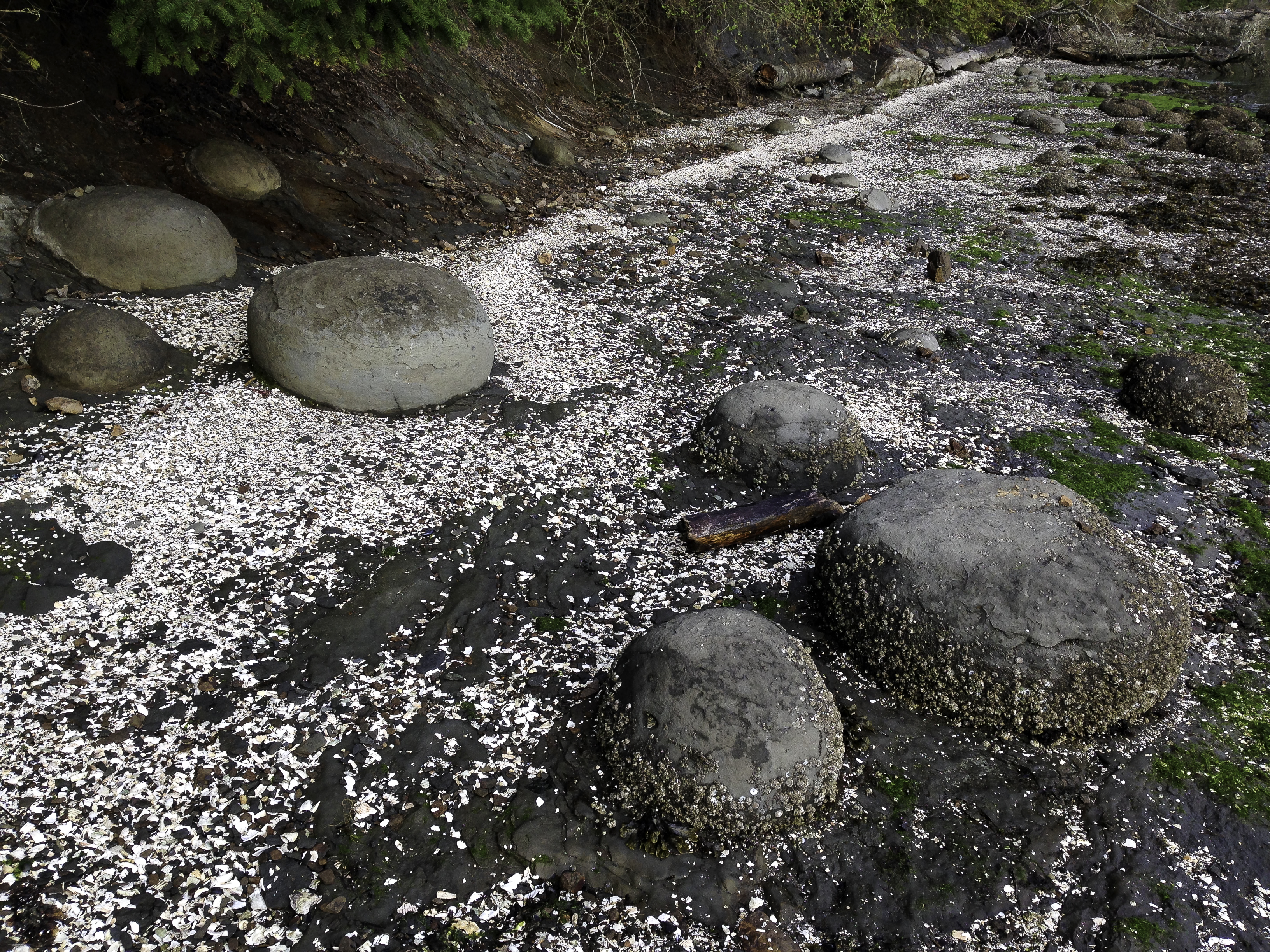
Rounded rocks that tumbled from their former home in the clay banks along the bay shore

Site of the former Elwah dam west of Port Angeles, WA

Oxalis oregana, a native PNW woodland plant

Skunk cabbage indicates woodland wetlands

More oxalis plus lichen in Bogachiel State Park

Trillium at Bogachiel State Park near teh Washington state coast off Highway 101

Ruby Beach on the Washington state coastal portion of Olympic National Park

Driftwood along Ruby Beach, a part of the Olympic National Park

Driftwood and sea stacks at Ruby Beach

Tony and Toller at Long Beach where dogs are allowed to run and play

Horseback riding on the beach at Long Beach, WA

You can drive on the packed sand beach at Long Beach. WA

Waikiki Beach at Cape Disappointment State Park near Ilwaco, WA with cargo ship

Camp site # 224 at Cape Disappointment State Park
BEST 20 Rockstar Images of 2013
Okay, I know, it is still 2013 so I am ahead of the game. Well, sorta. I only shot two music festivals plus a local band this year so I don’t have much material. But, still, there are some good ones even though I am still editing the ones from Rockfest.

Jasmine Greene * Jasmine Greene Band * Tulalip Casino * Marysville, WA

Scott Greene * Jasmine Greene Band * Tulalip Casino, Marysville, WA

Lizzie Hale * Halestorm * Rockfest * Cadot, WI

Arejay Hale * Halestorm * Rockfest * Cadot, WI

Adam Walst * 3 Days Grace * Rockfest * cadot, WI

Neil Sanderson and Brad Walst * 3 Days Grace * Rockfest * Cadot, WI

Barry Stock * 3 Days Grace * Rockfest * Cadot, WI

James Shaffer * Korn * Rockfest * Cadot, WI

James Shaffer * Korn * Rockfest * Cadot, WI

Jerry Dixon * Warrant * Rockfest * Cadot, WI

Robert Mason * Warrant * Rockfest * Cadot, WI

Tom Maxwell * Hellyeah * Rockfest * Cadot, WI

Slash * Slash featuring Myles Kennedy * Rockfest * Cadot, WI

Myles Kennedy * Slash featuring Myles Kennedy * Rockfest * Cadot, WI

Chris Broderick * Megadeth * Rockfest * Cadot, WI

Frank Sidoris * Slash featuring Myles Kennedy * Rockfest * Cadot, WI

Chris Broderick * Megadeth * Rockfest * Cadot, WI

Beau Lastavich * Dirtee Circus * Rockfest * Cadot, WI

David Mustaine and Chris Broderick * Megadeth * Rockfest * Cadot, WI

Vassilios Metropoulos * Otherwise * Rockfest * Cadot, WI

Adrian Patrick * Otherwise * Rockfest * Cadot, WI

Korey Cooper * Skillet * Rockfest * Cadot, WI

David Coverdale * Whitesnake * Rockfest * Cadot, WI

Anthony Gomes * Mt. Baker Blues festival * Deming, WA

Roger Fisher and shayne Dwight * Mt. Baker Blues Festival * Deming, WA
Best Rockstar Images of 2012
Better late than never I present: my Best RockstarImages of 2012 in 2013. On my website (www.clikrf8images.com), I uploaded what I considered to be my 50 best Rockstar images from 2012. Waaay too many images to post on a blog forces me to whittle that number to a more manageable 20.

Shinedown-Chippewa Valley Rock Festival-Cadot, WI

Shinedown-Chippewa Valley Rock Festival-Cadot, WI

Def Leppard-Chippewa Valley Rock Festival-Cadot, WI

Def Leppard-Chippewa Valley Rock Festival-Cadot, WI

Poison-Chipewa Valley Rock Festival-Cadot, WI

Shinedown-Chippewa Valley Rock Festival-Cadot, WI

Sully Erna-Godsmack-Chippewa valley Rock Festival-Cadot, WI

Sebastian Bach-Chippewa Valley Rock Festival-Cadot, WI

Iron Maiden-Chippewa Valley Rock Festival-Cadot, WI

Buckcherry frontman Josh Todd-Chippewa valley Rock festival

Def Leppard-Chippewa Valley Rock Festival-Cadot, WI

Lizzy Hale-Halestorm-Chippewa Valley Rock Festival-Cadot, WI

Lizzy Hale-Halestorm-Chippewa Valley Rock Festival-Cadot, WI


Rachele Lynae-East 542 Festival-Deming, WA

Dana Fuchs-Mt. baker Blues Festival-Deming, WA

Dana Fuchs-Mt. baker Blues Festival-Deming, WA

Oli Brown-Mt. Baker Blues Festival-Deming, WA

Hamilton Loomis-Mt. baker Blues Festival-Deming, WA

Aaron Pritchett Band-East 542 Festival-Deming, WA
2013/09-10 WA/OR/ID/WY/UT/NV/CA
Off on another adventure: Tuesday, maybe, weather and expected arrival of ordered essentials being the deciding factors, we will depart our city in a roundabout way toward Western Wyoming. We like to meander our way toward a vague destination, making the destination just another stop along the way.
The weather forecast will improve by the time we roll down our driveway. Due to a miscalculation on my part estimating when orders would arrive from B&H (new external HD), NGS (maps) and Amazon (travel books, Garmin Topo map, and a new 2.5″ foam mattress topper with cover- easier to find without than with), our scheduled departure was today. Hah, procrastinating the orders (when confronting decisions, I postpone) actually worked in our favor, weather-wise. Since we plan to travel west to go east via the Olympic Peninsula (bypassing my nemesis of I-5 through the Seattle traffic), we wanted to be sure of sunny skies. Even overcast would be preferable to the downpours of today. So the route is as follows:
Day 1: Bellingham to Bow Hill Blueberries to pick up half a flat then meander through the Skagit Valley and Whidbey Island to the Port Townsend ferry. Highway 101 will take us to our first overnight stop, tbd.
Days 2 & 3: The next morning we will head toward Sun and Sands RV park south of Lincoln City where we will rest several days looking for agates at Fogerty Beach State Park. Along the way, we will try to find the beach where Toller can run in Ocean Shores.
Day 4: We will be on our way to camping east of Eugene, maybe at the Blue Pool along highway 126. We want to drive the Aufderheisen Scenic Byway, America’s first scenic byway.
Day 5: This is the day we leisurely drive the Aufderhausen scenic byway which, in its serpentine route will bring us to highway where we will take an offshoot road to Waldo Lake, one of the clearest, purest lakes in the US.6
Days 6 & 7: Crater Lake National Park, our next destination, is a short little jaunt away, for photography and exploring.
Day 8: We are on the road to Hart Mountain Antelope Refuge along rural highways and gravel roads. Boondock camping?
Day 9: We will be exploring the Steens Mountain Loop, a very scenic drive with several overlooks into glacier-carved valleys on the eastern flank. Our campground will be at Page Springs near Frenchglen. If the aspens are in peak color then we will stay at one of the campgrounds along the Steens Mountain Loop.
Day 10: Our route is a meandering drive on gravel roads and rural highways to the Pillars of Rome. Dispersed camping?
Days 11 and 12: Two days to explore Succor Creek State Park, Owyhee Canyon and Leslie Gulch, very remote destinations that are becoming more well-known.
Day 13: This is is our first day into Idaho. We had watched a TV show about a scenic backway that will take us from Oregon into Idaho. We also want to see Silver City, a fairly intact ghost town in Idaho. This back door into Idaho will bring us to the Snake River Birds of Prey refuge.
Day 14: Today will be a day exploring Bruneau Sand Dunes.
**********************
Day #1*Wednesday*September 11:
Whoa! As with all plans, ours went all to h***. After all orders arrived, fall gardening chores completed, tasks assigned to daughter/caretaker, camper packed, maps organized, electronic gizmos updated and batteries charged, truck fueled, oil freshly changed and food prepared, etc., we were on our way. We departed at 9:30 am to catch the 11:30 am Whidbey/Port Townsend ferry (reservations required, $25.20 total fare for standard vehicle (20′ or less: we are within it by 6″) with driver and passenger, 65 + discount, overheight with the camper on.). The route we followed meandered through Skagit County farmland until we met Highway 20 which will temporarily end at the Whidbey island dock near Fort Casey State Park. It will pick up again at the PT ferry dock where it terminates at the junction of the coastal and Hood Canal portions of 101.
Our first overnighter was at Potlatch State Park along the Hood Canal section of Highway 101, where we parked at the less developed area in space # 70 for a quieter night’s sleep. There, the main site amenities were missing so we made do with a vault toilet rather than the flush variety but the water faucets weren’t shut off. The waterfront was muddy, not rocky or sandy along Hood Canal. Hindsight advises the next time to boon dock in Olympic National Forest or at any of the Lake Cushman sites or camp at the much nicer Dosewallips State Park near Brinnon (see last camping spot October 21). Both campsites are $23 for a standard site (no hook ups) but the Dosewallips state park is much nicer: lovely maples, very large sites and the Dosewallops River nearby.
Day #2*Thursday*September 12:
We wound our way south and west aiming for Cape Disappointment State Park near Ilwaco/Long Beach. We followed 101 until the junction with 108 which segued into highways 8/12. We bypassed Aberdeen when we chose 107 to bring us onto Coastal Highway 101. Along the way we bought diesel at the Elma Shell, Elma, WA: $50.00 to top off the tank.
Long Beach, Washington is very dog-friendly. Its very long beach is open to dogs off-leash. It is also open to vehicles who drive along the sandy beaches. Fast. Or, stuck. Toller, our two year old Chocolate Standard Poodle/German Shorthaired Pointer cross, quickly ran circles until he flopped down exhausted. He was wary of the waves that rolled onto the beach allowing himself to just venture in the shallows where the waves were receding before the next big one crashed onto the sand.

Toller at Long Beach

Toller and Tony at Long Beach
We secured our standard, no hook-up spot at CapeDisappointment State Park, space 225 ($23) by O’Neil Lake where we were the only ones as most people elected to camp closer to the ocean at Benson Beach. We did have one neighbor across the road in the hiker/biker site who was quiet and didn’t run a loud generator. We were within a short walk to Waikiki Beach and the Cape Disappointment Lighthouse which is a more scenic area. We took a short walk to the North Head Lighthouse complex where the lighthouse keeper and assistant lighthouse keepers’ homes are available to rent.
Cape Disappointment State Park is the most visited state park in Washington. 1882 acres are abutted by the Pacific Ocean, Baker Bay and the Columbia River. Cape Disappointment, named by Captain John Meares in 1788 while searching for the mouth of the Columbia River, is where the Columbia meets the Pacific. This is also where the Lewis and Clark Expedition first saw the Pacific.
Day #3*Friday*September 13:
We returned to 101 then drove over the Astoria-Megler Bridge to Oregon. The northern beaches and towns of the Oregon Coast seem too touristy so we make for just north of Depoe Bay with one detour that has us backtracking due to a mudslide. We enjoy the Three Capes Scenic Loop and made it just to Cape Meares before we had to return to Tillamook to resume our southern route. We overnighted at the Sun and Sea RV Park, one of the very few RV parks we stay at as it has very clean bathrooms and is sited on the beach. It caters mostly to big RVs and is a splurge for us. Even with the Good Sam Club 10% discount it is $35.00 for a “forested” site. It does offer full hookups, a laundromat, wifi, small store, and quick access to the beach. Our space was number 57 with neighbors a bit too close.
That afternoon and the next morning, we explored Fogerty Creek State Park, our favorite state park along the Oregon coast. Fogerty Creek runs through it to the ocean terminated in a jumble of a rock outcropping, suitable for climbing. On each side, accessible by a trail on each side, under Highway 101, there is a small and a larger crescent-shaped beach. The storms and ocean waves change the beaches but agates can be found on either side. The smelt sands differ from most Oregon Coast beaches which are very fine sand ground over the eons by the relentless pounding waves. It helps to be present at low tide but I have found many agates on the incoming or outgoing tides.
Day #4*Saturday*September 14:
Highway 20 from Newport takes you through the coastal mountains to the Corvallis/Albany area then continues through the Cascades into the eastern limits of the Great Basin and Oregon’s dry side. We took this route to explore the lakes and rivers of Oregon’s Central Cascades. Tonight’s camping spot was yet to be decided so we first stopped at Cascadia State Park, about 15 miles east of Sweet Home. There was a big loud family picnic so we moved on to check out House Rock, a USFS campground. It was down in a hole, the smoke from campfires creating a haze and the canopy of large trees made it seem dark even in the afternoon. We returned via the very winding highway to Cascadia. More expensive at $17 for a standard. no hookup site, it had nicer sites and flush toilets and showers. We chose number A4 next to an old nurse log.
Day #5*Sunday*September 15:

South Fork Santiam River

South Fork Santiam River
We explored the South Santiam River which flowed next Highway 20 and was part of the park. The ranger pointed out an access along the north side of the highway with a trail leading to a large boulder-strewn part of the river that was very photogenic. I found a ledge that was part of a boulder arrangement allowing me to handhold my 24-70mm lens to capture the up river section. These images are reminiscent of the Pacific Northwest: I love the quiet rivers, big boulders, fern glades as a photographic package. There are so many compositions along the focal lengths to keep me enchanted for some time.

Sahalie Falls
Our next destination was the Aufderheide Memorial Drive. We drove the very winding Highway 20 to its junction with Highway 126. Following this road south, we stopped at Sahalie Falls, a very dramatic and scenic waterfall that we unfortunately arrived at when the sun shone directly on it. I did a quick composition nabbing a rainbow without jamming my tripod on too many toes. Eventually, 126 turns right, passing the town of McKenzie Bridge. Less than five miles past the town is the beginning of the drive. Evidence was there that would justify it being a scenic drive as mentioned online but the fall color had yet to peak. It had more road bikes on it than cars. The route loosely followed the McKenzie River and the North Fork of Middle Fork Willamette River. It terminates when it meets Highway 58 from Eugene.
We passed by a large number of USFS campgrounds to settle in at Waldo Lake, one of the clearest lake in the US rivaling its southern neighbor, Crater Lake. It is also second to the better-known lake in depth (420 feet). We chose Shadow Bay as it is the first one and is less popular than North Waldo. Site number 67 ($10) was a short distance to the lake and close to a vault toilet.
Day #6*Monday*September 16:
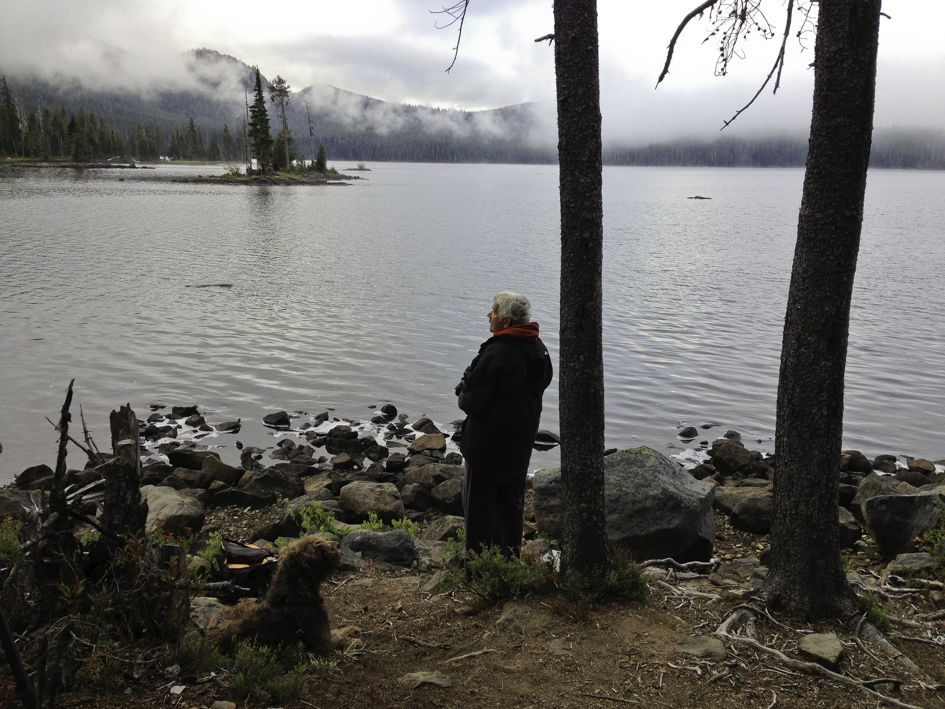
Tony and Toller at Waldo Lake

Waldo Lake
Early the next morning, we awoke to fog so grabbed the gear to shoot some moody photos of the islet offshore. The fog didn’t last long but it was quiet and peaceful. As the dawn became day, we noticed a man made structure on the islet made of logs. There are trails that wind around the lake revealing views of the Sisters but we were unable to see them from where we
were.
There was no direct route to Diamond Lake and Thielsen View campground so we returned to Highway 58 from Forest Road 5897 heading east to US 97, This would take us to the westbound East Diamond Lake Highway which can also take you to the north entrance of Crater Lake National Park. We are not particularly fond of 97 but we weren’t familiar with the many USFS roads that may or may not have taken us to Diamond Lake. We drove by several lakes but one, O’Dell looked like it was more of a resort and summer home type. Crescent Lake will wait for the next time as it was further off the highway and I saw no sign for a resort.

Campfire at Thielsen View

Mt. Thielsen
Thielsen View Campground, on the northwest side of the lake across from a resort, was rustic (vault toilets) but very scenic with a view of, you guessed it, Mt. Thielsen. We chose site B-4 ($7.50) one of the more scenic sites right by the lake. This is one of my favorite camp-grounds on this trip: spacious sites, pine tree canopy, and lots of free firewood from diseased trees. Blue skies make for uninspired images as does a breeze to ripple the lake so I shot a few frames for the memories. We built a campfire to roast real meat and veggie hotdogs.
Day #7*Tuesday*September 17:

Crater Lake National Park
The fog returned so there would be no sunrise over or behind Mt. Thielsen. We broke camp, noting the site number for a return visit. Crater Lake was just a short jaunt south on Highway 138. The scenic drive circles Crater Lake, mostly on a narrow road, often with narrow shoulders sagging precipitously to a drop off. Since it was still foggy, we slowly made our way counter-clockwise toward the Visitor Center. We parked at several overviews which afforded us views of Wizard Island up close. It was cold and rainy so we went to the park headquarters/visitor center near Mazama campground.
We watched an informative video on the making of Crater Lake. Essentially, there was a buildup of hot magma that pushed up through Mount Mazama. The mountain, unable to contain the pressure, erupted, the sides caving in and plugging the former magma chamber. Eons of melted snow and rain have resulted in a lake that is 1943 feet deep, the deepest in the U. S. and ninth deepest in the world. Its water is also very pure.
Our overnight accommodations were at Mazama campground as Lost Creek was closed for the season. The prices weren’t adjusted for teh season as a standard site (no hook ups) was $29. However, age 62+ has its goodies and one is the $10 NPS/USFS/BLM Golden Age Pass which lowered the price by half to $14.50. We chose site F-2 as it was distanced from the larger RVs and the construction work in the closer loops. The cold rain and strong winds continued so we took a quick look at Phantom Ship from an overlook then returned to our warm camper, ate soup and went to bed.
Day #8*Wednesday*September 18:

Beautiful blue Crater Lake from Cloudcap
We awoke to a sunny but cold day. We decided to make the loop clockwise because coming from the north, we were too close to the outside edge. It was icy in places on the road and in the parking lots. The true blue of the lake was revealed in the sunshine. We stopped at a few overlooks then drove to he highest paved road in Oregon which ends a mile off the Rim Drive on the east side of Crater Lake at 7,900 feet. You could see almost the entire lake from this vantage point. The photo at right was taken with my 14-24mm at 19mm.
We left the park and the Cascades for Eastern Oregon. Rim Drive connects with Highway 62 at the southern entrance which brings you to Highway 97. Along the way, we stopped at an overview where the lightning rod tip of Mt. Thielsen stood above the valley floor fog. The Chiloquin Highway is a shortcut which goes through the small town of Chiloquin connecting with Highway 858 or the Sprague River Road. There was very little traffic on this road and even fewer on a more scenic road that more closely followed the Sprague River (Drews Road).

Drews Creek, USFS campground
Eventually we connected with Highway 140 which would lead us to Drews Creek, the USFS campground I chose. Campgrounds in this area near the main roads are scarce. There were a few that were miles up USFS roads but we had driven many miles and didn’t want to overload the exhaustion factor. 140 (Klamath Falls – Lakeview Highway) would bring us to Lakeview, Oregon’s highest (elevation) town for fuel and groceries. Drews Creek was all ours for the evening. A number of cars drove by probably going to Drews Reservoir or Dog Lake but they didn’t disturb us. This campground was rated a 9 by Moons for its scenic value but I believe that is too generous. Yes, the pine trees provided a nice canopy, the vault toilets were charming (but smelly) and the pine litter was great for Toller to run on. Oh, and it was free.
Day #9*Thursday*September 19:
We awoke to a foggy morning. We began to drive slowly into Lakeview for groceries, propane and fuel but the fog soon lifted allowing us to watch the numerous raptors we saw the day before in the ranchers’ fields after the alfalfa was cut. Lakeview has had a Safeway since 1939. It was a decent size store and we were able to stock up on items we couldn’t find in the smaller towns we passed through. We then bought diesel for the truck and propane at the Shell on 395. Turning east on 140 (it joined 395 in Lakeview for a few miles), we drove to the Plush-Adel Road, bypassing the Plush Cutoff. We chose that route because we wanted to travel a more scenic route skirting Crump Lake, a shallow alkaline lake in Warner Valley. Since it was long past the morning golden hour, we drove on through. We passed through Plush, stopped at the Hart Bar Interpretive Site for information and vault toilets, and the Camp Hart CCC which had a nice campground.
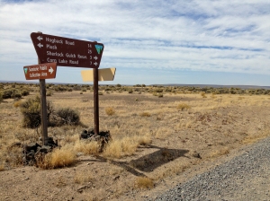
BLM Sunstone Collection area signage
Since we had questions about the Hart Mountain National Antelope Preserve and the BLM Sunstone Collection Site, we drove on up the winding gravel road (The paved part of Hart Mountain Road ends at the CCC campground.) to the headquarters. Beautiful views but big drop offs. We also saw some antelope once the road reached the summit and plateau. Alas, no one was home at the HQ so we returned to the Warner Valley. We decided to head for the sunstone area to look for Oregon’s state gem.
It is a long way on a gravel road that tends to washboard, about 25 miles long. The road has several forks but is well-signed. There is now an improved campground/picnic area with vault toilets and canopies. We talked to someone who showed us what to look for as he had amassed quite a collection. They were small but he said they were plentiful. After a few hours, we each had a pocketful of small pale yellow crystal-like stones. We chose the host spot at the CCC campground with only one other camper. The skies were clear, the stars were bright and the night quiet.
Day #10*Friday*September 20:

Hart Mountain Road vista into Warner Valley
Sunny again today so we again headed up to the antelope refuge. Today we are going to look for agates and jasper at Flook Lake. We will also look for antelopes up on Hart Mountain. The views from the road that climbs to the top is expansive overlooking Warner Valley and the chain of lakes supporting birdlife (and probably amphibians/reptiles/insects, too). Again, no staff at the HQ but it was open for using the toilet (flush) and picking up literature. All the older buildings, including two residences, were built by the crew who lived at the Camp Hart CCC during the 1930s.
Flook Lake is a few miles past the HQ (take the road on the left) heading for Highway 205 and Frenchglen. It is a flat alkaline lake reached by a ¼ mile long rutted single track. It is permissible to collect eight pounds of rocks per day per person but no digging allowed as it is on refuge land. We each went in a different direction finding agatized tan and red jasper, a dark purple agate and some interesting rocks which we can’t identify. The lake was bare except for the scattered rocks and scant vegetation. We saw no signs of life but the desert reveals its residents at night.

Flook Lake rock hounding
Once we sated our rock hounding appetites, we continued our drive to Page Springs, our next campground. We stayed there a few days last April during our two weeks in Eastern Oregon. Once you leave the refuge, the road becomes the Rock Creek Road which passes through the large holdings of the Rock Creek Ranch. There wasn’t a lot of traffic and the road had sporadic washboarding. We arrived at Page Springs to a full up campground. The host allowed us to camp under some aspens where we still had ample space between us and our neighbors. We paid the senior rate of $4. Then the trouble began. Our pop up began to unfold only on one side so we immediately flipped the switch to OFF. We could do nothing at that point as it was getting dark so we spent a very miserable night sleeping in the truck, thankful that Hallmark was open on Saturdays.
Day #11*Saturday*September 21:
At 9:00am we called Hallmark RV to inform them of our camper’s malfunction. The specialist gave my husband some pointers but these failed to raise the roof. He then advised us how to lower the roof on one side. Tony has an engineer’s mind and had packed the tools needed for the job. I busied myself cleaning out the truck, walking Toller and routing us to Fort Lupton, CO. We also discovered that the Steens Mountain Loop we wanted to take was partially closed by a landslide. We had been looking forward to this since last April as the loop doesn’t usually open until summer. The aspens weren’t in their full glory so this was a small consolation.

South entrance road to Succor Creek State Park, OR

Gravesite of Jean Baptiste Charbonneau, son of Sacajawea
We drove to Burns for fuel and groceries then headed east on Highway 78 (Steens Highway). The rain didn’t help the mood in the truck. But, there was little traffic and the miles went by quickly. 78 terminated at Burns Junction and Highway 95 (Idaho-Oregon-Nevada Highway) We saw a sign announcing the grave of Jean Baptiste Charbonneau, Sacajawea’s son who was born during the Lewis and Clark Expedition. We drove the few miles to his gravesite which had a few other tombstones and a few buildings for company.
95 makes long twists on its way to Idaho. Succor Creek State Park was on our must see list so we drove on the rough road to the campground. Our GPS didn’t match the miles posted and the sky was darkening not only due to the hour but the approaching storm. We stopped at an area that had been been previously used as a campground because of the scattered fire rings. It is also a rock hound’s destination for the prized thunder eggs. On the way out we discovered some agates on the road. Unfortunately, we couldn’t linger so we continued our eastbound journey through the park (and found the campground a mile or so down the road). This is definitely a place we want to return to. The wind was blowing the hard-driving rain into our faces as we got settled in for the night. I decided to sleep on the floor on the extra cushions and Tony slept in the truck’s cab with Toller in the back seat.
Day #12*Sunday*September 22:

Montpelior Canyon, a USFS campground

Boon docking at Succor Creek State Park
I awoke early, not only because of the cramped sleeping quarters but because I knew that early dawn might bring the LIGHT that we photographers are always seeking. The sky was dark but promising. I set up my gear and waited. Right time, wrong place. A rosy halo circled a black cloud and I had no foreground elements. I grabbed my tripod/camera and ran out to the bluff overlooking the valley. Too late for the dawn drama but the clouds remained and I continued to press the shutter using the 70-200mm to bring the landscape closer
Succor Creek Road ended at Highway 19 which brought us into Idaho and Highway 95. We turned off on Highway 55 then followed Highway 78 from Marsing loosely along the Snake River, passing through the Snake River Birds of Prey National Conservation Area and passing by the Bruneau Sand Dunes. Farewell until next year.
We joined I-84 at the 112 on ramp then joined I-86 when they split. In Pocatello, we hit their rush hour which wasn’t too hurried to take yet another interstate (I-15) southbound. The interstate relay ended when we opted for Highway 30 into Wyoming. Outside of Montpelior, ID, we spent another cramped night at Montpelior Canyon, a free USFS campground. Space 11 looked good as it was close to the single seat vault toilet, was roomier without overhanging branches and was close to a very small stream.
Day #13*Monday*September 23:
Another uncomfortable night sleeping on the floor and in the truck cab. My husband was really miserable due to his bad back and lack of sleep. I didn’t hurt but was cold all night as where I slept on the camper floor blocked the heater fan. Back on Highway 30/89, we drove into Wyoming just a short drive from our campground. We had a few flashbacks as from where we joined I-84 in Idaho, we were driving almost the same roads that we traveled almost a year ago on our way to pick up our camper. Traffic has been light since we left the interstates which is one reason we travel the back roads rather than freeways. The other reason is to avoid semis.
At Hoback Junction, WY, we joined 191/189 which would bring us to I-80 via Highway 372 to Green River. As usual, there was a strong wind, the speed limit too fast and too damn many semis, double trailers in the majority. I gritted my teeth and tried to enjoy the scenery that only an interstate can provide. At least, Wyoming is a sparsely populated state so we didn’t have to pass by too many population centers and the uniformity these exits provide. I know Wyoming is a beautiful state which is why my benchmark map had many notations of photo-worthy stops and the folder on my Mac had many pdfs and images of where we wanted to go. But, freeways are meant to get as many people to as many population centers as possible so we passed through Green River, Rock Springs (booming oil town), Rawlins, Laramie and Cheyenne. Three of those cities are in the top ten of the windiest cities in our country.

Site number 2 at Vedauwoo, USFS campground
Vedauwoo, a USFS campground, was a likely candidate for our next stop. It was not that far off the freeway, had very cool rocks (the Native Americans’ legends say that some mischievous spirits dumped them there and we could use our Golden Pass for half price. It was still windy so we found that site number 2 was sheltered from the wind somewhat and cost $5. It was sunny but cold. The vault toilet was clean, the water pump worked, and there was a garbage dumpster. After a couple of nights of dispersed camping, we had a full garbage bag.
Day #14*Tuesday*September 24:
A cold windy clear morning put us in a better mood for our last leg to Hallmark RV, several hours away in Fort Lupton, CO. We wanted to further explore the granite and quartz rock jumbles that were scattered around us. But, we said we would be at the plant in the morning and we were unsure of the road conditions in the aftermath of the floods from several weeks ago. We decided to exit I-80 in Cheyenne for Highway 85. We were familiar with it from before and we didn’t want to chance that one of the I-25 exits was closed. 89 goes directly to our destination.
2012-10/11 WA/OR/ID/WY/CO/UT/NV/CA
Day One: Sunday, October 14
We left Bellingham, WA in our new to us Ford F250 Super Duty to travel to Fort Lupton, CO to pick up our new camper at Hallmark Manufacturing. On the way to our first overnight at The Dalles, OR we stopped to visit with my sister in West Seattle and to drop off some fresh produce.
Returning to I5, we traveled south to exit at 205 which bypasses the confusion on I5 as it dissects Portland. There was light traffic on both highways and even lighter on state highway 14 which is an alternate to the I84 corridor on Oregon side’s of the Columbia. We glimpsed Beacon Rock through the evergreens. We drove through the small towns of Camas, Washougal, White Salmon and Bingen.
We crossed the Columbia at the bridge that leads us to The Dalles. We missed the turn off to the toll bridge that crosses from White Salmon to Hood River but probably squandered whatever we saved on tolls on the fuel it took us to backtrack to Motel 6. The Dalles has the usual mix of big box stores where we stayed. The Dalles is also the site of a dam that has the same name.
Day Two: Monday, October 15
The Dalles was left behind as we headed east on I84 at 8:30am. Traffic was sparse and we could enjoy the black volcanic rock outcroppings poking out of the golden tawny hills pocked with scrub on the dry side of Oregon. I caught sight of a pond with reflections that would have been a good photo op.
We passed over the Deschutes River as it merged with the Columbia close by to the north. Rows of towering white windmills blighted the view on both sides of the Columbia. We saw the Maryhill Museum on the Washington side. The John Day River and John Day Dam came and went as we sped along I84. Exits for Blalock Canyon (following Blalock Canyon Road) and Phillips Canyon (via John Day Road – Hwy 19) will be saved for another trip to this land that contrasts so sharply with our wet side of the Cascades.
Exiting onto U. S. highway 74 (Blue Mountain Scenic Byway), we headed south by southeast on our way to Ontario, OR which is in the very eastern part of Oregon separated from Idaho by the Snake River. We passed by small ranches, an abandoned pig farm, groups of horses, corn fields for silage, a row of windmills lining an entire hillside. We drove down a gravel road to see the old Cecil Store (1903-1974). A hunter we spoke with said that in the 6 or 7 years since the windmills, the animals have left; no deer, eagles, geese. The ranches earn $8-12,000 a year per machine rent so it is profitable.
The Oregon Trail is evident here: trail markers, old buckboards, covered wagons. We parallel year round Willow Creek which flows into the Columbia River. Granaries are wooden and tall and narrow with a smaller, narrow rectangular second story. There was a remnant of a train depot and bridge (1933). Passing through Ione, we see a sign proclaiming “Don’t Take My Scenic Views-No Windmills”. Past Ione, we stop to shoot a bright green carpet of grain and golden leaved trees against the hills.

Blue Mountain Scenic Byway near Ione, OR
We pass through Heppner, OR, elevation 2000′ , “Home of the Fillies”. The county seat of Morrow County had a beautiful wedding cake Victorian building for county business. We also saw a neat old square schoolhouse. The USFS has a building there where the friendly employees gave us directions to Willow Creek Road leading to Ukiah.
Best Rockstar Images of 2011
Here are what I consider to be my best work in music photography this year. Looking back on 2010, I have improved during 2011 and thus will include 12 images instead of 10.

Sick Puppies-Chippewa Valley Rock Festival-Cadot, WI

Skillet-Chippewa Valley Rock Festival-Cadot, WI

Three Days Grace-Chippewa Valley Rock Festival-Cadot, WI

Avenged Sevenfold-Chippewa Valley Rock Festival-Cadot, WI

Chevelle-Chippewa Valley Rock Festival-Cadot, WI

Cinderella-Chippewa Valley Rock Festival-Cadot, WI

Hinder=Chippewa Valley Rock Festival-Cadot, WI

Sick Puppies-Chippewa Valley Rock Festival-Cadot, WI

STP-Chippewa Valley Rock Festival-Cadot, WI

Ted Nugent-Chippewa Valley Rock Festival-Cadot, WI

Tesla-Chippewa Valley Rock Festival-Cadot, WI

Kid Rock-Chippewa Valley Rock Festival-Cadot, WI
2011/06 WA:Springtime in the Methow
The only previous times I have made the jaunt to Winthrop was in the summer when the weather was hot and the landscape was brown and dusty. On June 8th, we set out for Winthrop and the Methow Valley via the North Cascades Highway (Hwy 20) through the North Cascades National Park and Ross Lake Recreation Area. The weather was overcast but we were hoping for more sun that is typical of “east of the mountains”. The highway, which follows the Skagit River for much of the way until Newhalem where it is obstructed by the first of 3 dams, began in Sedro Woolley for us. We stopped at one of the many pullouts along the river to shoot the swollen river.


The image on the left caught our attention because of the draped moss hanging over the river. The morning light was overcast with some sun breaks. But, when some light filtered through on some foliage behind the moss coated tree on the right, we swung our tripods to frame that scene.
Unfortunately, the trail that leads to Ladder Falls and the other waterfalls behind the Newhalem generating plant was closed due to the tremendous water flow from all the runoff caused by near-record spring rains and melting snowpack. We decided to have lunch at the Ross Lake overlook then drive the remaining distance to our destination: River Run Inn this side of Winthrop on the Methow River.
Both passes still had snow off to either side of the rode from the recent plowing. There were also a few mudslides that took out trees and rocks along the highway. Cascades of water came pouring off the rock faces as we drove further east. We stopped at a trailhead to use the facilities. Three sailors had built a rough cabin in the woods to mine for gold that a Seattle fortune teller had told them that would for sure be there. They spent a winter there then abandoned the claim and the cabin because they found no gold. This was way before the highway was built in the early 1970s so they must have followed Indian trails from the west or came through the east side by way of Wenatchee. Tough men who traveled some rough territory and survived a harsh winter.
The weather was no improvement over the west side so we bought some dinner at the local grocery store and settled in for the night. Thunder clapped as we ate our dinner and went to bed. The surrounding hills were velvet green. Unfortunately, Winthrop has a large number of second homes which were dotted here and there amongst the hills and valleys.
The morning was foggy so we didn’t venture out at first light. We drove out to the Gunn Ranch Road to shoot an old building. The fog was still heavy in the valley but the blue sky was trying to break through.

We continued on the gravel road to where we discovered a small pond nestled down in a small valley. A pair of loons had settled as we could hear their cries from our perch on the road above. Below is a tight crop of the pond and a few Quaking Aspens that lined its shore. This should be a great shot in the fall when the leaves turn gold.

Since megamansions aren’t that photogenic, we turned around when we saw a few up ahead. We wandered along the paved road that followed the Chewuch River on the west side to check out Falls Creek Falls and camping possibilities. Our lunch spot was along roaring Lake Creek that fed into the Chewuch River which travels through Winthrop, eventually joining the Methow and later emptying into the mighty Columbia River. The pines trees that were thick in the area were part of the Okanagon National Forest. Mule deer were present everywhere and we had to be extra cautious when driving.
Our favorite USFS campground was the hosted Chewuch site with 16 sites along the Chewuch River. This is a primitive campground with tested water, vault toilets and garbage. And, it is also bear country, so food must be stored safely away from these opportunistic mammals.
We drove to the dead end then returned to Winthrop to drive to Pearrygin Lake. Near the turnoff to the boat launch and campgrounds, we discovered a red barn and a six-sided wooden silo. There was a pull off so we set up to shoot in the fading light of an approaching storm. The Cascades were visible in the distance beyond the fields and foothills. A passing runner told us the farm was now a state conservation area. We were treated to some dramatic lighting. Quaking aspens stood off to the side and their bark caught some sun. This is a definite return-to-spot for autumn foliage. Also, a small wetland across the road featured a few aspens up close.


The darkening sky and loss of light forced us back to our room. On the return, we saw several large snakes sunning themselves on the road. The next morning, one of the inn employees told us that they were a garter snake that could be aggressive. I am just glad that I didn’t venture further into the fields. At least they weren’t rattlesnakes which we don’t have on the west side.
The next morning saw us returning to the farm/conservation area to catch the sunlight on the red buildings. There were a few clouds in the sky and the sun did light up the red boards. The snow-covered Cascades were more visible making a more scenic backdrop than the night before. The clouds weren’t as dramatic, though.


Eager to return home before the weekend crowds hit the highway, we left Winthrop behind. We stopped for lunch in the parking lot at the Newhalem generating plant. We stopped at the same pullout along the Skagit River but the lighting wasn’t as good. And, we didn’t miss the traffic headed for a weekend on the other side of the mountains.
Jefferson Starship 40th Anniversary Tour
Can it be 40 years since Jefferson Starship arose from the remnants of Jefferson Airplane? Two of the original members of that band, Paul Kantner of Jefferson Airplane and David Freiberg of Quicksilver Messenger Service, performed Thursday night at the Wild Buffalo House Of Music in Bellingham, WA. They were accompanied by Cathy Richardson, vocals, and Chris Smith on keyboards.
Through a connection with David Freiberg, I was able to get a +1 photo pass to that performance. Please see this post regarding how fortunate I was. Below are a few of the images from that show. As usual, the lighting was small venue with an emphasis on blue and magenta lighting for the benefit of ambiance not photographers. For all the images that made the cut, please see my website.

Jefferson Starship

David Freiberg

Cathy Richardson

Paul Kantner
