2014-09 WA/OR/ID/WY/MT 1/4
*Day 1/Tuesday/September 9:
Because I5 from Marysville to Olympia is such a traffic-choked exercise in frustration, we usually take Highway 20 east over the North Cascades Highway to the dry side of the state or head west on the same highway gaining access to the Olympic Peninsula via the Washington State Marine Highway ferries. This time, the North Cascades Highway was our choice as we were headed east toward Wyoming. It can be a leisurely drive with overlooks and trailheads along the way to Winthrop, an over 150 mile drive from Bellingham.
We usually stop at the Diablo Lake overlook to use the vault toilets and enjoy the vistas of the mountains and the blue green lake. We also stop at the Gorge Creek falls overlook to enjoy 2 waterfalls. Often, when you live in a beautiful area, you almost take your environment for granted. I never tire of the mountains, waterfalls, lakes, and rivers. Well, maybe the grey skies and drizzle but then we wouldn’t be the Evergreen State.
Since we left later than usual and weren’t sure about road closures due to the extensive summer forest fires near Twisp, we opted to camp at Klipchuck, a USFS campground (elevation 2940′) in the pine trees off Highway 20 which muffle the road noise. Early Winters Creek is nice to listen to also if you get a creekside site. Mid-week, after Labor Day, is a great time to camp in a popular area in peak season. Our Senior Pass discounted the camping fee to $4.
We wandered around the pine forested campground. Our neighbor had a truck camper trailering a motorcycle. His small dog fit into a pack behind the windshield on his bike which he would take on short jaunts. After our dinner of homemade soup and sandwiches, we fell asleep.
*This journey and subsequent ones will be in honor of my sister’s son who lost his 9 month battle with melanoma yesterday. A former Marine and father of three, he fought a valiant battle with this insidious disease. He loved to travel so we will wander the west in his memory.
Day 2/Wednesday/September 10:
After returning to Highway 20, we passed through Winthrop (tourist trap) where we fueled up. At Twisp, we were directed to the Twisp-Carlton Road, a detour around the destructive Carlton Complex fire near highway 153 where that same area subsequently suffered mudslides. 153 connects with Pateros and 97. We were glad to see that our favorite fruit stand/bakery/orchard just before the junction with 97 escaped the fire damage. We bought organic peaches and pears for me and an apple fritter for Tony.
Turning east from 97 onto 17, we passed through Bridgeport and the Chief Joseph Dam (potty break) until we turned south on Bridgeport Hill Road NE. We spotted an interesting fluted rock formation so drove up a dirt road almost getting stuck in some deep sand. Formerly a ranch, all that remains are piles of fencing and collapsed structures, poplar trees (to shield the winds), and a wooden water tower. Now, it is the West Foster Creek Wildlife Area set aside for the sharp tailed grouse, among others.
Zig-zagging down 172, we arrived at Highway 2 (if we wanted to return west to Everett, we would travel this road). Just a short while later, we turned south on Coulee Meadows Road/Rimrock Road/Sagebrush Flat Road which brought us just north of Ephrata. It was a paved road that wandered through wheat fields and abandoned farm houses and outbuildings.
From Ephrata, we went south on 28/283 to its junction with I90 just before George (the Gorge Amphitheater is close by). We crossed the bridge over the Columbia River/Wanapum Lake to Vantage. Our plan was to camp at Wanapum State Park but it was closed because of breaches in the Wanapum Dam down river. Because we had planned this small detour to visit Gingko State Park, we were stuck with staying at the Vantage Riverstone Resort nearby. $11 paid for a grassy strip near residents who lived in permanent trailers.
Gingko Petrified Forest State Park has a trail that winds up a hillside featuring caged specimens of petrified maple, walnut, fir and, of course, gingko. A sign warned of the presence of rattlesnakes but the trail had little vegetation for them to hide in and a local hiker said he rarely saw any. The coolest part was the rustic home for the resident ranger built by the CCC. It is a multilevel Craftsman bungalow.
When we returned to the RV park, we met a couple who knew the parents of the groom whose wedding we shot last August. In a twist of fate, we had met the bride’s parents while we were exploring the Olympic Peninsula near Port Angeles last Spring who asked us to be the wedding photographers. We played with the small dog that belonged to one of the kids who lived nearby, had dinner, then went to bed.
Day 3/Thursday/September 11:
Back on I90, we made a quick exit after recrossing the Vantage Bridge onto Highway 243. This highway follows the Columbia River passing through vineyards and now we were on the opposite side of the Wanapum Dam where we saw work in progress to repair the damage.We cross the Columbia River once again at the Vernita Bridge. Nearing the end of this trip, we will be camping here in several weeks amongst the many people who launch their boats.
On 240 we pass through the Hanford Reservation (DOE) and the Hanford Reach National Monument. Just move along folks, nothing to see here, just gated roads leading towards compounds. Just after turning onto 225, we stop at Horn County Park to bathe Toller at one of the campsites. Most sites are in the open in a grassy area but several are amongst some shade trees along the periphery.
Highway 225 leads us to Benton City and an on ramp to I82. We follow this quiet freeway east and south to again cross over the Columbia River into Oregon. Just for a change of pace, we exit onto a road that will bring us to Oregon Highway 207 or the Hermiston/Lexington-Echo Highway. We could have taken the exit for Highway 395, our eventual main road through the northern part of Oregon. But, we decided to take a more scenic route that would lead us to 395 further south. We would bypass Hermiston and the outskirts of Pendleton.
Somehow, we became lost on a road that ended in a cantaloupe field. Since, it appeared the harvest had finished, we took several that remained and eventually found our way to 207. We were in Oregon Trail territory according to a highway sign. From 207, we turn left onto Butter Creek Road, winding our way through ranch lands along Butter Creek. At Vinson, we turn onto 74 then begin our southbound journey down 395.
In the distance, we could see smoke to the west and south. We stopped at the Ukiah-Dale Forest State Scenic Corridor along Camus Creek for a picnic lunch. There was camping there also, but it was too close to the highway. 395 goes all the way into southern California passing through some beautiful country such as along the Eastern Sierras. Here, in Oregon, there is little traffic except for the occasional logging truck.
We began to scout for a place to camp for the night but wanted to avoid any fires. Toll Bridge campground was an option but it looked like a scene out of a spooky movie (our truck barely made it through the brushy entrance). We explored several roads on either side of 395 along the Middle Fork John Day River but only found several folks fishing and no roads for dispersed camping. Just after we explored those two roads, we drove further down 395 and found an ODOT clearing for disposal of rock slide debris. We had a view of some livestock on the next hillside over, a scenic rocky ridge and the valley below. The highway quieted down and we slept well.
Day 4/Friday/September 12:
395 continues south until a junction with highway 26 at Mt. Vernon where we fueled up. No self-serve in Oregon; there is an attendant who fills your tank. 395 and 26 are the same road east until you again turn south onto 395 at John Day heading towards Burns. Last April, we took a county/USFS road south from Dayville which would have led us to just outside of Hines near Burns. Somehow, we missed a turn and exited onto 395 way north of Burns.
This time, we found 63 aka the Izee Road, and retraced our route to follow the Burns-Izee Road to Hines. 63 is across 395 by the Zwick Old Growth Interpretive Trail. 63 ends at 68/47 which is the Burns-Izee Road. In a funny way, USFS roads, well, other roads too, take on another number and name: 68/47 or the Izee Road becomes 127 or the Hines Logging Road. We just continued to drive south, eventually ending in Hines where we fueled up at the Shell station and picked up a few groceries at the Thriftway across the highway. At a store nearby, we saw several llamas being loaded with item their owner just purchased. Just part of the rural west.
From Hines, we traveled south on 205 until we turned onto the Center Patrol Road, a graveled road that traverses the Malheur National Wildlife Refuge. It was early afternoon and we saw a few pelicans, hawks and songbirds. We returned to 205 toward Frenchglen and our favorite campground, Page Springs, a BLM facility that features nice vault toilets, garbage/recycling, water and a resident deer family. The sites are located near the scenic springs and in the spare pine and aspen woods. Our Senior pass entitles us to half off the $8 fee. After a walk and dinner, we went to bed.
Day 5/Saturday/September 13:
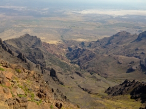
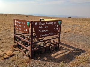
We awoke early to explore the 59 mile Steens Mountain Loop. It is not open year round and was closed when we were there last spring. We were hoping to photograph golden aspens and the scenic gorges: Kiger, Little Blitzen and Big Indian. The road is graveled and graded and there was surprisingly little washboards. Unfortunately, a controlled burn was happening east of Burns so the Alvord Desert was hazy. There were a few educational signs about the Basque shepherds who once kept their flocks in this area. We did see a large flock below when we were checking out an aspen grove.
Steens Mountain is one large fault block mountain, over 50 miles long, steeply plunging from a summit elevation of 9730 feet down to the Alvord Desert, elevation 4200 feet. In 2000, President Clinton approved the Steens Mountain Cooperative Management and Protective Act which was a collaboration of local landowners and government representatives responding to a movement for national monument status. This area now protects 425,000 acres for recreation and limited ranching.
We met a group of people on SxS UTVs that could carry their dogs. An aha moment for us as we were not previously aware of such machines. They looked sturdy and could allow us to access areas where our F-250 would be too wide or heavy. They can be easily accessorized with extra fuel cans, crates, doors, under carriage plates, etc.
We continued on the loop which ended on 205 further south from Frenchglen. The main overlooks are in the more scenic area and you could backtrack to Frenchglen. The road deteriorates somewhat and there is a narrow section with step dropoffs that is scenic. We passed a crossing where people were fishing the Donner Und Blitzen River. There is also a campground on this stretch, South Steens, that had a few horse trailers.
Once back on 205 which becomes 202 in the Catlow Valley, we stopped at Fields for fuel. The son of the owners said it was for sale due to their wanting to retire. It is one of the few fuel stops here so hopefully there will be new owners who will keep it open in this sparsely populated corner of Oregon. When in areas where services are few it is a best practice to get fuel as you never know where the next service station is. Some that have been around for years are suddenly gone. Or, you might that that urge to explore further than your original plans.
Our planned camping spot was on the Whitehorse Ranch which is bisected by a road which is open to the public. The Willow Creek Hot Springs campground is operated by the BLM. The ranch has 63,222 acres of deeded land and has grazing rights to an additional 287,205 acres of public range land administered by the BLM. It has operated continuously since 1869. Along the road, which is a well-graded gravel road, there are signs of some former buildings, either homes or outbuildings.
The campsite is not well-signed but the GPS on my iPhone worked well enough to find the access road before we saw any signs. Unfortunately, the campground was filled with a group that was partying. We backtracked a few miles and found a clearing in the sparse sagebrush. There was an amazing sunset that blazed across the western sky in red and golden streaks. The night sky was so pockmarked with bright stars that we had trouble finding the Big Dipper. It was so quiet that we had no trouble falling to sleep.
Day 6/Sunday/September 14:
It was a bright sunny day so we began to search for interesting rocks. We found a few agates and jasper. Eventually, the group at the campsite left so we decided to check it out. It was divided into two parts by a cement barrier: warm and warmer. It felt so good to wash out the desert dust and even Toller took a plunge. I could just imagine how nice it would have been last night. Maybe another time, not on a weekend.
Continuing on the ranch road, we eventually came to Highway 95 (aka the Idaho, Oregon, Nevada Highway). There wasn’t much traffic but what traffic there was were in a big hurry. Even a truck with a multi-horse trailer passed us. It seems that folks from Idaho bring their faster speed limits with them as those who passed us had Idaho plates. Oregon has more sensible speed limits than most western states, imho.
In Jordan Valley, we fueled up and saw the horse trailer folks parked along the road. What was their hurry? Pleasant Valley Road in Jordan Valley will take you to the start of the 90+ mile Owyhee Uplands Backcountry Byway. We saw a TV program on it once so decided to check it out for ourselves. Pleasant Valley Road winds through small ranches and there was a small local school. We also saw a turnoff for Silver City, a living ghost town in Idaho that we visited last Spring accessing it from the Idaho side.
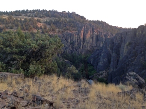
We drove through cattle country passing the Lone Tree Ranch and the Dougal Ranch which was sited on a lake or reservoir. It was getting dark and we just missed the evening light on a gorge carved by the North Fork Owyhee River. The road twisted down to the North Fork campground, a free BLM campground in the North Fork Owyhee Wilderness. This campground was new and featured a vault toilet, fire rings, and picnic tables. We were the only guests that night. It was quiet and peaceful.

Wooden water tower and poplars, evidence of a ranch off of Bridgeport Hill Road south of Bridgeport, WA

Official Steens Mountain Cooperative Management Area- public and private cooperation for mutual benefit

This way to Silver City. I wonder if it is as rugged as the way into this living ghost town is from the Idaho side

On our way into Idaho. We encounter lots of these cattle guards wherever we wander in the Open Range Country West.


